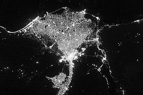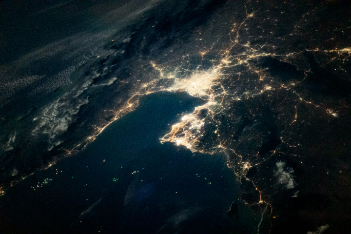
An astronaut aboard the International Space Station captured this nighttime photograph of Santiago, Chile’s capital city, while orbiting over the western coast of South America. The city is situated in a valley of central Chile, between the Andes to the east and the Chilean Coast Range to the west, at an elevation of 520 meters (1,700 feet) above sea level. The lack of lighted settlements around the city is an indication of the surrounding rugged terrain and agricultural fields along the valley.
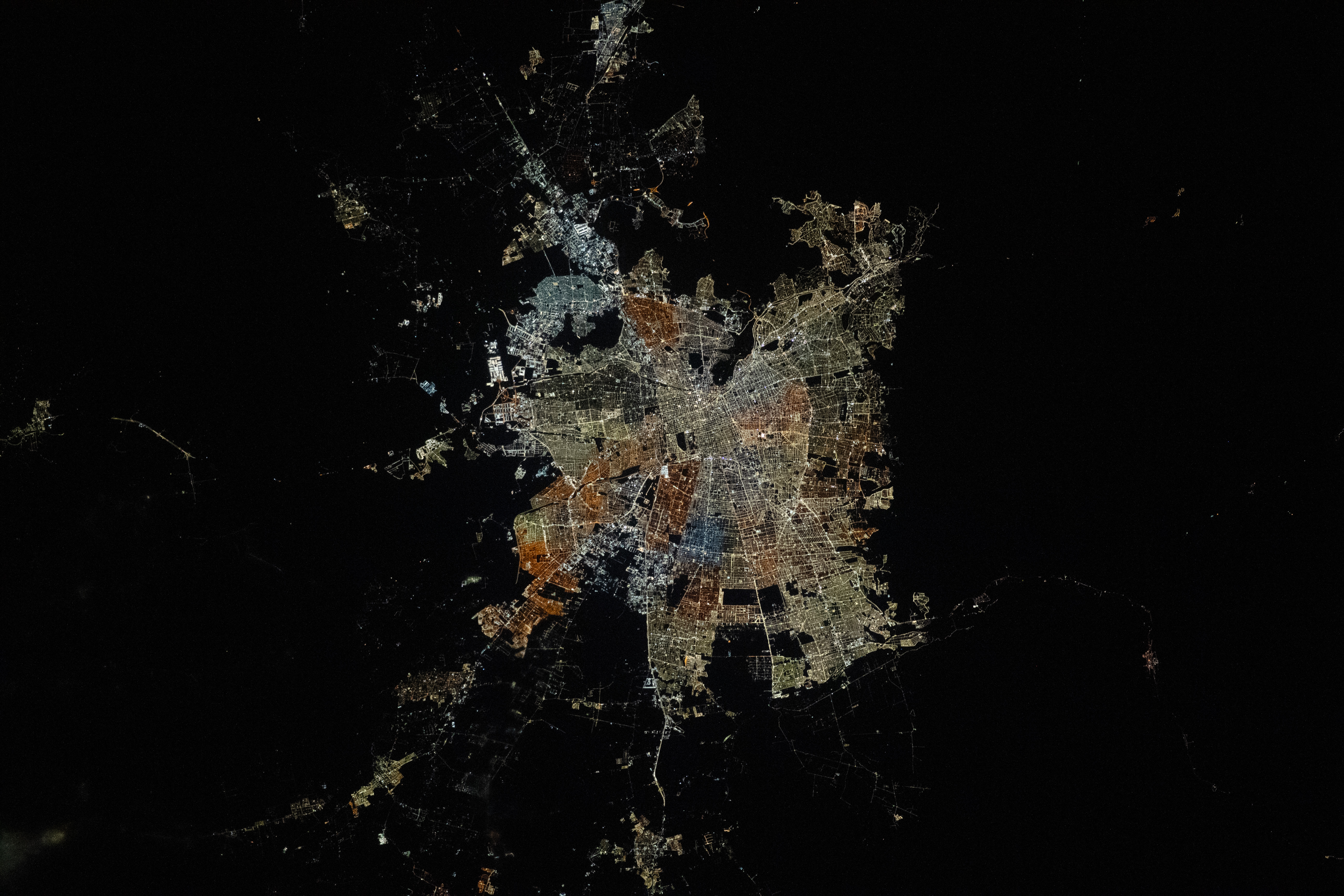
Santiago is close to the geographic center of continental Chile and is also the country’s economic center. It lies within the Metropolitan Region of Santiago, which has a population of more than 7 million people. The region is divided into provinces, which in turn are divided into communes. This photo shows several communes around the center of Santiago.
Santiago’s urban structure combines modern areas with historical zones, creating a contrast between contemporary and traditional, indicated here by the various hues of city lights in different communes. Each commune has its own character and development, visible through their contrasting street layouts and lighting patterns. Each hue indicates the different kinds of lighting used in that area and can represent social differences, the age of structures, zoning, or land use.
Warm-hued orange and yellow lights suggest older high-pressure sodium lamps, while bright white-colored lights indicate the use of newer, more energy-efficient light-emitting diode (LED) devices. In large cities across the planet, such as Milan, Paris, or New York City, the urban cores are typically illuminated with bright white lights. In fall 2023, Santiago-area municipalities, including Maipú and El Bosque, started changing their lighting in efforts to modernize, increase security, and save energy.
In the northwestern reaches of the city, industrial zones and communes surround the brightly illuminated Santiago International Airport. Dark regions within Santiago indicate open space and parks, such as the Santiago Metropolitan Park. Between Colina and central Santiago, communes have properties with bigger footprints and a correspondingly lower light density than other communes close to the center. In the southern commune of La Pintana, dark rectangular features indicate areas of unlit fields and crops. Some of these are part of agricultural and agronomic research and citizen efforts for recycling vegetable waste.
Astronaut photograph ISS070-E-93399 was acquired on February 14, 2024, with a Nikon D5 digital camera using a focal length of 180 millimeters. It is provided by the ISS Crew Earth Observations Facility and the Earth Science and Remote Sensing Unit, Johnson Space Center. The image was taken by a member of the Expedition 70 crew. The image has been cropped and enhanced to improve contrast, and lens artifacts have been removed. The International Space Station Program supports the laboratory as part of the ISS National Lab to help astronauts take pictures of Earth that will be of the greatest value to scientists and the public, and to make those images freely available on the Internet. Additional images taken by astronauts and cosmonauts can be viewed at the NASA/JSC Gateway to Astronaut Photography of Earth. Caption by Wilfredo García López/Jacobs-JETS II Contract at NASA-JSC.