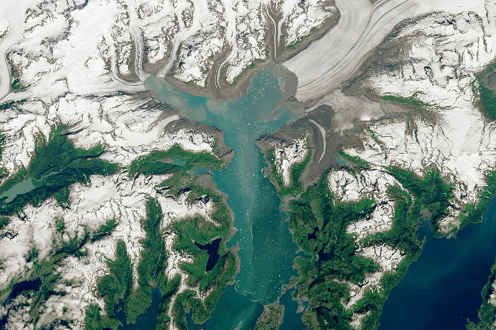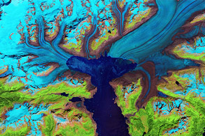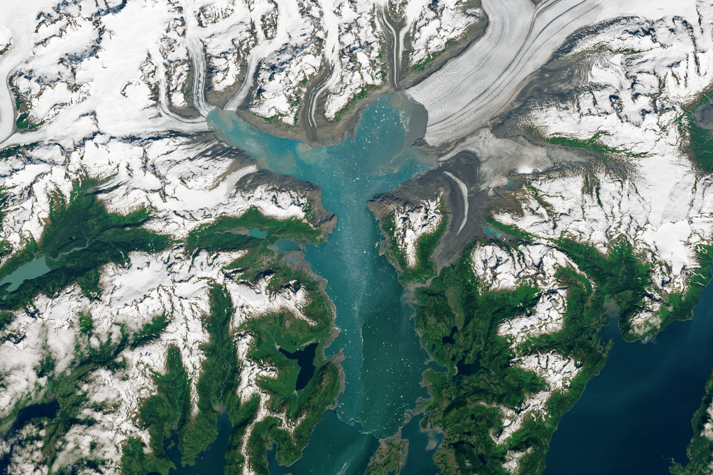

The Columbia Glacier in southern Alaska has long been an archetype of the world’s most rapidly changing glaciers. Today, additional tidewater glaciers across the planet have garnered attention from scientists for their collective potential to contribute to sea level rise. In the meantime, the remainder of Columbia Glacier has continued its decades-long course of retreat and thinning.
The ice of a tidewater glacier originates on land and flows downslope into seawater, where the glacier loses mass through the calving of icebergs. Columbia’s ice descends from an icefield 3,050 meters (10,000 feet) above sea level, down the flanks of the Chugach Mountains, and into a fjord that leads into Prince William Sound. The glacier once reached south across Columbia Bay to Heather Island. But since the 1980s, it has lost more than half of its total thickness and volume, and its front has retreated more than 20 kilometers (12 miles) north into the bay.
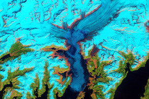
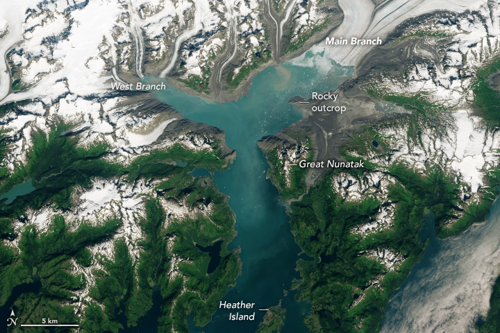
These images (above) reveal some of the more recent changes, showing the glacier’s position during the summers of 2019 (left) and 2024 (right). Both images were acquired with the OLI (Operational Land Imager) on Landsat 8.
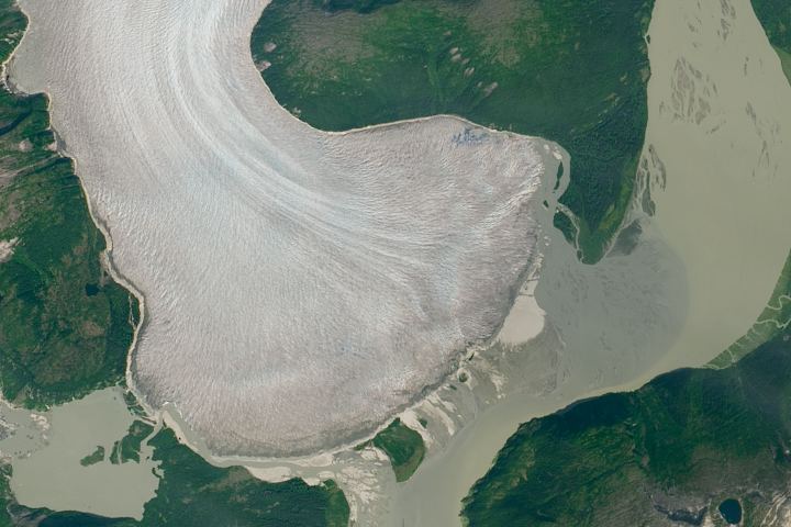
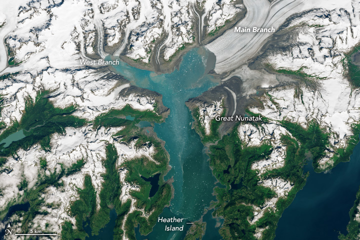
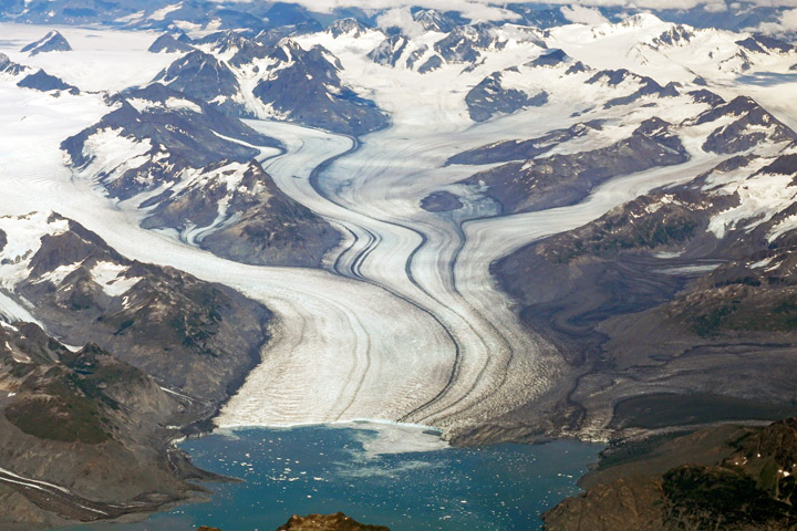
Notable changes persist on the glacier’s Main Branch and West Branch. (The glacier split into these two branches around 2011.) The Main Branch was constricted for several years by the rocky outcrop north of the Great Nunatak, visible in 2016 in the photograph below. Christopher McNeil, a geophysicist at the U.S. Geological Survey, pointed out that the Main Branch has since pulled away from this pinning point.
“That peninsula represented a constriction point for the glacier in the 2019 image,” McNeil said. “Since retreating back, the calving face has less constraint and thus a more unstable configuration.”
The West Branch appears to have already lost its tidewater terminus by 2019, as suggested that year by Shad O’Neel, a glaciologist at the Cold Regions Research and Engineering Laboratory. That means it no longer reaches fjord waters where it once spawned icebergs, as the Main Branch continues to do. “The fjord size looks relatively constant through the past few years, but you can see a lot of terrestrial retreat now,” O’Neel said. “It looks like a lot of new gravelly real estate.”
The rapid retreat of glaciers like Columbia can leave the surrounding land unstable. “Entire mountainsides once held back by a glacier’s ice can start to move, increasing the risk of landslides and subsequent tsunamis for coastal communities, local fishers, and shipping lanes,” McNeil said.
Tidewater glaciers tend to cycle between periods of advance and retreat. The position of a glacier’s terminus and its rate of retreat are influenced by factors such as fjord shape, sea level change, iceberg calving, and water and air temperature. These dynamics can mitigate or reinforce the effects of climate, making tidewater glaciers highly variable in how rapidly they respond to climate change.
Mauri Pelto, a glaciologist at Nichols College, noted that increases in melt-accelerating feedbacks have contributed to the rapid losses observed at Columbia Glacier. A similar scenario is unfolding elsewhere in Alaska, including at Taku Glacier and Muir Inlet’s East Arm. And roughly 15,000 kilometers away, tidewater glaciers in West Antarctica have come under scientific focus for the changes occurring there.
“The wider implication of tidewater glaciers like Columbia is that they have the ability to rapidly contribute to sea level rise—much faster than their land terminating counterparts,” McNeil said. “However, not all tidewater glaciers have the same configuration as Columbia Glacier, so improving our understanding of the forcings of tidewater glaciers could help further constrain sea level rise projections from these glacier changes globally.”
View the related World of Change story to see these images in context with changes at Columbia Glacier since 1986.
NASA Earth Observatory images by Wanmei Liang, using Landsat data from the U.S. Geological Survey. Photo “Glaciar de marea (Tidewater) - Columbia Glacier, Alaska,” by Banco de Imágenes Geológicas, is licensed under CC BY-NC-SA 2.0. Story by Kathryn Hansen.