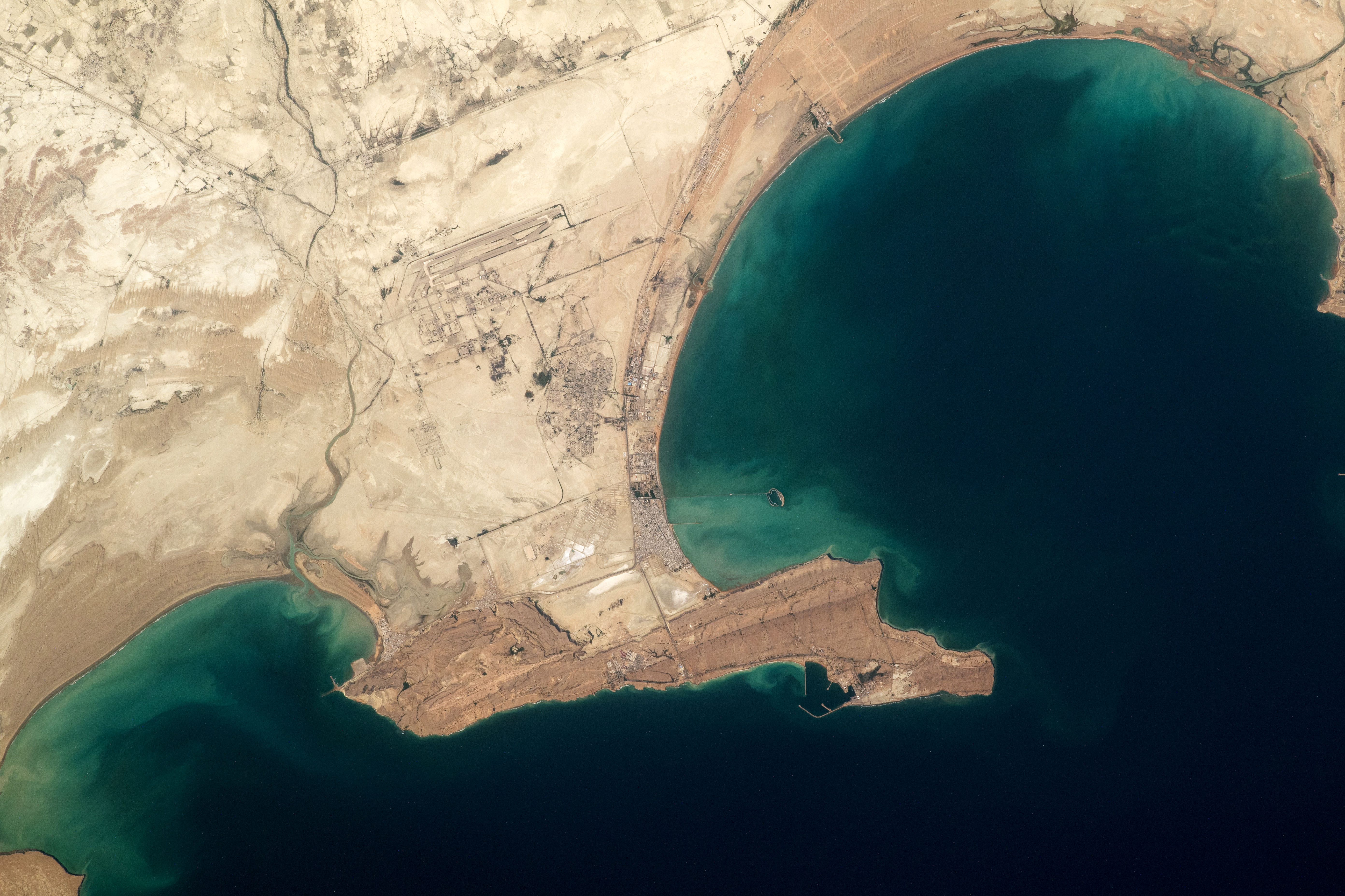
An astronaut aboard the International Space Station captured this photo of the Makran coast in southeastern Iran. Here, a prominent headland protects the small fishing ports of Konarak and Pozm. The Chabahar Konarak International Airport is visible at the top-left of the image.
Several capes and bays appear along the Makran coast—a strip of land along the Gulf of Oman in southeastern Iran and southwestern Pakistan. Nicknamed “hammerhead” capes because of their elongated forms and narrow necks, the headlands are shaped by the region’s plate tectonics, primarily uplift.
The long curves of the bays’ shorelines show accumulations of sandy sediment. This buildup appears as numerous semi-parallel lines that reveal the locations of past shorelines. These features, known as beach ridges, appear particularly well developed on the north shore of Chabahar Bay at the top of the image.
Scientists recently investigated the vulnerability of the headlands and bays to climate change, especially to the effects of sea level rise. The research was conducted in part because the Makran coast experiences high rates of tectonic uplift. The researchers concluded that the harder rocks of the headlands were less vulnerable to wave erosion than the more erodible rocks where the neighboring bays formed. These bays are expected to change shape as waves and currents move sediment. The bays’ coastlines might move farther inland as sea level rises and shorelines erode. Or, the coastlines may advance seaward as coastal sediment accumulates over time.
Astronaut photograph ISS067-E-19632 was acquired on April 17, 2022, with a Nikon D5 digital camera using a focal length of 400 millimeters. It is provided by the ISS Crew Earth Observations Facility and the Earth Science and Remote Sensing Unit, Johnson Space Center. The image was taken by a member of the Expedition 67 crew. The image has been cropped and enhanced to improve contrast, and lens artifacts have been removed. The International Space Station Program supports the laboratory as part of the ISS National Lab to help astronauts take pictures of Earth that will be of the greatest value to scientists and the public, and to make those images freely available on the Internet. Additional images taken by astronauts and cosmonauts can be viewed at the NASA/JSC Gateway to Astronaut Photography of Earth. Caption by Justin Wilkinson, Texas State University, JETS II Contract at NASA-JSC.