The Earth Observatory has published its last Image of the Day on this website. Please join us on our new home at science.nasa.gov/earth/earth-observatory.
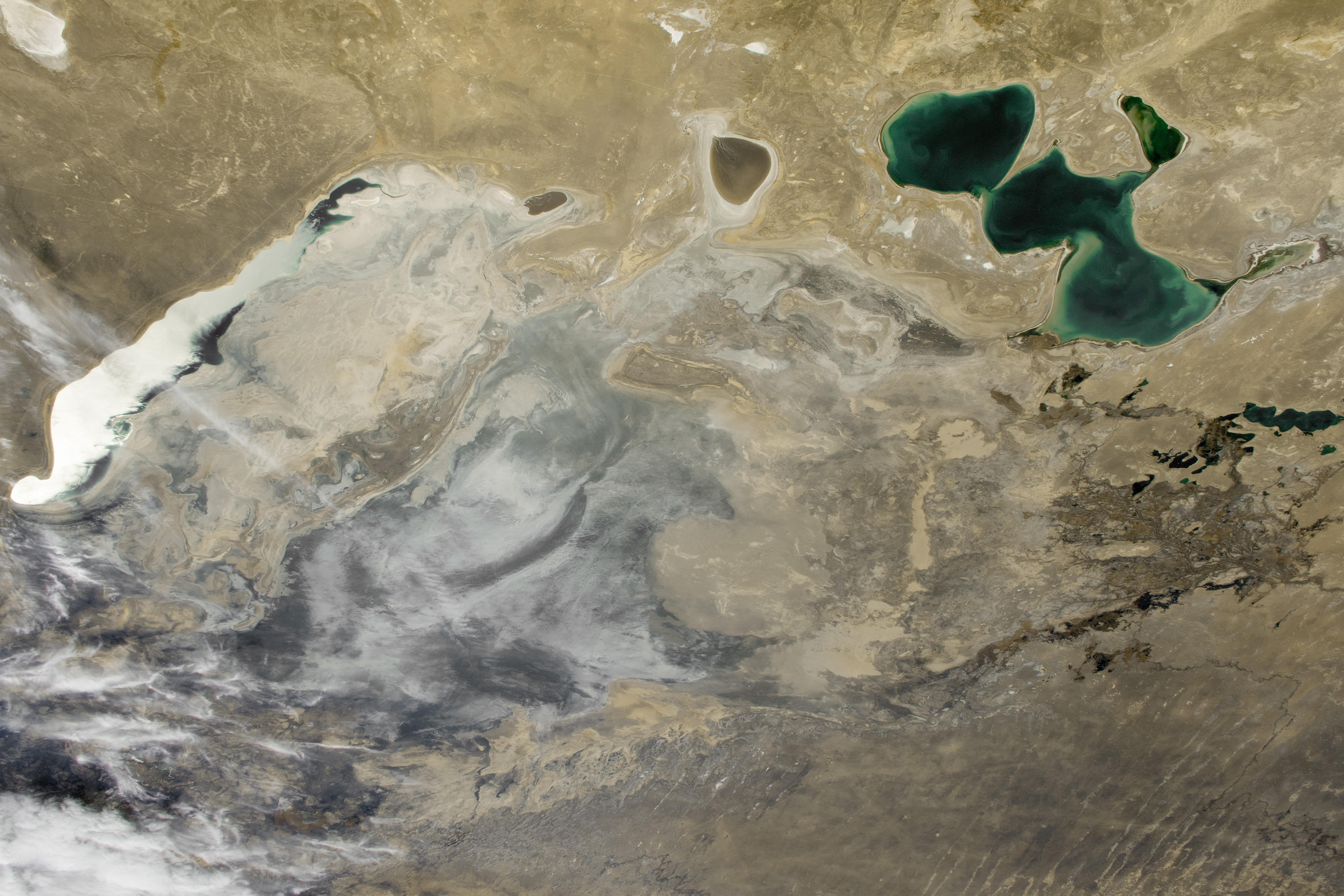
An astronaut aboard the International Space Station took this photograph of the Aral Sea while in orbit over Kazakhstan. This “sea” is actually an endorheic lake, located along the Kazakhstan and Uzbekistan border and fed by the Amu Darya and Syr Darya rivers. For the past 60 years, the lake has experienced a rapid decline in surface area due to the diversion of its two inflowing rivers to irrigate crops. At its greatest extent, the Aral Sea would have spanned almost the entirety of this photo.
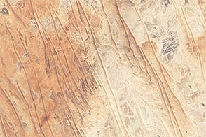
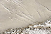
The Aral Sea was previously the world’s fourth-largest lake by surface area. But since the 1960s, it has decreased to approximately 10 percent of its original area. Desertification is visible toward the southeast, where the dried lakebed has transformed into the Aralkum Desert. This region is one of the newest deserts in the world and spans 62,000 square kilometers (24,000 square miles). Sand dunes, built by winds blowing across the drylandscape, are visible in the bottom-center of the image. In addition to dunes, the rapid aridification of the Aral Sea has triggered sand and dust storms that impact local air quality.
In the local Turkic language, “aral” translates to “island,” an allusion to the Aral Sea’s past as an expansive lake with over 1,100 islands. The Barsa-Kelmes Nature Reserve is situated on one of these former islands, between the remains of the North Aral Sea and South Aral Sea. The reserve provides habitat for hundreds of plant and animal species. As part of a U.S. Agency for International Development project to restore the local ecosystem and slow aridification, black saxaul shrubs (Haloxylon aphyllum) are being planted to help reestablish populations of native plant and animal species. They also mitigate the effects of dust storms by helping hold the soil in place.
Astronaut photograph ISS070-E-4509 was acquired on October 17, 2023, with a Nikon D5 digital camera using a focal length of 58 millimeters. It is provided by the ISS Crew Earth Observations Facility and the Earth Science and Remote Sensing Unit, Johnson Space Center. The image was taken by a member of the Expedition 70 crew. The image has been cropped and enhanced to improve contrast, and lens artifacts have been removed. The International Space Station Program supports the laboratory as part of the ISS National Lab to help astronauts take pictures of Earth that will be of the greatest value to scientists and the public, and to make those images freely available on the Internet. Additional images taken by astronauts and cosmonauts can be viewed at the NASA/JSC Gateway to Astronaut Photography of Earth. Caption by Cadan Cummings, Jacobs, JETS II Contract at NASA-JSC.