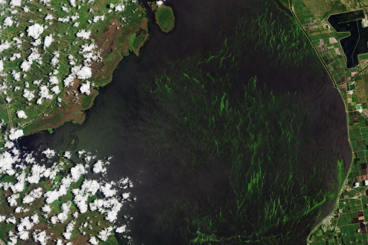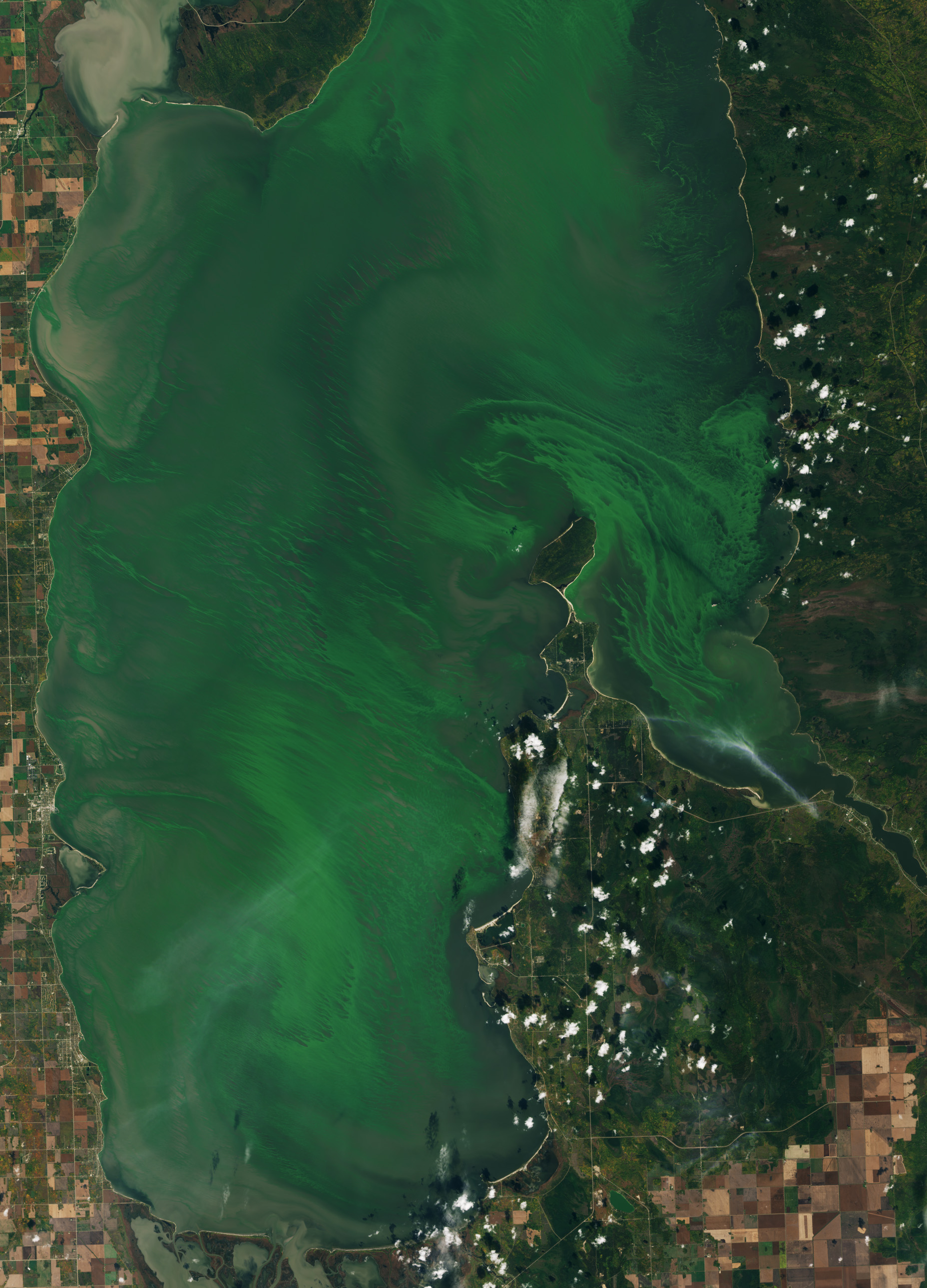
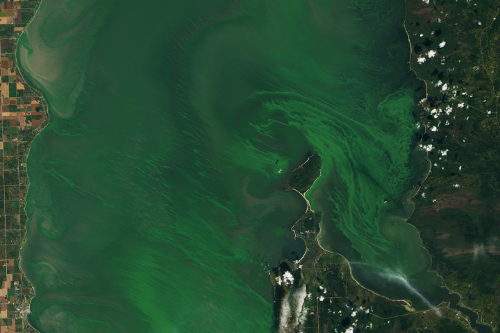
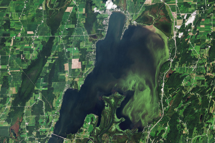
Lake Winnipeg, the world’s 10th largest freshwater lake by surface area, has experienced algae blooms at a regular occurrence at least since the 1990s. A bloom of blue-green algae once again covered parts of the lake in September 2023.
Located in Manitoba, Canada, the long lake has a watershed that spans one million square kilometers (386,000 square miles), draining some of Canada’s agricultural land. The lake consists of a large, deep north basin and a smaller, comparatively shallow south basin.
Swirls of algae filled the south basin of the lake on September 25, 2023, when the OLI-2 (Operational Land Imager-2) on Landsat 9 acquired this image. Around this time, satellite observations analyzed by Environment and Climate Change Canada indicated that algae covered about 8,400 square kilometers (3,200 square miles), or about a third of the lake’s area.
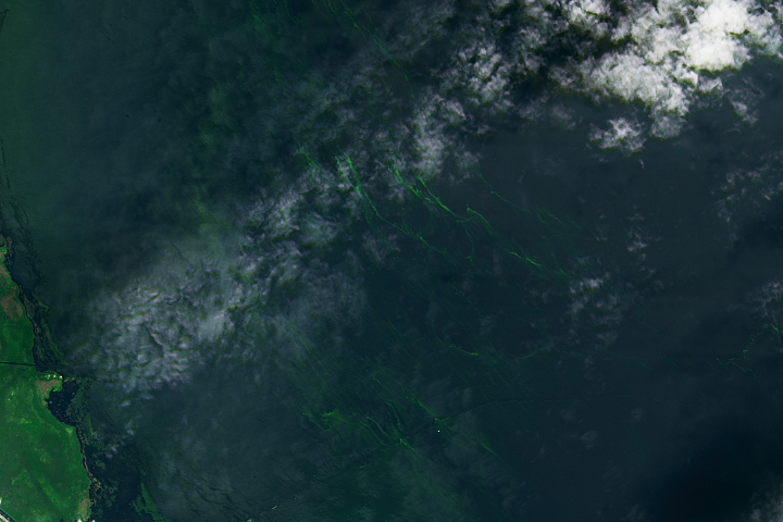
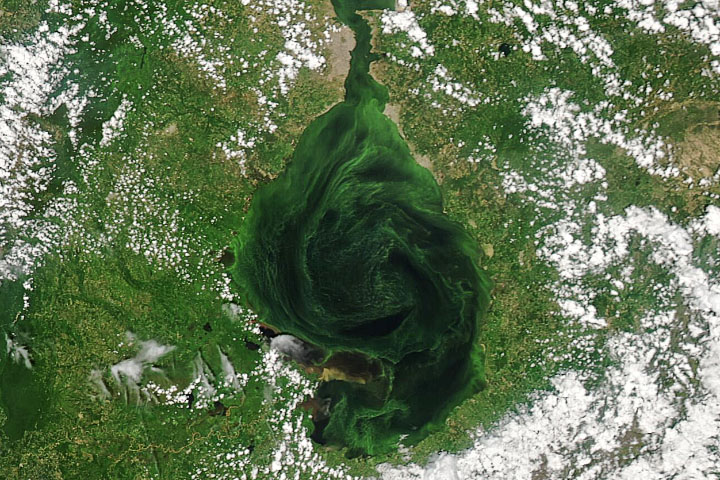
Blue-green algae, also known as cyanobacteria, are single-celled organisms that rely on photosynthesis to turn sunlight into food. The bacteria grow swiftly when nutrients like phosphorus and nitrogen are abundant in still water. The bloom pictured here may contain blue-green algae, as well as other types of phytoplankton; only a surface sample can confirm the exact composition of a bloom. Some cyanobacteria produce microcystin—a potent toxin that can irritate the skin and cause liver and kidney damage.
While algae are part of a natural freshwater ecosystem, excess algae, particularly cyanobacteria, can be a nuisance to residents and tourists using the lake and its beaches for fishing, swimming, and recreation. Beaches in the south basin of Lake Winnipeg can get as many as 30,000 visitors a day during the summer months. Water samples taken at Winnipeg Beach on the west shore found that cyanobacteria levels were elevated in August, and visitors were advised to avoid swimming and fishing if green scum was visible.
The health of Lake Winnipeg has been in decline in recent decades. Between 1990 and 2000, phosphorous concentrations in the lake almost doubled and algae blooms proliferated, both in terms of occurrence and extent. The major contributors to the influx of phosphorous to the lake were increased agricultural activities in the watershed and a higher frequency of flooding, which has increased runoff into the lake.
Phosphorus concentrations are almost three times higher in the south basin of Lake Winnipeg, compared to the north basin. A 2019 study using data from the MODIS (Moderate Resolution Imaging Spectroradiometer) instrument on NASA’s Terra satellite found that the chlorophyll-a concentrations, which are used as a measure of phytoplankton biomass, were on average more than twice as high in the south basin, compared to the north.
NASA Earth Observatory images by Wanmei Liang, using Landsat data from the U.S. Geological Survey. Story by Emily Cassidy.
Image of the Day Water Water Color
An influx of nutrients in recent decades has contributed to the proliferation of algae in the large Canadian lake.
Image of the Day for October 6, 2023
View more Images of the Day:

Floating, plant-like organisms reproduce abundantly when there are sufficient nutrients, sunlight, and water conditions. Extreme blooms of certain species can become harmful to marine animals and humans.
alert message