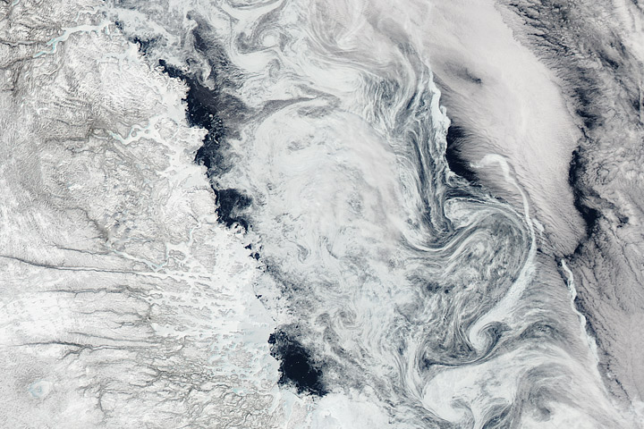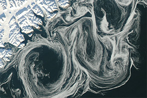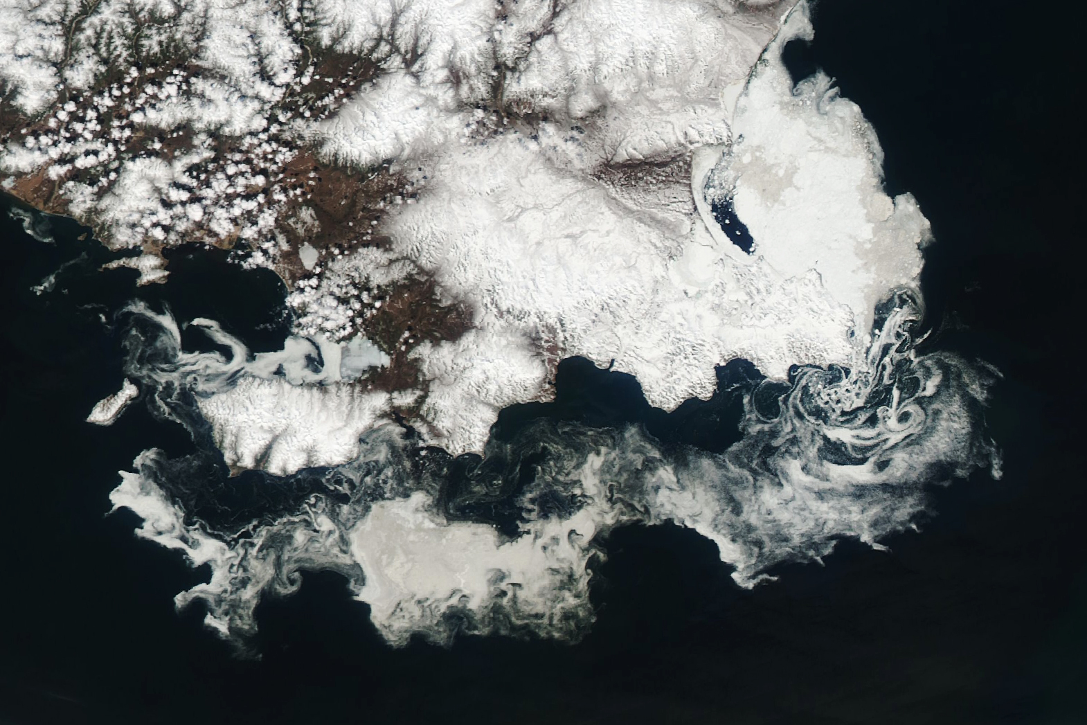
Sea ice in the Sea of Okhotsk put on a dazzling display in late May 2023, as the winter’s ice pack thinned and broke up. The freely drifting ice, subject to wind and currents, formed a series of spirals off the coast of Russia.
The Moderate Resolution Imaging Spectroradiometer (MODIS) on NASA’s Aqua satellite captured this image on May 28, 2023. More-intact ice is visible on the north side of the P’yagina Peninsula (Poluostrov P’yagina), at the top of the image, with smaller pieces breaking away and drifting to the south and west. A group of islands—too small to see clearly at this scale—off the eastern tip of the land may be responsible for the small eddies in that area. Spirals such as these can form downstream of a stationary object that obstructs fluid flow.
The Sea of Okhotsk, which is hemmed in by the Siberian coast and the Kamchatka Peninsula, is the southernmost sea in the Northern Hemisphere that freezes seasonally. An influx of frigid Siberian air, in addition to inflows of freshwater from rivers that lower the salinity and raise the freezing point of the water, create conducive conditions for ice to form during the colder months.
During the 2022-2023 winter, the extent of sea ice in the Arctic was below average. The end-of-winter minimum extent, reached on March 6, was the sixth lowest in the satellite record, according to data maintained by the National Snow & Ice Data Center (NSIDC). The NSIDC also noted that seasonal ice decline picked up in the last several days of May, when this image was captured.
In a recent study, researchers in Japan found that yearly differences in ice extent are largely governed by regional cold air masses and low-pressure systems, along with large-scale patterns associated with the El Niño/Southern Oscillation (ENSO). Looking at longer term climate-driven trends, they reported that ice extent in the Sea of Okhotsk decreased by about 9 percent per decade between 1979 and 2010.
NASA Earth Observatory image by Wanmei Liang, using MODIS data from NASA EOSDIS LANCE and GIBS/Worldview. Story by Lindsey Doermann.