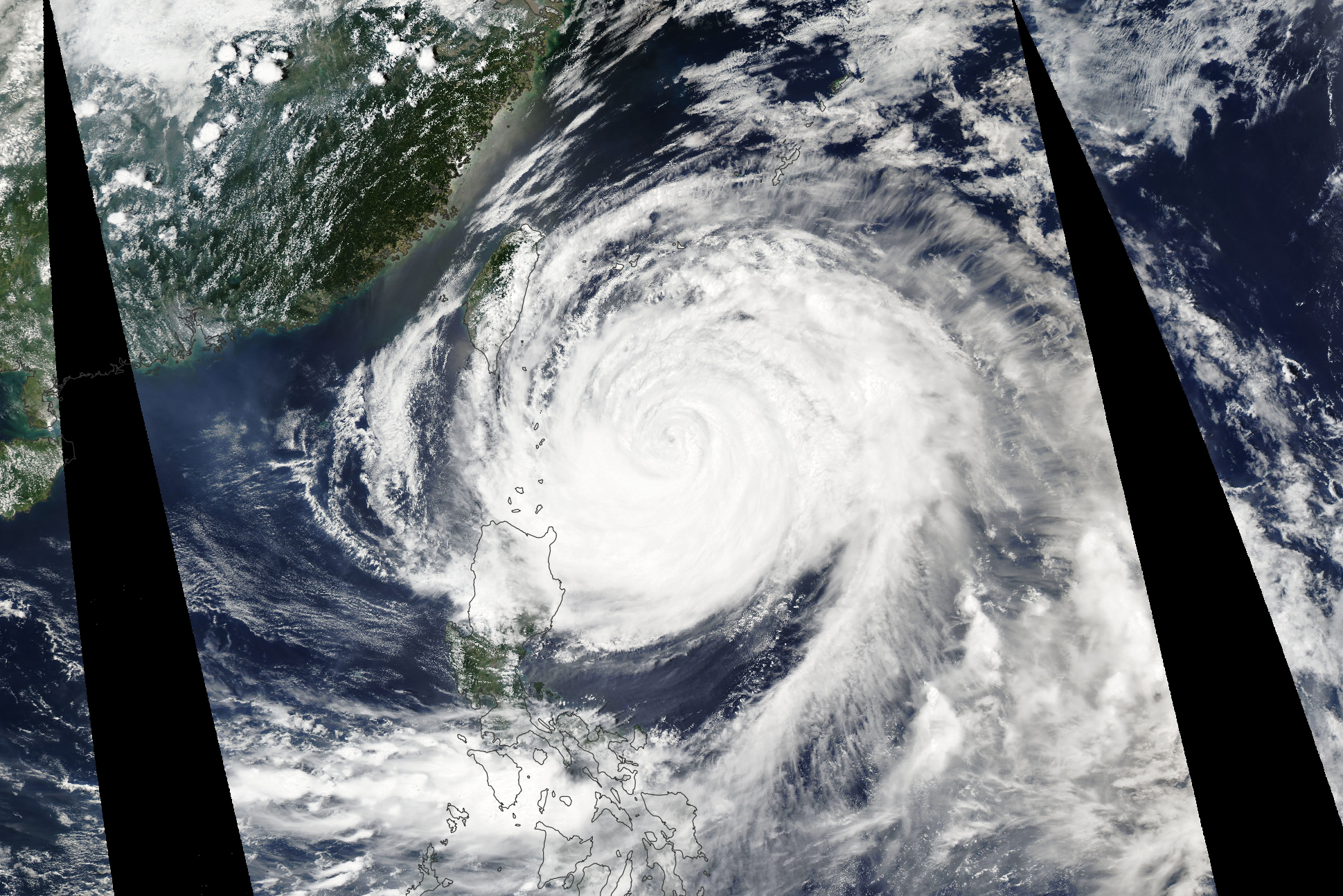
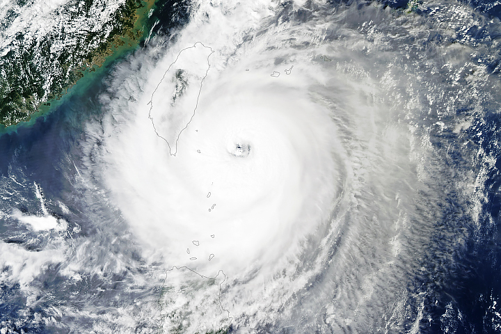
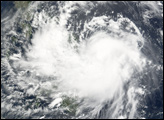
For most of 2023, the northwest Pacific has been relatively quiet. Typhoon Mawar (also called Betty), the first typhoon of the season, shattered that calm when it lashed the Mariana Islands on May 24 and rapidly intensified to category-5 strength in the Philippine Sea. With sustained winds that reached 295 kilometers (185 miles) per hour on May 25, the super typhoon grew to be one of the strongest May storms on record.
The Moderate Resolution Imaging Spectroradiometer (MODIS) on NASA’s Aqua satellite acquired this natural-color image of Mawar at 05:20 Universal Time on May 30, 2023. Though the storm appeared to be bearing down on Taiwan, it was in the process of turning north and away from the island. After rapidly intensifying between May 24 and 25, Mawar then weakened significantly as it encountered cooler water temperatures and less favorable wind shear conditions as it neared Taiwan.
Around the time of the MODIS image, the U.S. Joint Typhoon Warning Center reported that Mawar had sustained winds of 120 kilometers (80 miles) per hour, with gusts up to 150 kilometers per hour. Though Mawar did not strike the Philippines or Taiwan directly, the outer bands of the storm brought heavy rains to northern Luzon and rough seas to the eastern coast of Taiwan. Forecasters expected the weakening storm to next move north toward the Sakishima Islands, an island group in southern Japan, and then northeast and away from the Japanese mainland.
The Western Pacific typhoon season stretches across the entire year, but most storms form between May and October. As of May 30, one named storm and one typhoon had formed so far in 2023.
NASA Earth Observatory image by Allison Nussbaum, using MODIS data from NASA EOSDIS LANCE and GIBS/Worldview. Story by Adam Voiland.


