The Earth Observatory has published its last Image of the Day on this website. Please join us on our new home at science.nasa.gov/earth/earth-observatory.
Today’s story is the answer to the April 2023 puzzler.
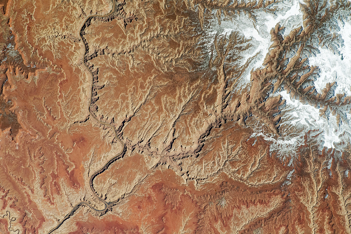
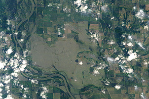
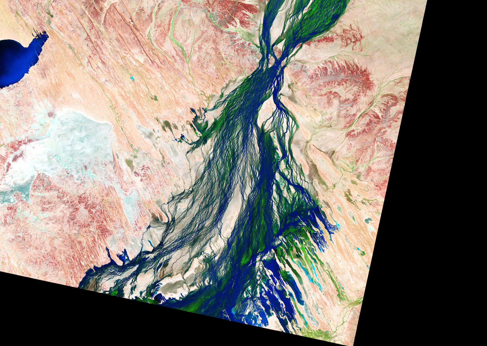
The Diamantina River in Australia runs southwest from northern Queensland toward Lake Eyre (Kati Thanda) in South Australia—the lowest point on the continent. It is one of several rivers in the Lake Eyre Basin, which is situated in Australia’s desert interior and drains approximately 15 percent of the continent.
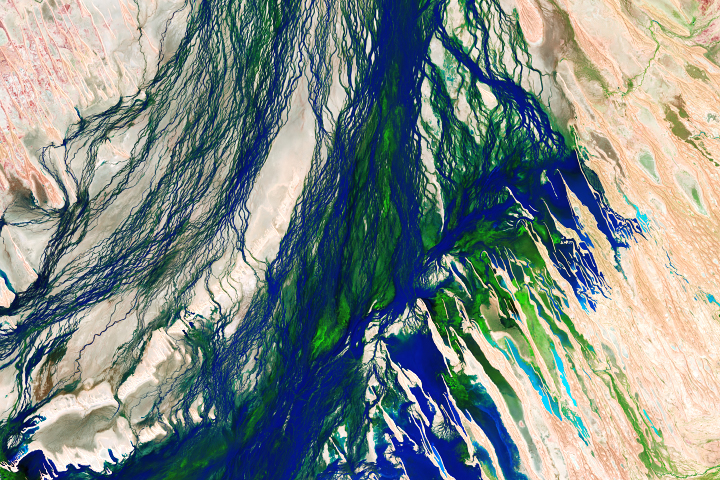
For much of the year, its beds remain dry. However, seasonal rainfall sends water coursing through its channels and transforms the otherwise parched landscape. These false-color images illuminate the results of this phenomenon.
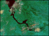
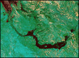
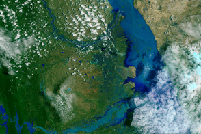
The Operational Land Imager (OLI) on Landsat 8 captured the images on April 7, 2023, as floodwaters from rainfall in February and early March flowed through the Diamantina River catchment. The images combine the shortwave infrared, near infrared, and red light (OLI bands 7-5-4). In this configuration, bare earth appears brown or reddish, vegetation is green, and sediment-laden water and saturated soil are shades of blue.
Bursts of vegetation growth that tend to follow in the wake of the floodwaters appear to be cropping up. A similar pulse of green is visible in images acquired in 2018.
The wide view (top) shows a textbook example of an anabranching river, according to Sara Polanco, an expert in landscape dynamics and a lecturer at The University of Sydney. In contrast to the channels of braided rivers, which shift around within the riverbed, the many channels in anabranching rivers are hemmed in by semi-permanent islands stabilized by vegetation.
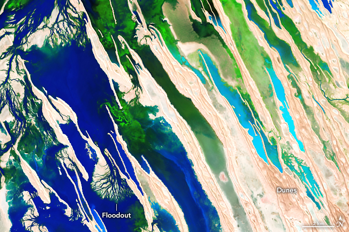
A detailed look at the lower-right portion of the wide view reveals other notable features. Here, some of the floodwaters divert into north-northwest trending ridges that are part of a fossil landscape of wind-formed dunes. As water flows through the troughs, it forms several small delta-like features, which some researchers refer to as floodouts. “They are ubiquitous in Australia,” said Polanco. “Sometimes it looks like the river channels just disappear, but when these systems are in flood, the connection between the channels and the surrounding landscape is finally revealed.”
About every eight years, rivers in the basin reach Lake Eyre. The Diamantina River has historically provided 75 percent of the lake’s water. Floodwaters have yet to flow that far this year, and it’s uncertain if there will be enough water to reach the lake. Most is lost to evaporation and transpiration along the way.
Recent observations and the three-month streamflow forecast, from Australia’s Bureau of Meteorology, show levels near or slightly above the median, relative to historical records. On May 1, 2023, the bureau still had a minor flood warning in place for the town of Birdsville, about 130 kilometers (80 miles) downstream of these images. However, the report noted that flooding is easing and the river should soon dip below the minor flood level.
NASA Earth Observatory images by Allison Nussbaum, using Landsat data from the U.S. Geological Survey. Story by Lindsey Doermann.