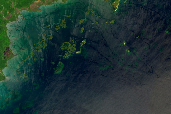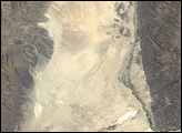
The salty Siwa Oasis is one of five large oases scattered across Egypt’s Western Desert, a vast sandy expanse that is part of the Sahara. Situated about 50 kilometers (30 miles) east of the Libyan border and nearly 600 kilometers (370 miles) west of Cairo, the region averages only about 10 millimeters (0.4 inches) of rainfall annually. However, owing to its unique geology, there is currently enough water to support agriculture, tourism, and salt harvesting operations.
The oasis has sustained settlements dating as far back as ancient Egypt’s 26th dynasty in the 6th century B.C.E. Travelers to the area today can visit, among other ruins, the temple where Alexander the Great was said to be pronounced the son of the deity Amun. They may also delight in bobbing in the dense waters of its many salt ponds.
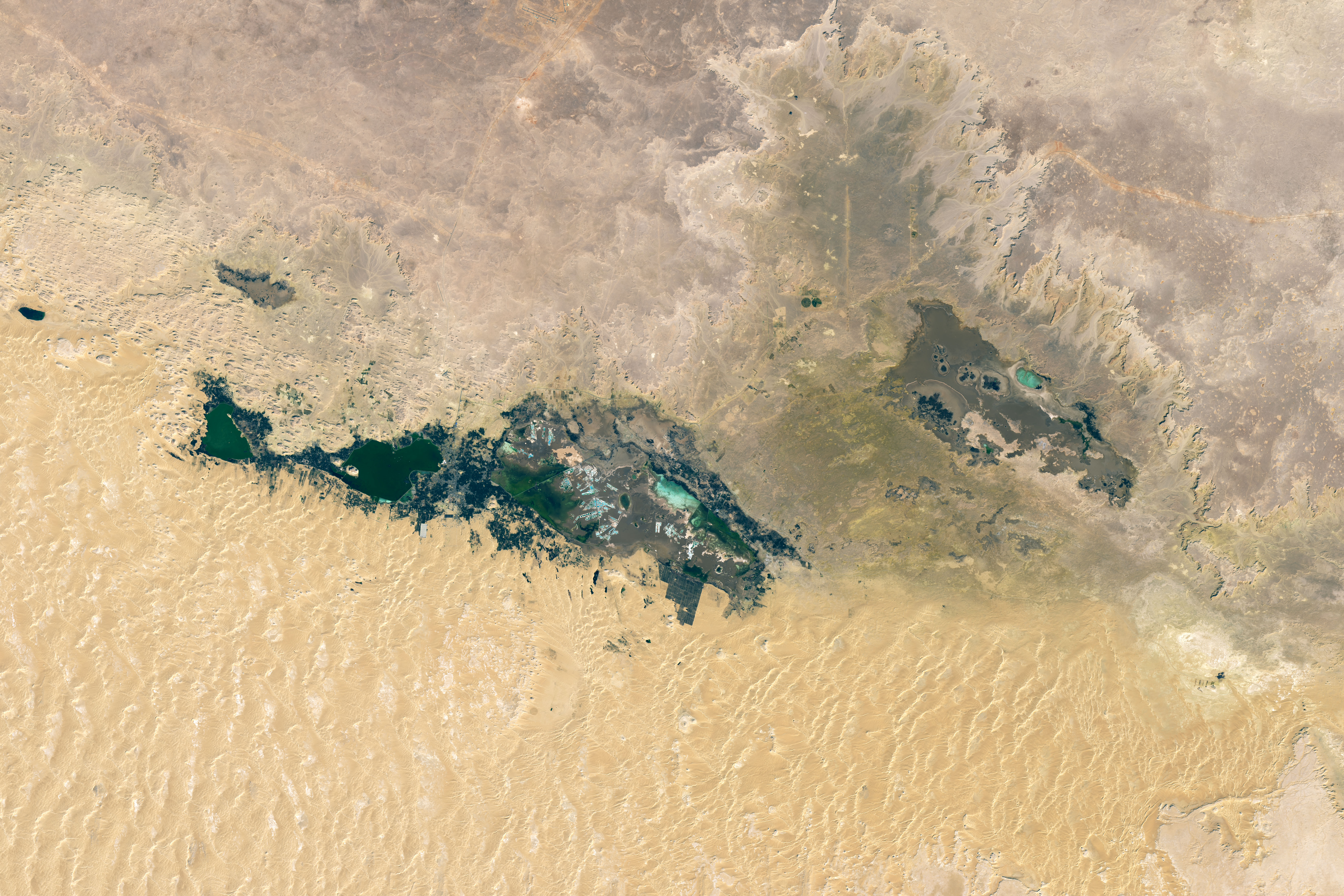
The image above shows several lakes and nearby springs amid the arid environment. It was captured on January 23, 2023, by the Operational Land Imager-2 (OLI-2) on Landsat 9. The array of lakes exists here because of a tectonically formed depression that reaches depths of 20 meters (65 feet) below sea level. Surface water in the depression is supplied by springs that are fed by shallow groundwater, which in turn is supplied with water from the Nubian Sandstone Aquifer System (NSAS)—one of the largest aquifers in the world.
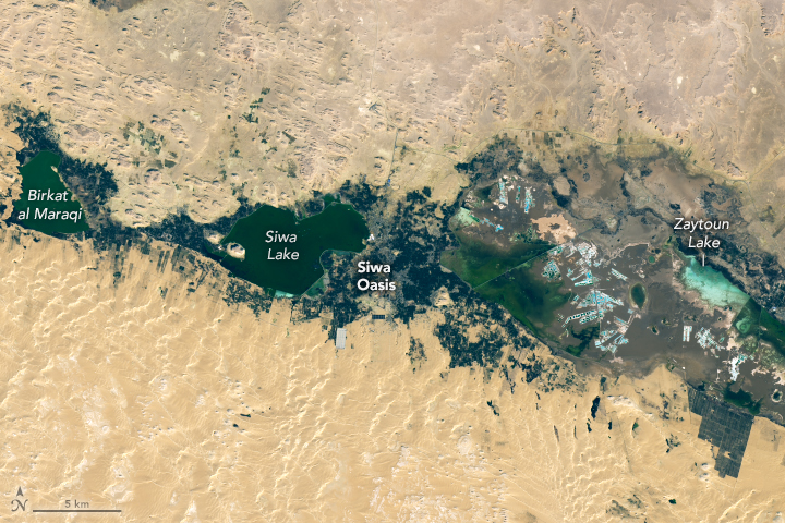
Cultivated land, primarily used to grow olives and date palms, is visible in the image above as the dark areas abutting the lakes. The extraction of water through wells for irrigation has caused the surface area of the Siwa lakes to fluctuate significantly.
Researchers monitoring the Siwa region via remote sensing over the past several decades have found that the surface area of the lakes and the extent of waterlogged land generally increase in tandem with agricultural activity. Drainage in the Siwa area is poor, so agricultural runoff and excess irrigation water pumped from wells tend to pool. Changes to well design and water management have helped to mitigate these issues.
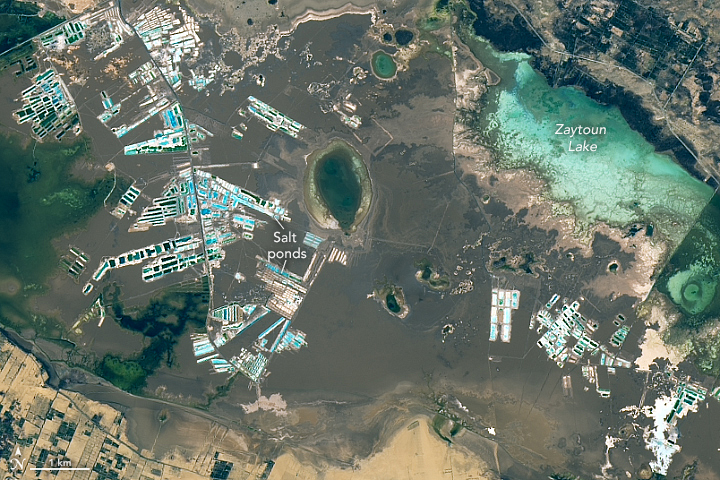
But water is only part of Siwa’s story. The area is rich in salt deposits, which is evident in this detailed view of evaporation ponds used for salt harvesting. Near-surface groundwater has high salt content and contributes to salt accumulation in the topsoil. Water from the deep aquifer, while suitable for irrigation, still contains some salt and contributes to soil salinity when it’s applied to cropland.
The accumulation of salts in the soil and groundwater has had a profound impact on crop yield. For example, one study reported that olive and date palm yields decreased about 46 percent and 55 percent, respectively, from 2000 to 2011. Researchers have proposed establishing a surface drainage network to sustain more agriculture.
NASA Earth Observatory images by Lauren Dauphin, using Landsat data from the U.S. Geological Survey. Story by Lindsey Doermann.
alert message