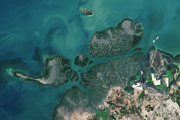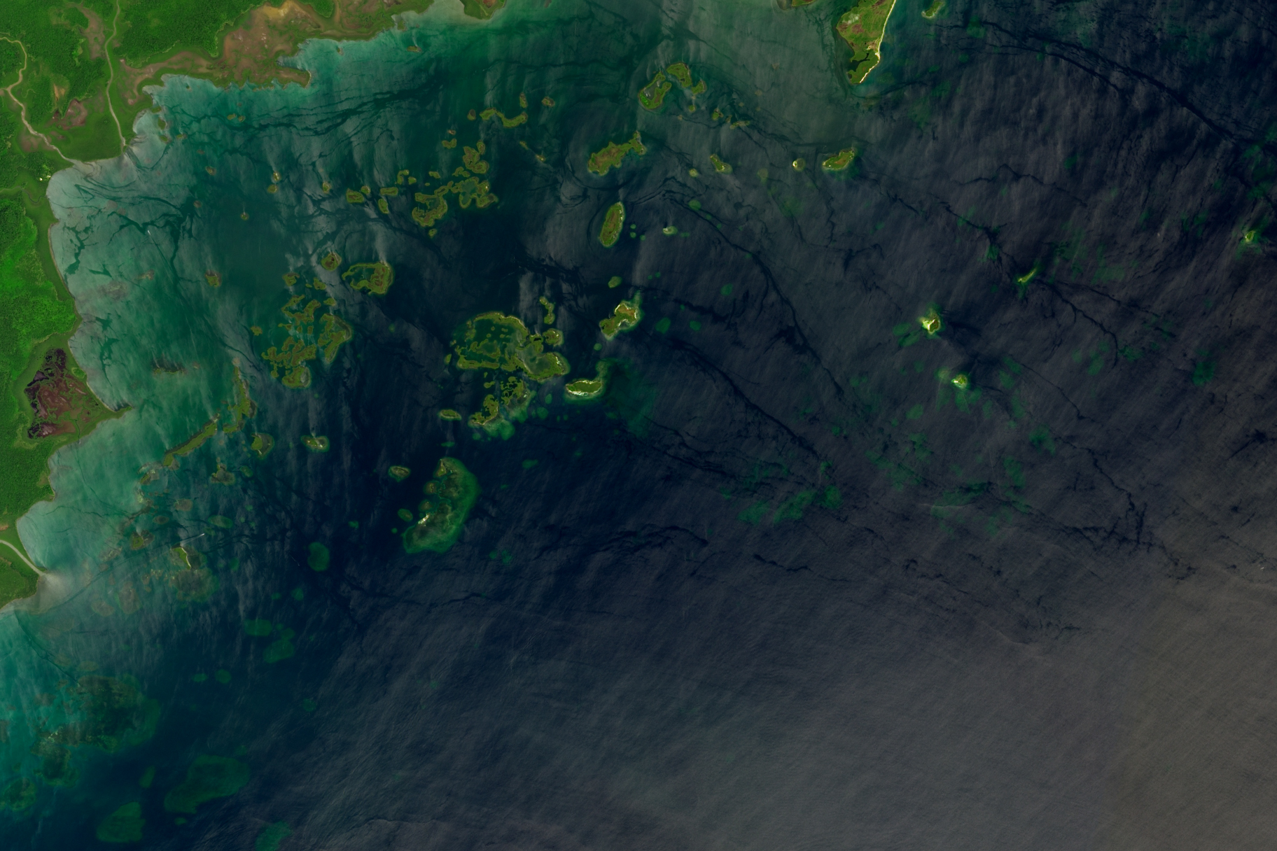
In the Port Honduras Marine Reserve in southern Belize, assemblages of coral teem with parrotfish, snappers, sharks, sea turtles, sponges, and a panoply of brightly colored reef fish. Closer to shore, meadows of seagrass—playgrounds for dolphins and lunch for manatees—also serve as nurseries for lobsters, conch, finfish, and a multitude of invertebrates.
The reserve includes most of the waters shown in this image (above), which was was acquired by the Operational Land Imager-2 (OLI-2) on Landsat 9 on September 25, 2022. Mangroves (dark green) line the shoreline and cover more than 100 small offshore cays (also spelled cayes) spread throughout the shallow waters. These forested cays—the tops of old coral reefs—are surrounded by seagrass meadows. The clusters of light green features farthest offshore are coral reefs found in deeper waters around the Snake Cayes—four sandy islands situated atop a limestone ledge. Among the many species found in the reserve, are some of the rarest and most endangered in the world: manatees, hawksbill turtles, hammerhead sharks, staghorn coral, goliath grouper, and elkhorn coral.
But the backbone of the entire ecosystem—its coral reefs—is vulnerable. According to a new ranking of risk to coral reefs in Belize’s marine reserves, the reefs in Port Honduras Marine Reserve scored poorly. The international team that conducted the ranking—including researchers from Belize and the United States—analyzed the vulnerability of coral reefs in 24 protected areas in Belize. They developed a vulnerability index based on satellite observations of water temperatures and clarity collected between 2002 and 2022, assigning each area a number from 2 (least vulnerable) to 12 (most vulnerable). Port Honduras Marine Reserve scored 10.
Coral in this reserve had more exposure to warm and turbid (cloudy) water over the past two decades than any other reserve in Belize. Warm water can exacerbate coral diseases and cause reefs to bleach. Bleaching occurs when corals expel the beneficial algae that live within them due to temperature and other environmental stresses. Poor water clarity—typically caused by runoff carrying sediment after heavy rains—can contribute to problems for reefs by smothering corals and preventing them from getting enough light.
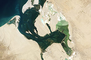
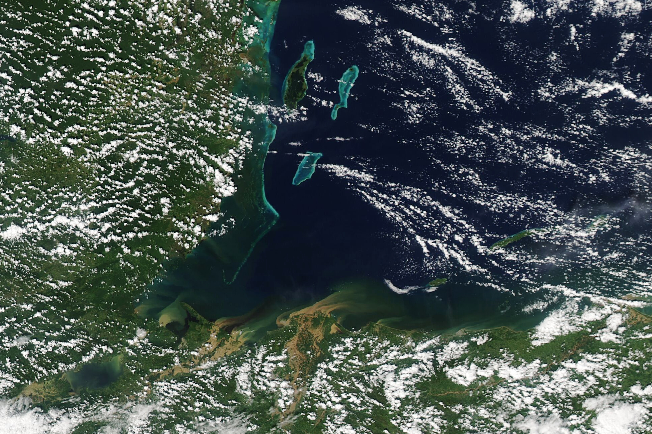
The analysis was based on satellite data acquired by the Moderate Resolution Imaging Spectroradiometer (MODIS) on NASA’s Aqua satellite. The MODIS observations showed that water temperatures were the warmest in September. Water clarity was the worst during the rainy season—June through September. The image below, acquired by MODIS on November 8, 2020, shows runoff with sediment flowing into the reserve following heavy rains associated with Hurricane Lisa.
Other areas that had high vulnerability scores were Swallow Caye Wildlife Sanctuary (9), Sapodilla Cayes Marine Reserve (8), and Corozal Bay Wildlife Sanctuary (7). Despite their vulnerability, reefs in Belize are relatively healthy compared to reefs in other parts of the world, according to a management plan developed by Toledo Institute for Development and Environment (TIDE) and the Belize government. But they have still experienced problems with bleaching, coral diseases, and coral mortality in recent decades. Scientists have also documented significant coral damage in the reserve after Hurricane Mitch in 1998 and Hurricane Iris in 2001, and there are concerns that nutrient-rich agricultural runoff that empties into the preserve could also be affecting coral health.
The vulnerability rankings—published as part of a study in the Frontiers in Remote Sensing—are intended to help authorities in Belize protect its reefs from human impacts such as development, overfishing, pollution, and climate change. All the protected areas in the study are included in Belize’s Integrated Coastal Zone Management Plan, a framework to guide Belize’s government on how to support the sustainable use of the country’s coastal areas. The new study, along with other Belize-focused research sponsored through NASA’s Earth Applied Sciences program, will help inform the next plan, which is currently being revised, said Samir Rosado, a co-author of the study and a coastal planner at the Coastal Zone Management Authority & Institute (CZMAI).
NASA Earth Observatory images by Allison Nussbaum, using Landsat data from the U.S. Geological Survey. Story by Adam Voiland, with information and reporting from Andrew Wang (NASA JPL).
alert message