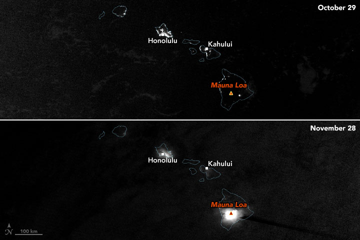
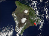
The world’s largest active volcano—Hawaii’s Mauna Loa—has been quiet for the past four decades. But in November 2022, the volcano began to stir.
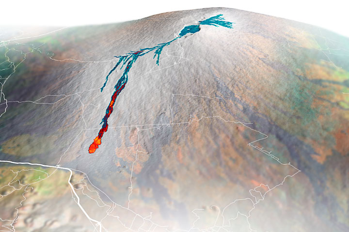
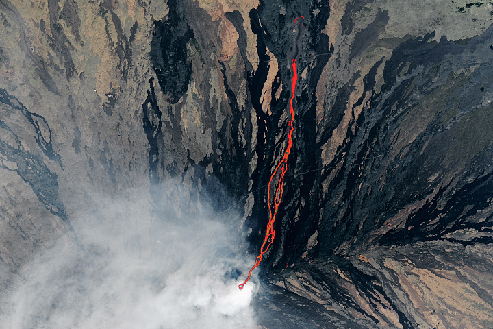
The first signs of unrest emerged in early October 2022, when U.S. Geological Survey data showed a tenfold increase in small earthquakes beneath the volcano’s summit caldera—a result of the underground movement of magma. Swarms of earthquakes continued sporadically through November 27, 2022, when new fissures began to spill lava across the caldera floor at 11:30 p.m. local time. Most of the lava fountains were only a few yards tall, though some of the tallest rose as high as 100–200 feet (30–60 meters). The lava flows in the caldera had quieted by the next day, although other fissures had opened slightly to the northeast by then.
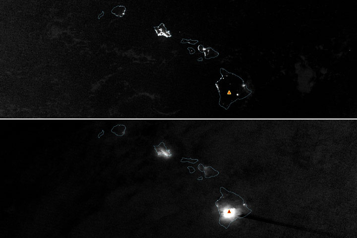
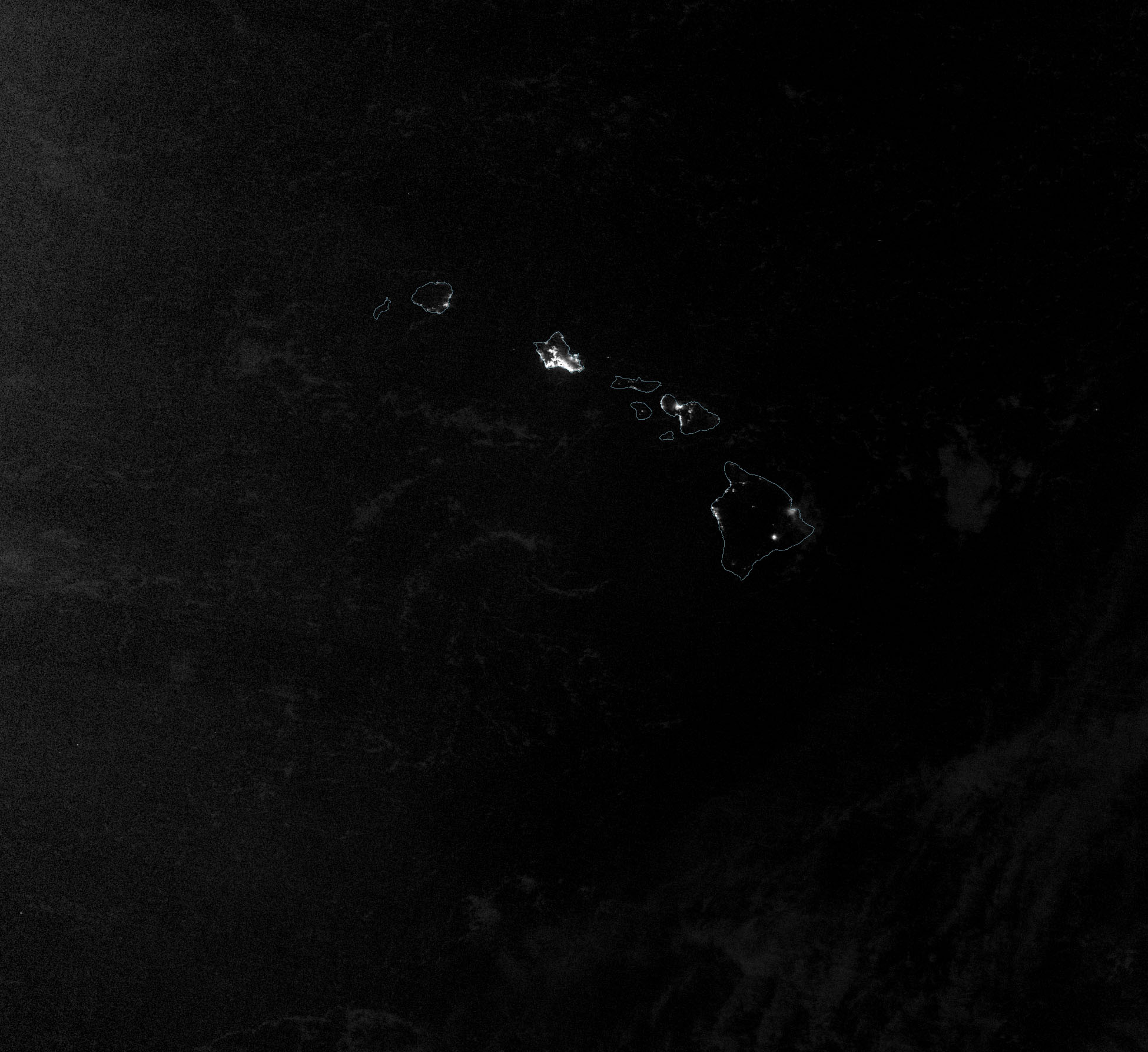
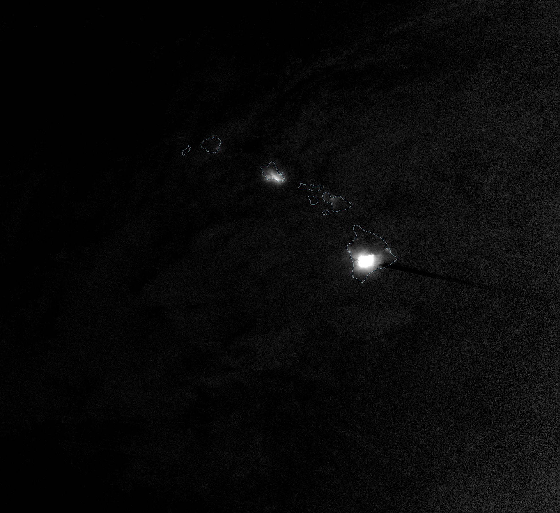
The bright glow of the eruption was visible to NASA and NOAA satellites orbiting hundreds of miles above the surface. The image above was acquired at 2:25 a.m. local time (12:25 UTC) on November 28 by the “day-night band” of the Visible Infrared Imaging Radiometer Suite (VIIRS) on the NOAA-NASA Suomi NPP satellite. For comparison, the image above shows the same area on October 29, 2022, before the eruption had begun.
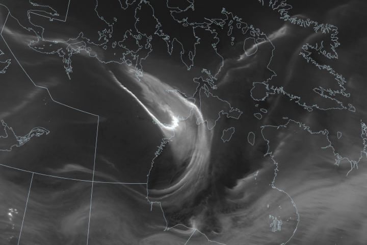
Some cloud cover on November 28 scattered light from the eruption and urban areas and made it more diffuse. “It also looks like the lava emitted by the eruption was so bright that the sensor was saturated, producing a ‘post-saturation recovery streak’ along the VIIRS scan to the southeast,” noted Simon Carn, a volcanologist at Michigan Tech. “These streaks are only seen over very intense sources of visible radiation.”
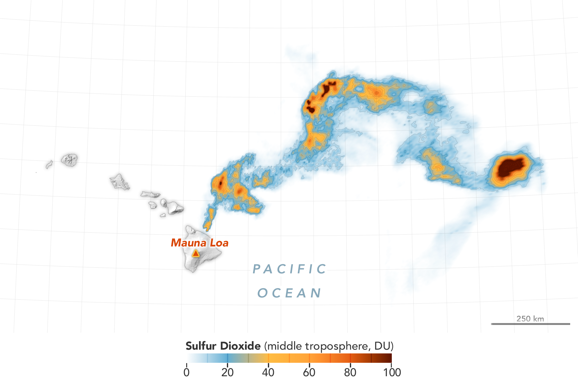
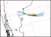
Among the substances pouring from the volcano was sulfur dioxide (SO2), a pungent gas that reacts with oxygen and water to form a gray volcanic haze called vog. The map above shows where the European Space Agency’s Sentinel-5P satellite detected sulfur dioxide in the middle troposphere with its Tropospheric Monitoring Instrument (TROPOMI) sensor. The Ozone Monitoring Instrument (OMI)—the predecessor to TROPOMI—on NASA’s Aura satellite makes similar measurements. The Ozone Mapping and Profiling Suite (OMPS) on Suomi NPP, NOAA-20, and NOAA-21 does as well.
“The eruption is effusive rather than explosive, although its initial phase overnight on November 28 was quite energetic and injected some sulfur dioxide to high altitudes, possibly all the way to the tropopause,” said Carn. “That is unusual for this type of eruption.”
Scientists at NASA used both OMPS and TROPOMI to measure sulfur dioxide emissions of about 0.2 teragrams on November 28. “Both sensors measured within 5 minutes of each other in early afternoon and are in excellent agreement despite having different algorithms,” said Nickolay Krotkov, an atmospheric scientist at NASA’s Goddard Space Flight Center. For comparison, Mauna Loa’s previous eruption, in March–April 1984, emitted about 1.2 teragrams of sulfur dioxide over a three-week eruption.
“Mauna Loa eruptions typically last for a few weeks, but this is an evolving eruption and we’re just in the early days of it,” added Ashley Davies, a volcanologist at NASA’s Jet Propulsion Laboratory. “The U.S. Geological Survey’s Hawaiian Volcano Observatory is closely monitoring and assessing all aspects of the eruption and is a great source of information for people wondering about the risks and hazards this eruption might pose.”
Scientists affiliated with NASA’s Disasters program are actively monitoring the eruption and are in the process of providing data and imagery to other agencies—including the Hawaiian Volcano Observatory and FEMA—that are responding to the eruption.
NASA Earth Observatory images by Joshua Stevens, using VIIRS day-night band data from the Suomi National Polar-orbiting Partnership and modified Copernicus Sentinel 5P data (2022) processed by the European Space Agency. Story by Adam Voiland.
alert message


