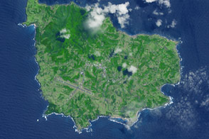
Lying in the middle of the Atlantic Ocean about 1,400 kilometers (870 miles) off Portugal’s coast, the Azores archipelago is an autonomous region comprised of nine islands and home to almost a quarter million people. The islands are clustered in three groups in a chain spanning 600 kilometers (370 miles) across the Mid-Ocean Ridge. The westernmost island group lies on the North American tectonic plate, while the central and eastern groups lie on the Eurasian plate.
The islands of the Azores began to form about 10 million years ago over a mantle hotspot, similar to the formation of the Hawaiian Islands. However, unlike Hawai'i, which lies in the middle of a tectonic plate, the Azores lie on the edge.
The North American, Eurasian, and African plates meet to form the Azores triple junction— an uncommon type of plate boundary where three divergent ridges meet. (Most triple junctions involve a subduction zone where plates converge.) The North American and Eurasian plates are moving apart at a rate of 2 to 5 centimeters (0.75 to 2 inches) per year, an average speed for a spreading center. The Eurasian and African plates, however, are diverging at a hyperslow rate of 2 to 4 millimeters (0.08 to 0.16 inches) per year along the 550-kilometer (340-mile) Terceira Rift.
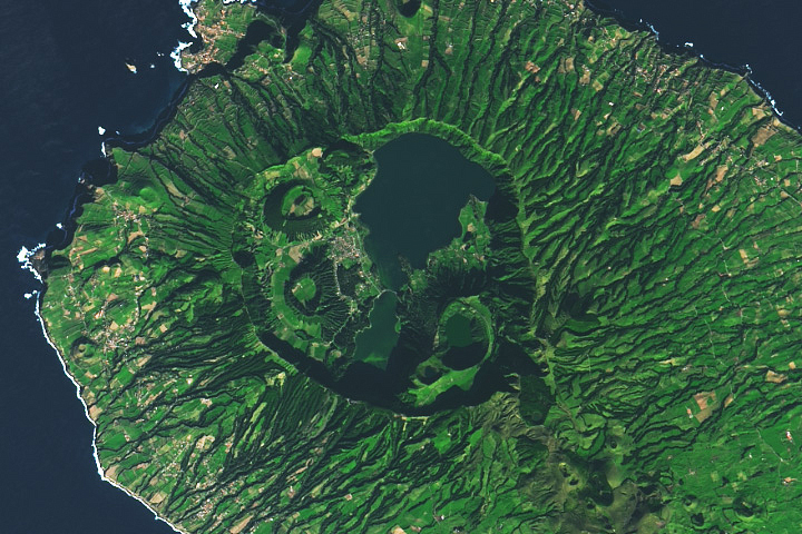
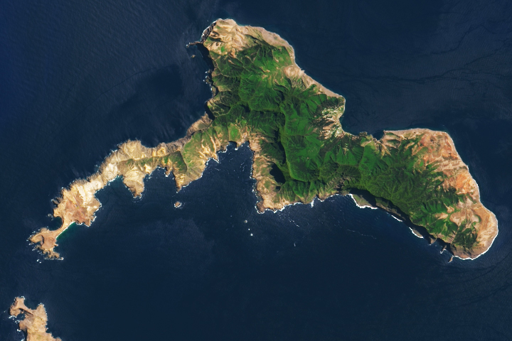
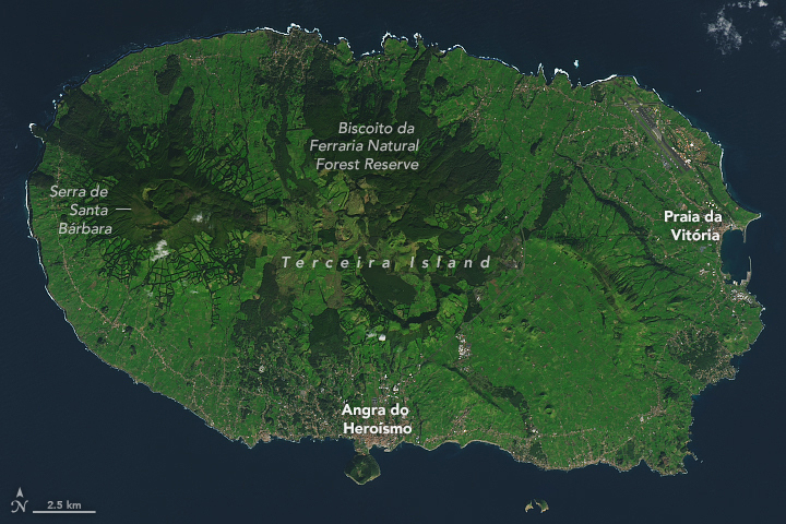
The rift passes through the island of Terceira, shown in the above image, which was acquired on January 3, 2020, by the Operational Land Imager (OLI) on Landsat 8. This 400-square-kilometer island in the central Azores first formed about 400,000 years ago. At the western end, Serra de Santa Bárbara rises to the island’s highest point at 1,021 meters (3,350 feet) above sea level.
Nearly a quarter of the island, which is dominated by forests and grasslands, has been designated as protected nature reserves. These include Biscoito da Ferraria Natural Forest Reserve in the north and Serra de Santa Bárbara in the west.
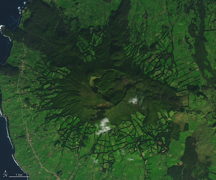
This detailed view shows the volcanic features of Serra de Santa Bárbara. The peak includes a double caldera, which formed from summit collapses 25,000 and 15,000 years ago. Also visible are small lava domes that formed on the eastern flank in 1761 during the last volcanic eruption to occur on land on Terceira.
The flanks of the volcano are covered by agricultural fields and pastures. The Azores are famous for the production of wine and tea, as well as cattle, which were brought by settlers in the 15th century. When the armadas of the Iberian empires ruled the seas, the Azores were a port of respite and resupply for ships in the mid-Atlantic. This was made possible by a deep-water anchorage at Angra do Heroísmo (“Bay of Heroism”). The harbor is sheltered by Monte Brasil, an extinct, 200-meter-tall volcanic cone attached to the south shore of the island. The second-largest town is Praia da Vitória (“Beach of Victory”). Both towns were named by Queen Maria II in the early 1830s to commemorate victories in the Portuguese civil war.
The island’s most recent volcanic activity occurred underwater on the Serreta Volcanic Ridge, which lies about 10 kilometers (6 miles) west of the island. That eruption started in December 1998 and continued through March 2000. During this eruption, a submarine plume emitted basalt balloons. These hot blobs of basaltic lava contain volcanic gases that expand, causing the lava balls to inflate and float to the surface. Once the gas dissipates and the lava is quenched by seawater, the newly formed igneous rocks sink back to the seafloor.
NASA Earth Observatory images by Lauren Dauphin, using Landsat data from the U.S. Geological Survey. Story by Sara E. Pratt.