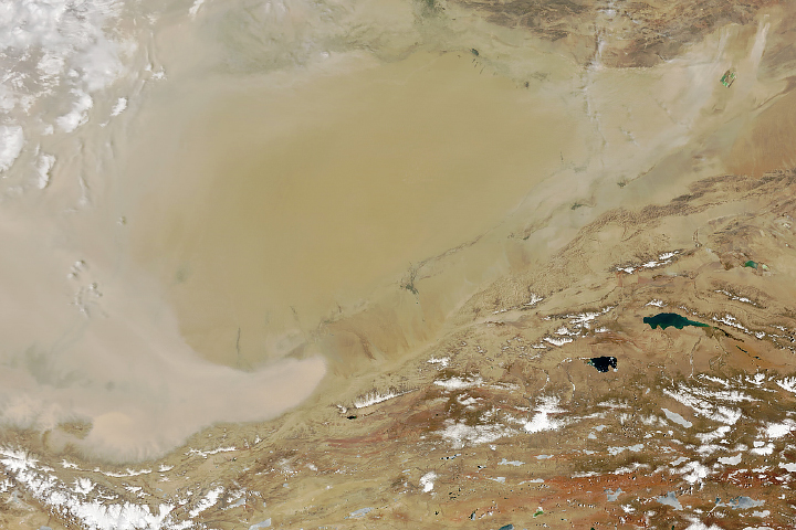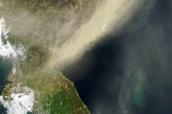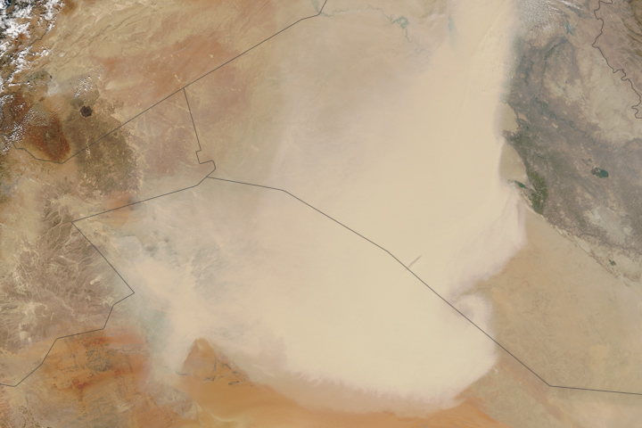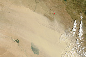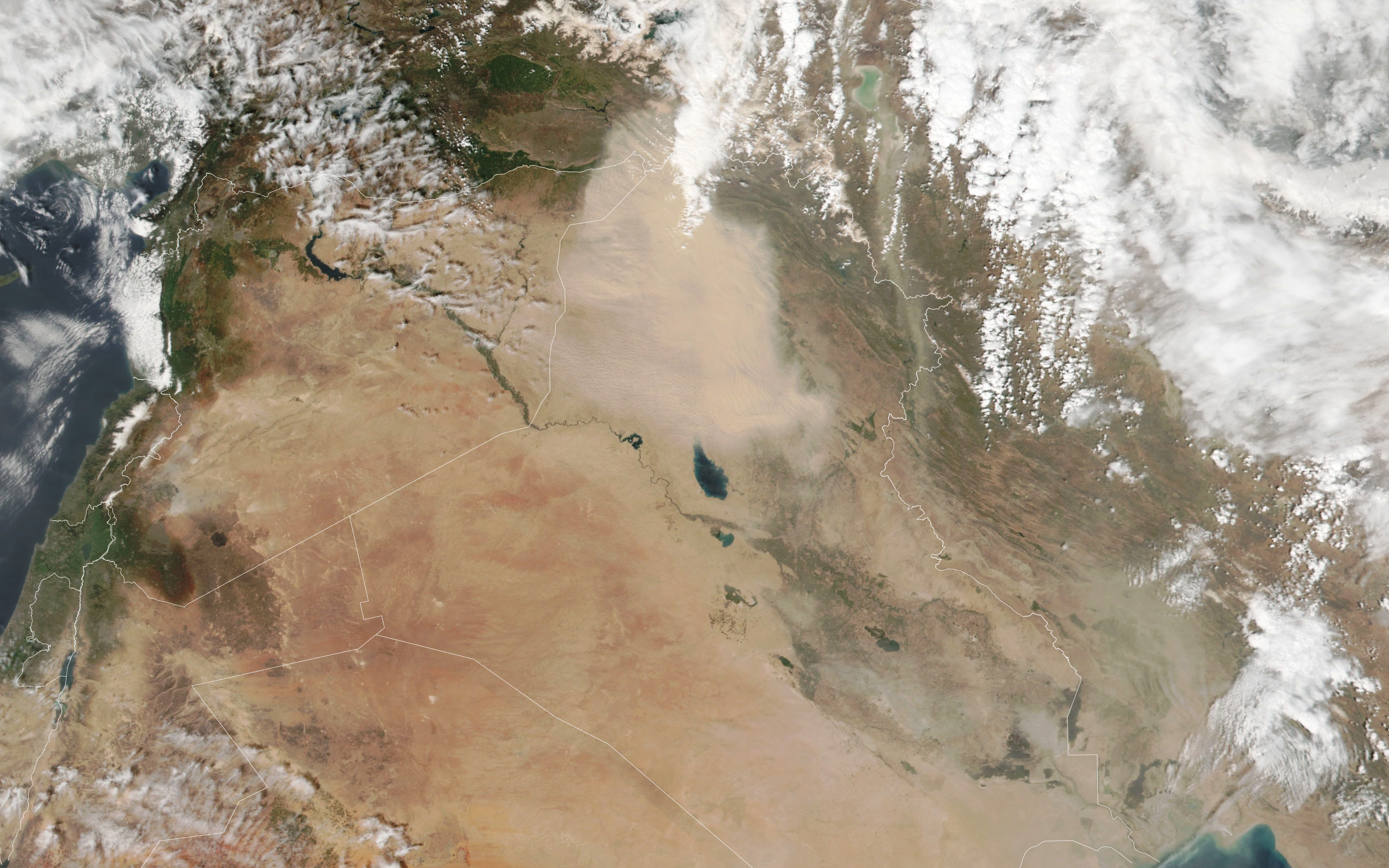
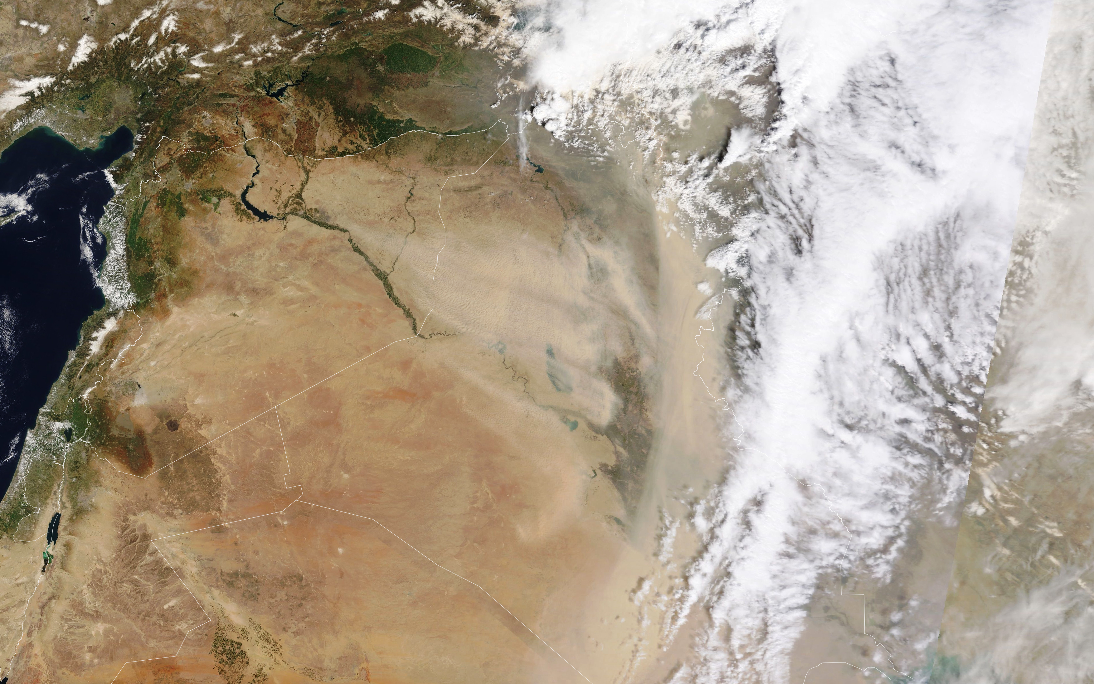

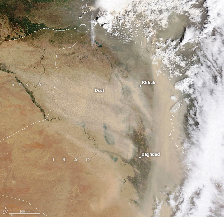
A dust storm engulfed parts of Iraq for multiple days in early April 2022, turning skies orange, reducing visibility, and degrading air quality.
The progression of the storm is visible in these images, acquired on April 7 and April 9 with the Visible Infrared Imaging Radiometer Suite (VIIRS) on the NOAA-NASA Suomi NPP satellite and the Moderate Resolution Imaging Spectroradiometer (MODIS) on NASA’s Terra satellite. On April 7, most of the dust was drifting over northern Iraq; two days later, the plume extended south past Baghdad.
Dust storms in Iraq are most common in the summer, provoked by the shamal—strong winds that blow from the northwest. But they can occur in other seasons, too. Western Iraq, for example, sees more shamal-driven dust storms in spring. According to a report from The World Bank, northern Iraq—between the Tigris and Euphrates rivers and along the border of Syria—has the highest density of dust sources in the Middle East.
News reports indicate that dozens of people across the country were hospitalized with respiratory problems during the recent outbreak. The dust also appears to have darkened the snow on mountains in Turkey.
The director of Iraq’s meteorological office noted that drought is causing dust storms in Iraq to become more frequent. While the shamal winds are common, drought makes it more likely that eroded material can be lofted into the air.
NASA Earth Observatory images by Lauren Dauphin, using MODIS data from NASA EOSDIS LANCE and GIBS/Worldview and VIIRS data from NASA EOSDIS LANCE, GIBS/Worldview, and the Suomi National Polar-orbiting Partnership. Story by Kathryn Hansen.