This Image of the Day includes the answer to the January 2022 EO puzzler.
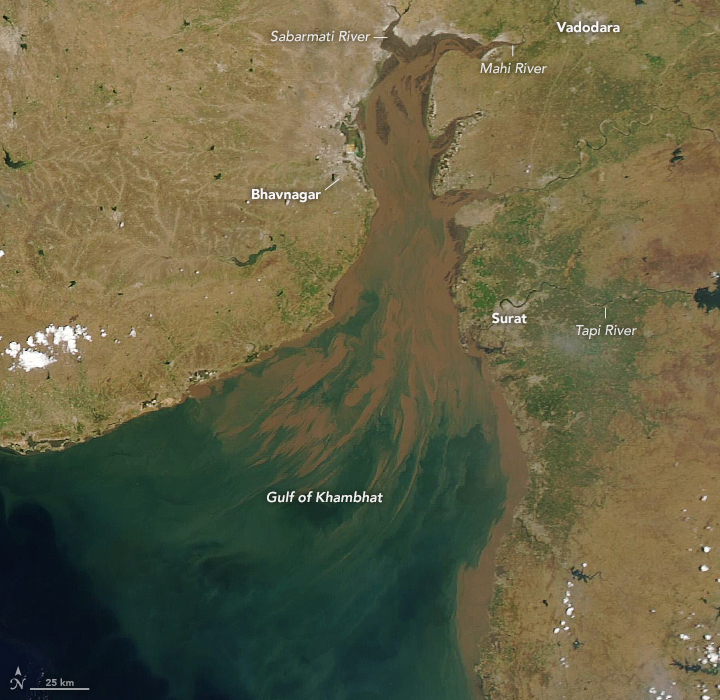
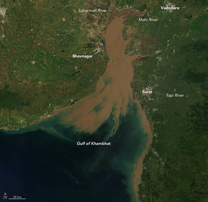
The Gulf of Khambhat lies on the west coast of India between the Saurashtra Peninsula and mainland Gujarat. Several major river systems—including the Narmada, Tapi, Mahi, Sabarmati, and Shetrunji—deliver abundant freshwater and heavy sediment loads to the gulf. The gulf measures 80 kilometers (50 miles) wide at its mouth in the Arabian Sea but narrows to about 25 kilometers (15 miles) at its head, where the deltas of the Sabarmati and Mahi rivers meet.
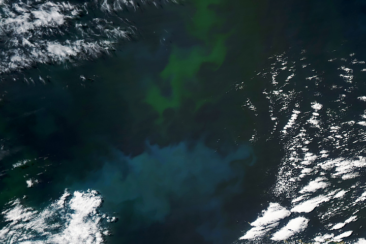
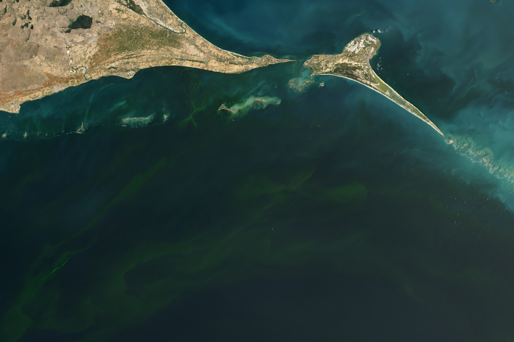
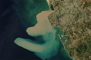
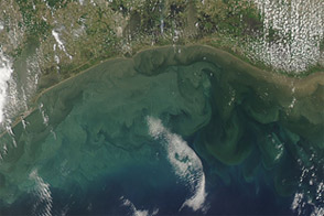
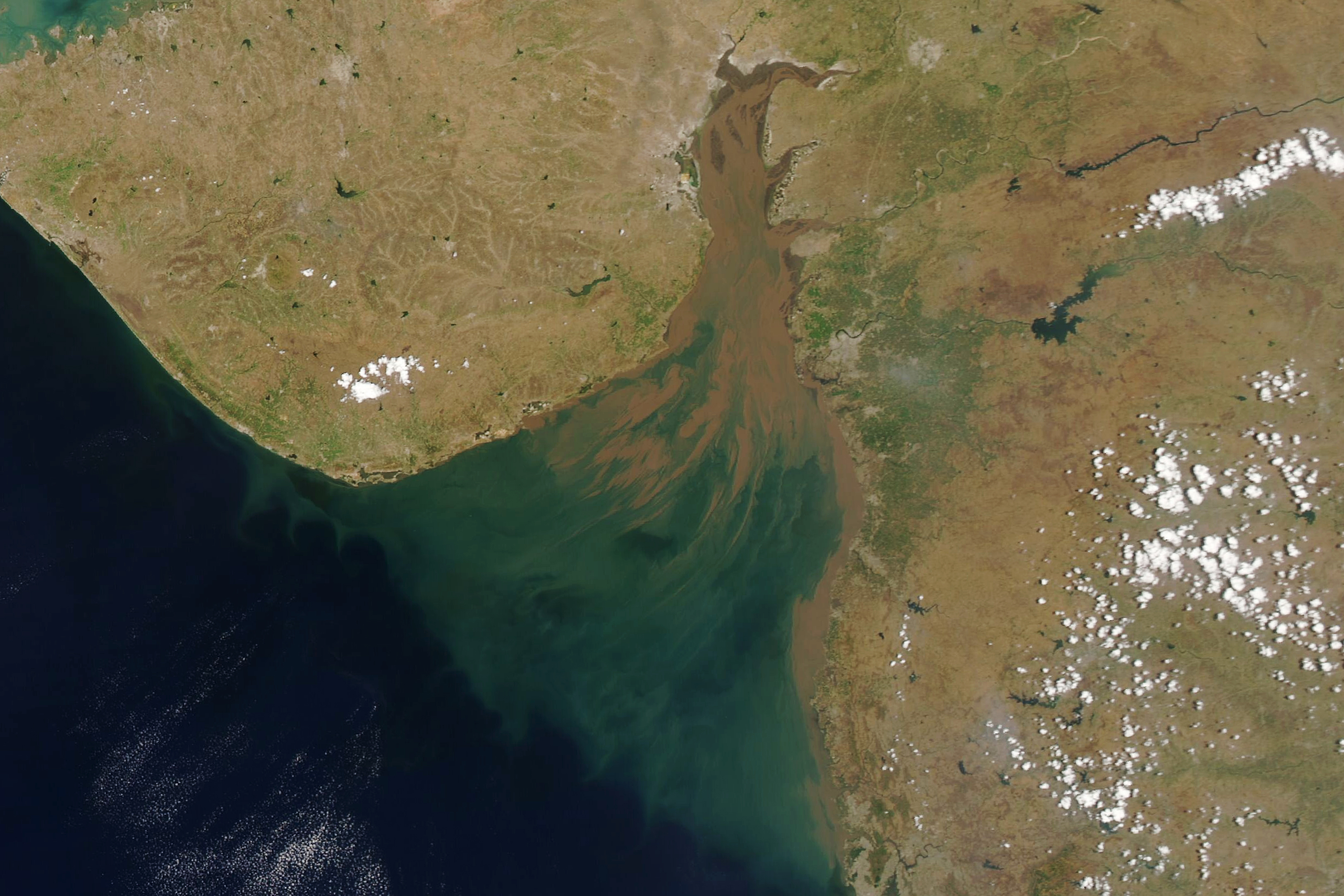
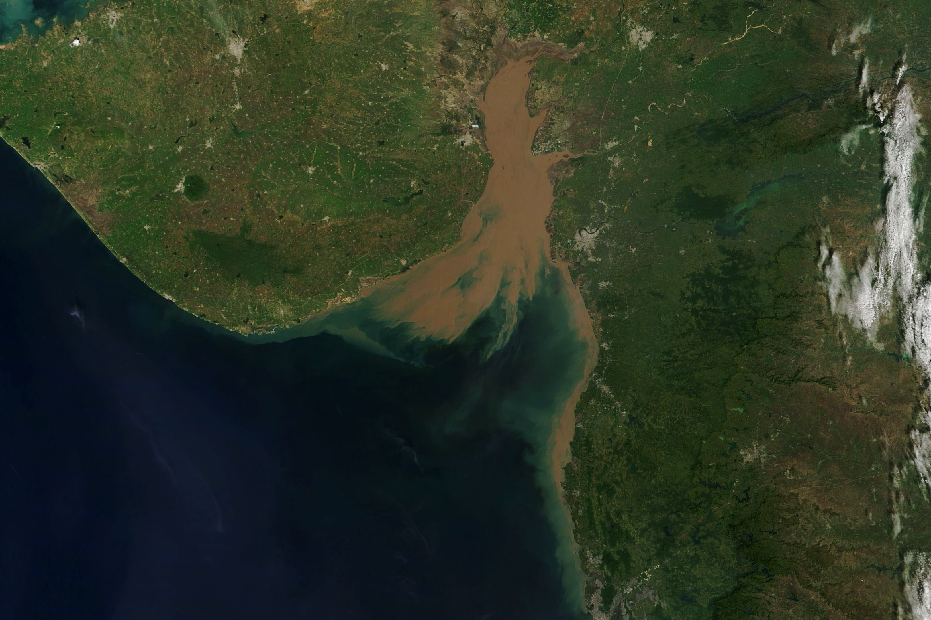
These natural-color images, acquired by the Moderate Resolution Imaging Spectroradiometer (MODIS) on NASA’s Aqua satellite on April 16 and October 16, 2021, show the sediment discharge concentrated at the northern end of the gulf. The monsoon season extends from June to September, leading to increased sediment discharge that is evident in the October image. As freshwater begins to disperse and sink at the outer reaches of the gulf, the reflectivity of the sediment changes, appearing green instead of brown.
The Gujarat coast experiences the highest tides anywhere along the Indian coastline, and the funnel shape of the 145-kilometer (90-mile) long Gulf of Khambhat amplifies them. As incoming tides are constricted by the narrowing gulf, they increase in height. At Bhavnagar, the maximum neap tide height is 10 meters (33 feet) while the maximum spring tide height is 11.6 meters (38 feet)—some of the largest tidal ranges in the world.
The currents in the gulf are dominated by these strong tides, which can flow at 1.5 to 2 meters per second (3.3 to 4.5 miles per hour). Additionally, the water is less than 20 meters (65 feet) deep in most parts, and receding tides expose vast intertidal areas up to 5 kilometers (3 miles) wide. Extensive mudflats, along with large shoals and banks (see the April image) can make navigation potentially hazardous for even small vessels.
With all of the dynamic flows in the gulf, the bathymetry (bottom topography) can shift rapidly and pose additional hazards to navigation. This has prompted some researchers to develop a bathymetry model based on satellite radar data. Such a model could allow more rapid updating of charts of bottom features.
NASA Earth Observatory images by Lauren Dauphin, using MODIS data from NASA EOSDIS LANCE and GIBS/Worldview. Story by Sara E. Pratt.