The Earth Observatory has published its last Image of the Day on this website. Please join us on our new home at science.nasa.gov/earth/earth-observatory.
The Dixie fire in Northern California has surpassed the Bootleg fire in Oregon to become the largest fire so far this year in the United States. As of August 6, 2021, the Dixie fire had charred more than 432,000 acres (675 square miles/1,750 square kilometers).
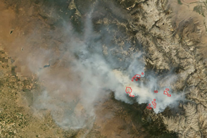
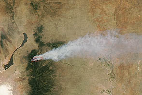
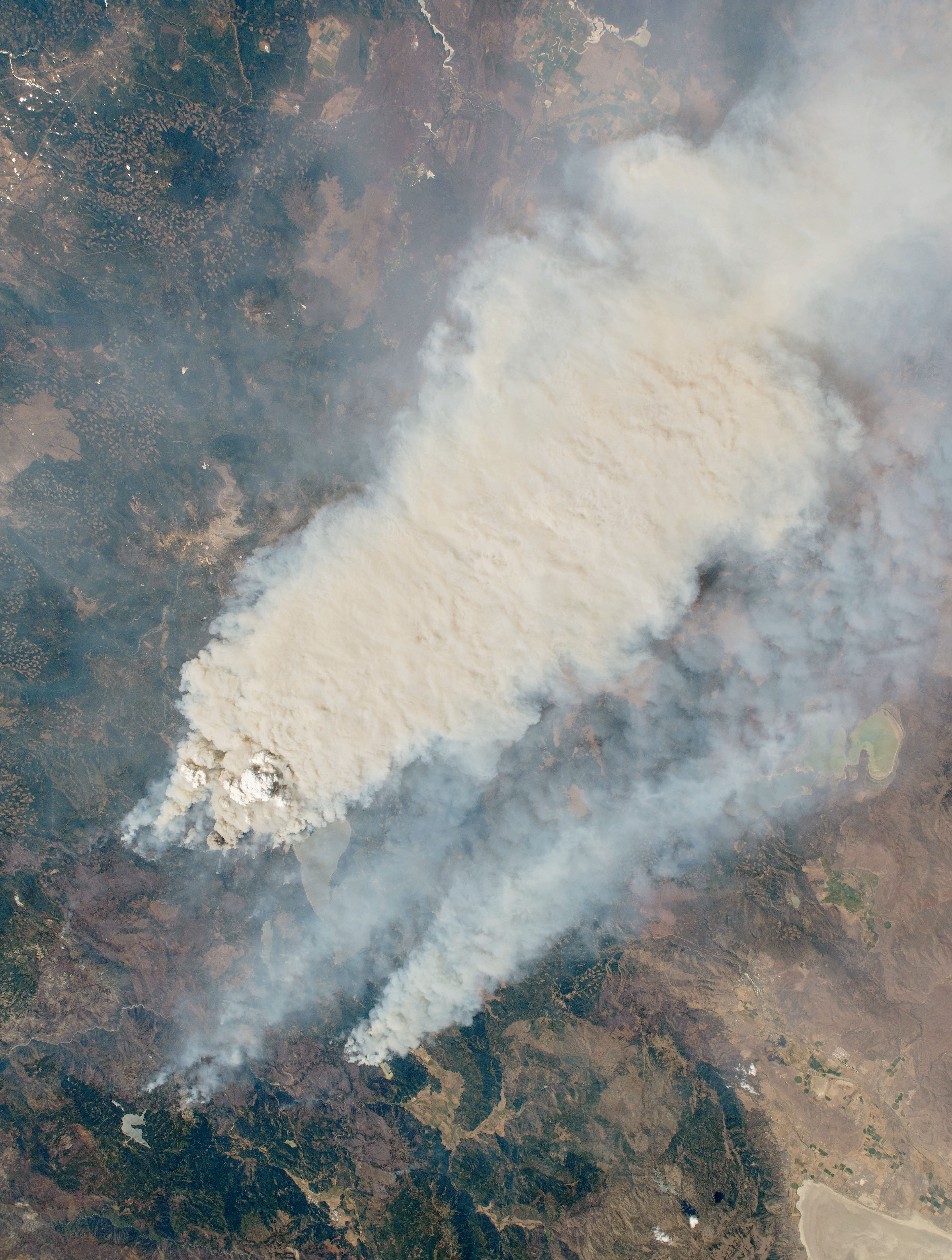
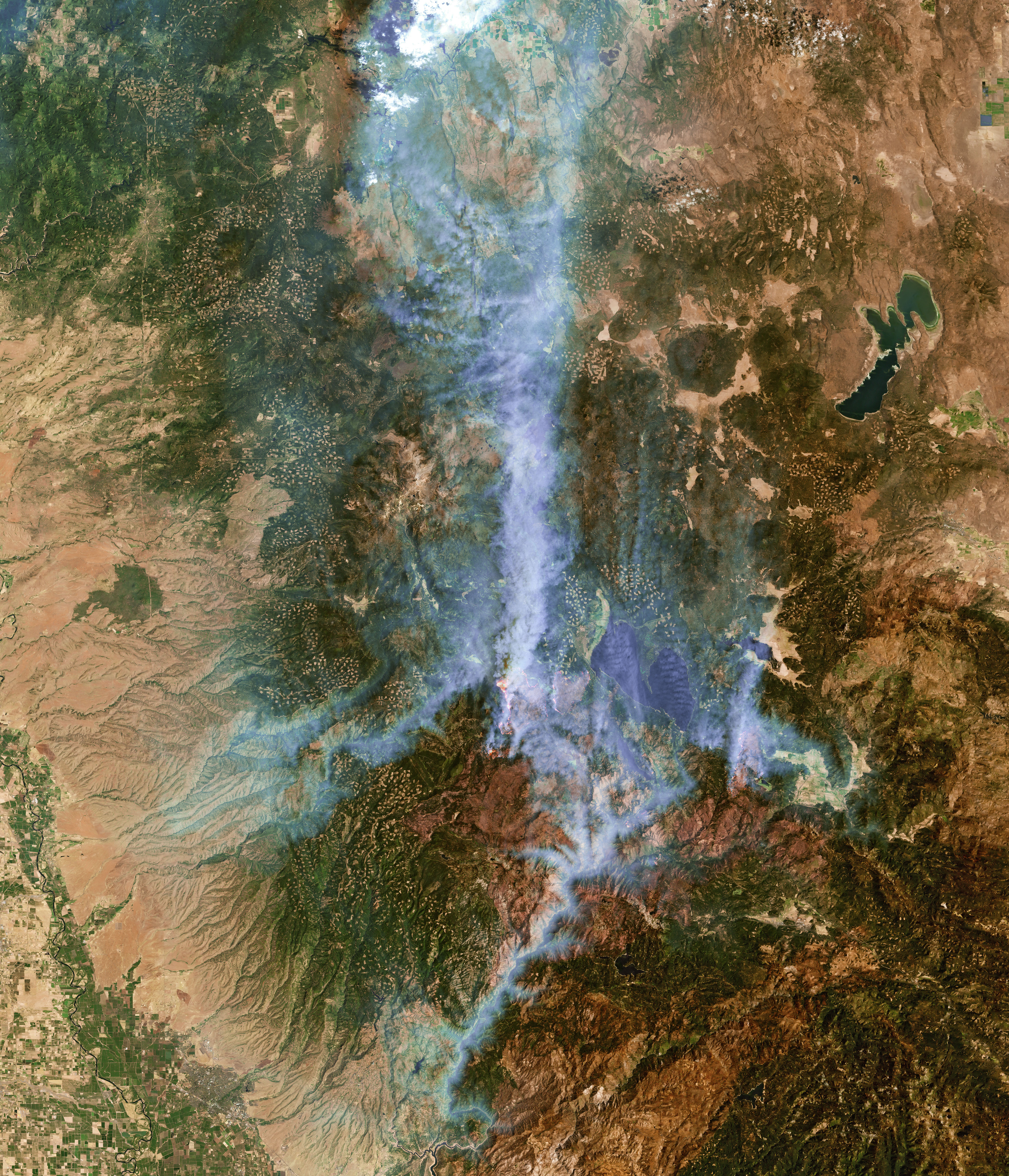
On August 4, 2021, an astronaut on the International Space Station shot a photo of the Dixie fire’s thick smoke plume (top). The second image, also acquired on August 4, shows the fire as observed by the Enhanced Thematic Mapper Plus (ETM+) on Landsat 7. It combines natural-color with shortwave-infrared light to cut through some of the smoke and highlight the active fire fronts. In this view, the hottest and most active parts of the fire are orange-yellow.
With wind gusts as high as 40 miles per hour (65 kilometers per hour) that day, the fire quickly advanced across the dry mountain vegetation. It burned through the historic Gold Rush era town of Greenville.
Notice that while most of the smoke is being carried toward the north, some smoke hangs in the valleys and canyons south of the active fire areas. Smoke, which can sink toward the ground during a temperature inversion, is especially apparent in the Feather River Canyon. Wind blowing down the canyon carried some of the smoke toward the Sacramento Valley.
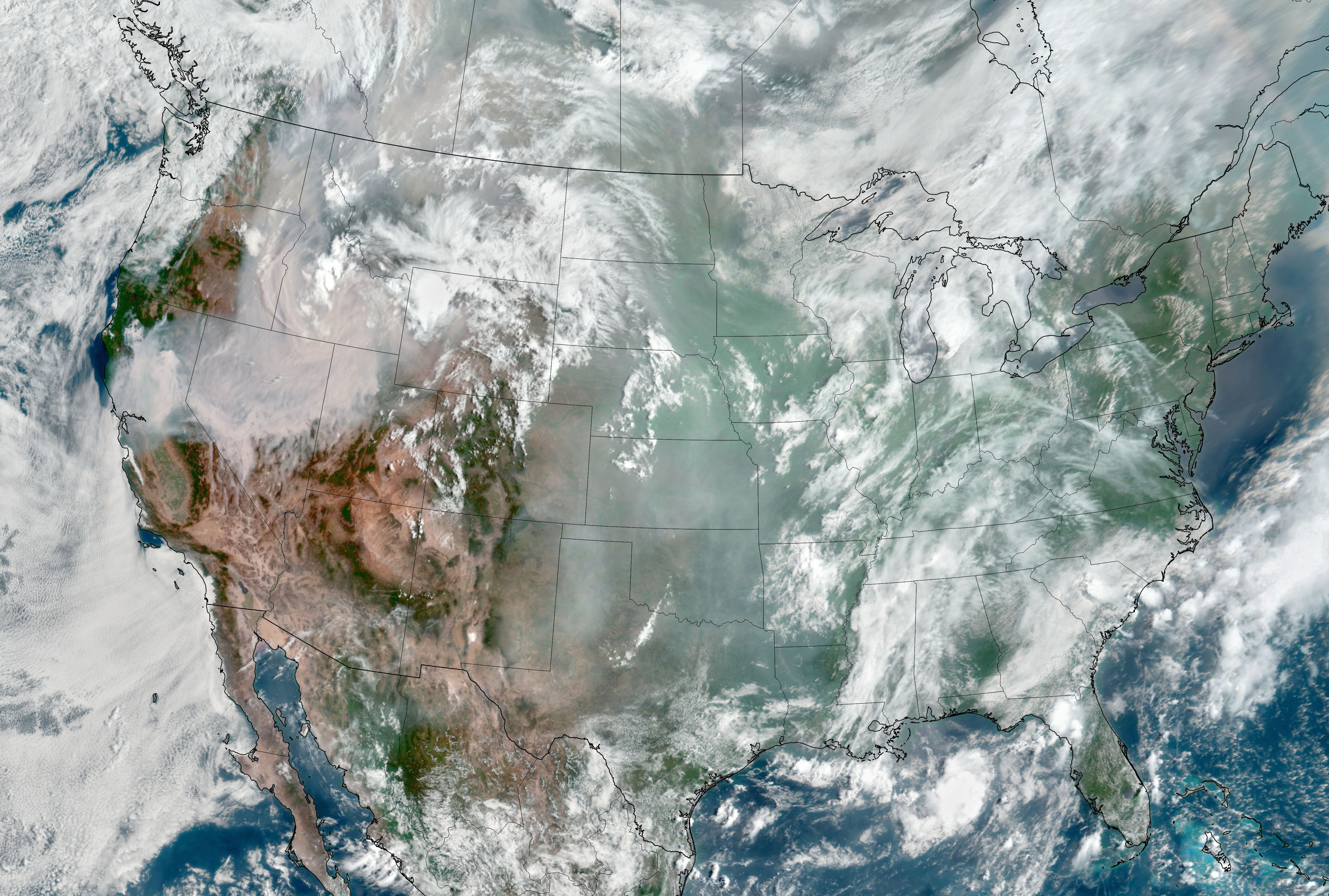
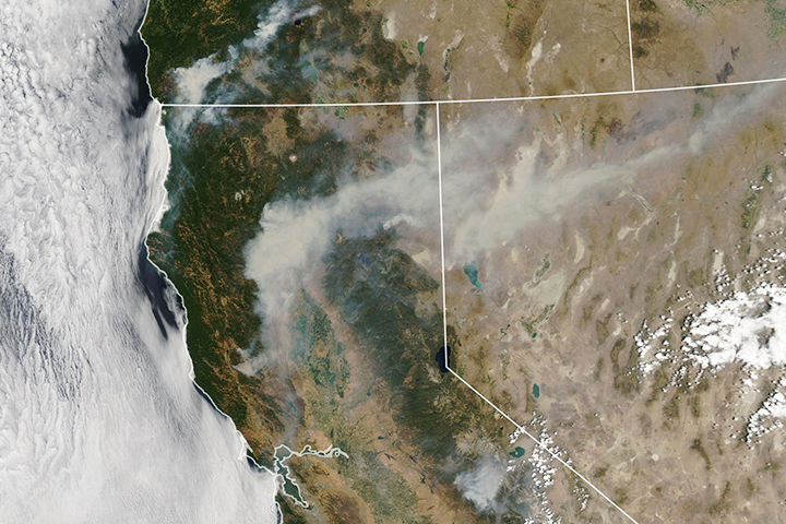
The enormous blanket of smoke from the Dixie fire and dozens of others burning across the western U.S. is visible in this image, acquired on August 6, 2021, with the Geostationary Operational Environmental Satellite 17 (GOES-17) (above). GOES-17 is operated by the National Oceanic and Atmospheric Administration (NOAA); NASA helps develop and launch the GOES series of satellites.
Overnight (August 5 to August 6) the Dixie fire grew by about 70,000 acres (110 square miles/280 square kilometers) to become the third-largest fire on record in California. It is still less than half the size of the August Complex, which burned more than 1 million acres in 2020.
NASA Earth Observatory images by Joshua Stevens, using Landsat data from the U.S. Geological Survey and GOES 17 imagery courtesy of NOAA and the National Environmental Satellite, Data, and Information Service (NESDIS). Astronaut photograph ISS065-E-220417 was acquired on August 4, 2021, with a Nikon D5 digital camera using a 116 millimeter focal length and is provided by the ISS Crew Earth Observations Facility and the Earth Science and Remote Sensing Unit, Johnson Space Center. The image was taken by a member of the Expedition 65 crew. The image has been cropped and enhanced to improve contrast, and lens artifacts have been removed. The International Space Station Program supports the laboratory as part of the ISS National Lab to help astronauts take pictures of Earth that will be of the greatest value to scientists and the public, and to make those images freely available on the Internet. Additional images taken by astronauts and cosmonauts can be viewed at the NASA/JSC Gateway to Astronaut Photography of Earth. Story by Kathryn Hansen.