January 4, 2020JPEG
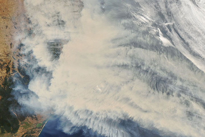
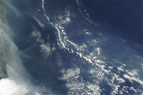
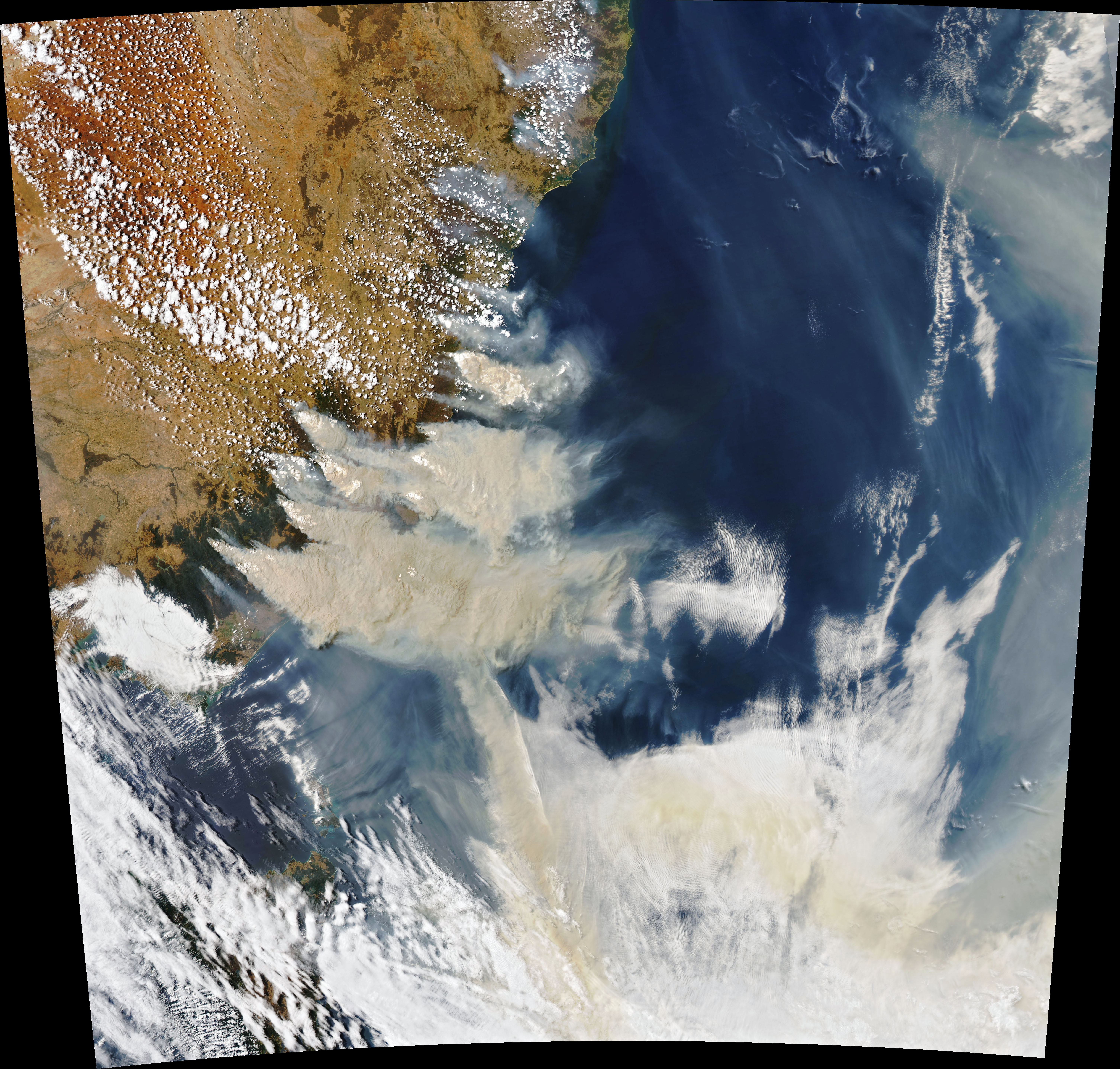
Forecasters predicted extreme fire conditions in southeastern Australia for the weekend of January 4–5, 2020, and they were correct in their assessment. The natural-color image above was acquired on January 4, 2020, by the Moderate Resolution Imaging Spectroradiometer (MODIS) on NASA’s Aqua satellite. Smoke has a tan color, while clouds are bright white. It is likely that some of the white patches above the smoke are pyrocumulonimbus clouds—clouds created by the convection and heat rising from a fire.
NASA Earth Observatory image by Joshua Stevens, using MODIS data from NASA EOSDIS/LANCE and GIBS/Worldview. Text by Michael Carlowicz.
As predicted, the weekend brought extreme fire weather.
Atmosphere Heat Land Drought Fires
Drought and extreme heat primed much of the continent for unusually extreme fire activity, which was then followed by dangerous flooding.
Fires keep raging through an intense and deadly fire season.
Acquired in mid-June 2011, this natural-color image shows smoke from fires in Florida and Georgia blowing over the Atlantic Ocean.
Fires are burning so fiercely that they are lofting smoke to unusual heights.
Image of the Day Atmosphere Heat Drought Fires Remote Sensing
The Terra satellite observed two large bushfires in Western Australia. One of them threatened the towns of Northcliffe and Windy Harbour.