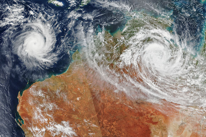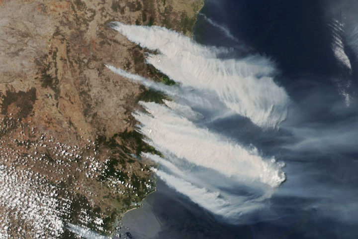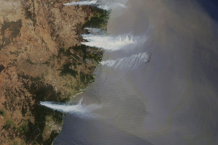
Bushfires are still raging in Australia, particularly along the east coast of New South Wales (NSW) and Queensland. The leader of the rural fire service told media that this could be “the most dangerous bushfire week this nation has ever seen,” and the NSW premier has declared a state of emergency.
At least six million people in the region were facing extreme bushfire weather—strong winds, low humidity, high temperatures—as the week began. Fire agencies warned of “catastrophic” fire danger in the Greater Sydney and Greater Hunter regions and in Illawarra/Shoalhaven. “Extreme” fire danger was forecast for the North Coast, Southern Ranges, Central Ranges, New England, Northern Slopes, and North Western. Weather forecasters predicted that not a drop of rain was likely to fall on mainland Australia on November 11.
Approximately 600 schools in Sydney and other cities and towns were closed due to the fire threat. At least three people have died and 150 homes have been destroyed, according to Australian media.
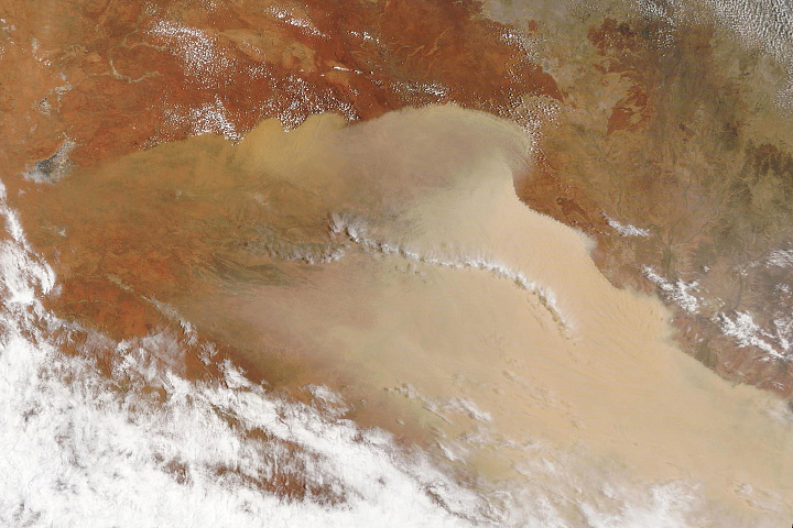
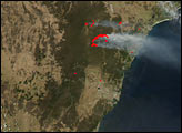
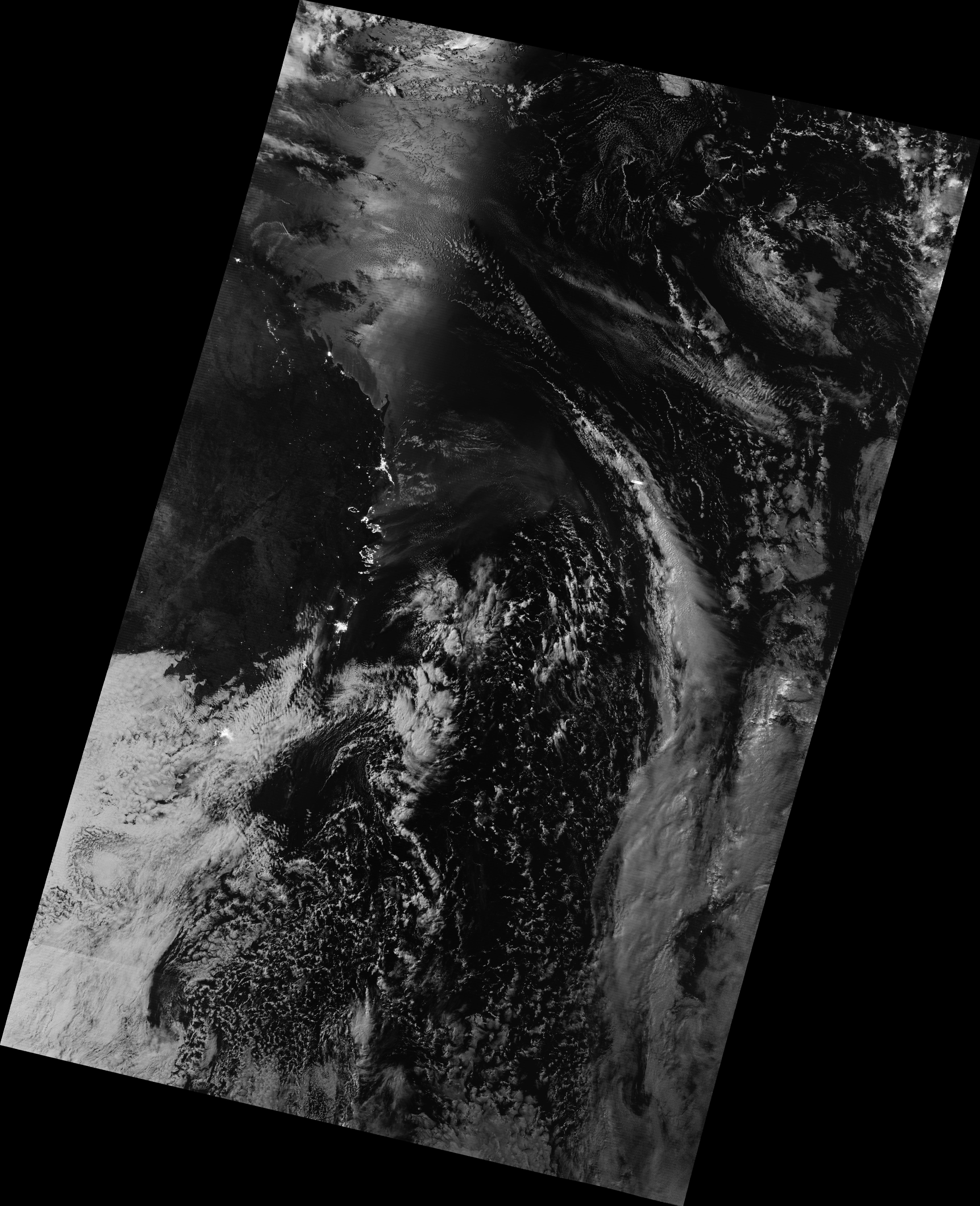
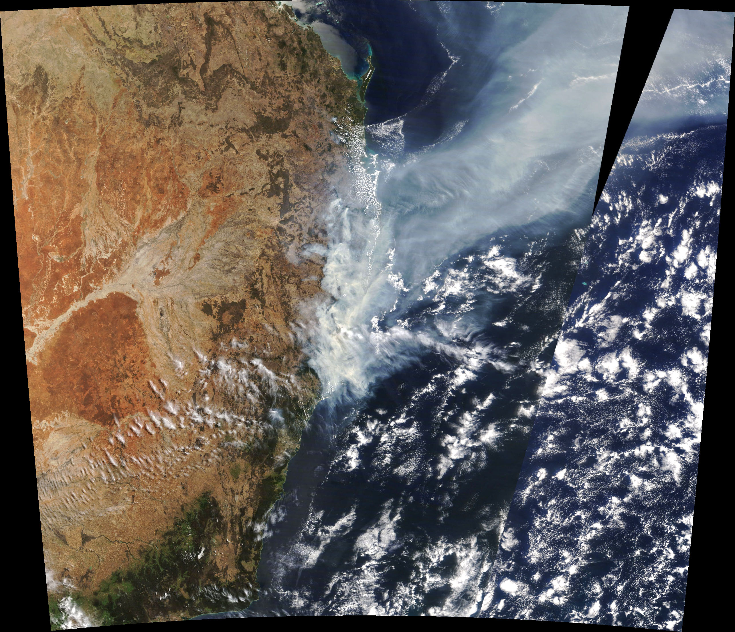
On November 9, 2019, the Visible Infrared Imaging Radiometer Suite (VIIRS) on the NOAA-NASA Suomi NPP satellite got a nighttime view of the fires raging in Queensland and New South Wales. The image was acquired with the VIIRS “day-night band,” which detects light in a range of wavelengths from green to near-infrared and uses filtering techniques to observe signals such as city lights, auroras, and wildfires. The natural-color image below was acquired by the Moderate Resolution Imaging Spectroradiometer (MODIS) on NASA’s Terra satellite on November 11, 2019. Strong westerly winds fanned the flames and carried smoke several hundred kilometers out to sea.
In late August, the Australian Bushfire and Natural Hazards CRC predicted that the 2019–20 fire season had the potential to be quite active due to warm and dry across much of the nation. According to the Australian Bureau of Meteorology (BOM), October 2019 rainfall was below to very much below average across most of Australia, continuing a long-term drought in the region.
“Rainfall deficiencies have affected most of the New South Wales, Queensland, and South Australian parts of the Murray–Darling Basin since the start of 2017,” BOM reported. “The deficiencies have been most extreme in the northern Murray–Darling Basin, especially in the northern half of New South Wales and adjacent southern Queensland, where areas of lowest-on-record rainfall extend across large parts of northeastern New South Wales...The 34 months from January 2017 to October 2019 have been the driest on record...for the state of New South Wales (35 percent below average).”
NASA Earth Observatory images by Joshua Stevens, using VIIRS day-night band data from the Suomi National Polar-orbiting Partnership and MODIS data from NASA EOSDIS/LANCE and GIBS/Worldview. Story by Mike Carlowicz.
alert message