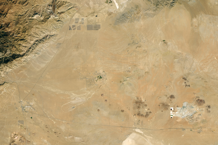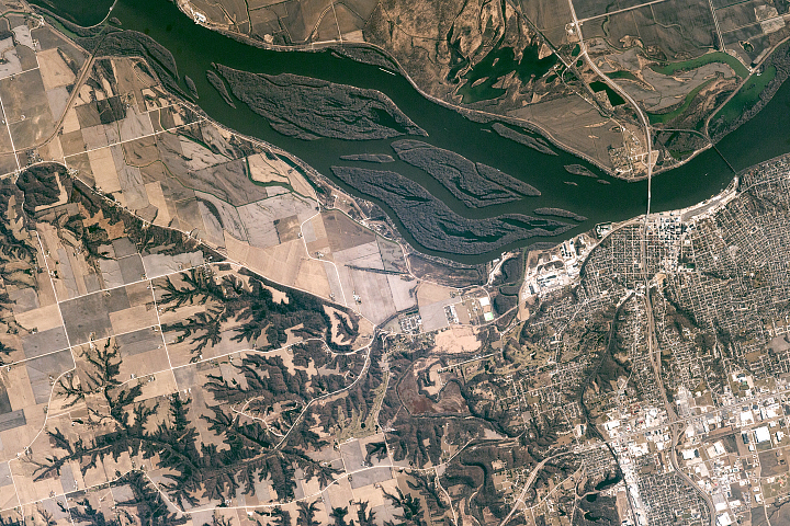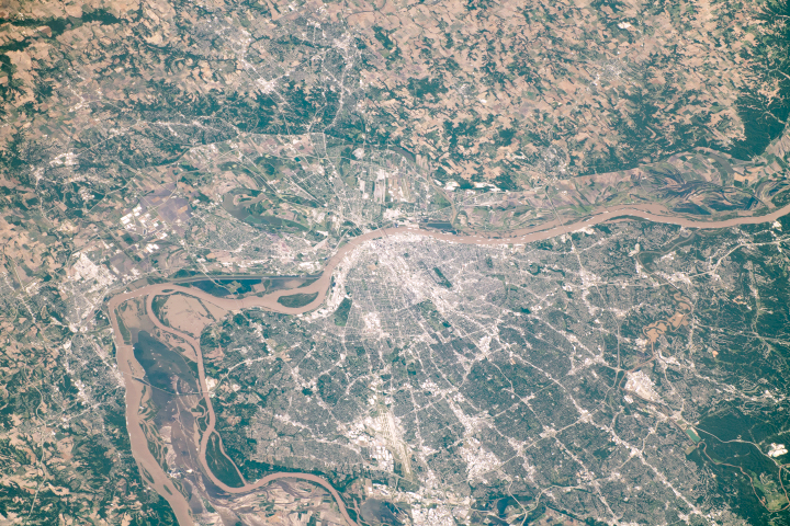
An astronaut onboard the International Space Station took this photograph of the St. Louis metropolitan area. The photograph contrasts the agriculturally dominated regions of western Illinois and the more densely urbanized areas of eastern Missouri. St. Louis lies on the west bank of the Mississippi River, which also forms the border between the two states. At the time of this photo, some flooding was visible along the river.
Initially founded in the 1760s as a fur-trading outpost, St. Louis grew up to become a major port on the Mississippi River. Throughout the 1800s and 1900s, the evolution of transportation and infrastructure led to the suburbanization of the city.
Public transportation, railroads, and advanced road networks developed as the population increased, which allowed for the gradual migration of people from the city center into the outer reaches of the greater St. Louis area. The urban pattern in the image includes a series of small-scale grids that follow the lines of the major railways and highways in the region. The network of roadways radiates out from the urban core and connects smaller towns.
Astronaut photograph ISS060-E-556 was acquired on June 25, 2019, with a Nikon D5 digital camera using a 290 millimeter lens and is provided by the ISS Crew Earth Observations Facility and the Earth Science and Remote Sensing Unit, Johnson Space Center. The image was taken by a member of the Expedition 60 crew. The image has been cropped and enhanced to improve contrast, and lens artifacts have been removed. The International Space Station Program supports the laboratory as part of the ISS National Lab to help astronauts take pictures of Earth that will be of the greatest value to scientists and the public, and to make those images freely available on the Internet. Additional images taken by astronauts and cosmonauts can be viewed at the NASA/JSC Gateway to Astronaut Photography of Earth. Caption by Laura Phoebus, Jacobs Technology, JETS Contract at NASA-JSC.
alert message