Launched in December 2018 to the International Space Station, the Global Ecosystem Dynamics Investigation (GEDI) was built with lasers that can make three-dimensional maps of Earth’s forests and landforms. In January 2019, those lasers were turned on for the first time, giving scientists a first glimpse of the detailed insights it can provide.
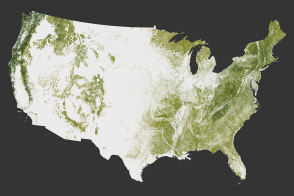
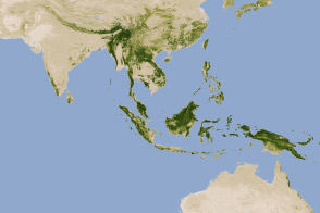
GEDI’s primary mission is to decipher forest structure: how tall the trees are, how densely their branches fit together, how much space lies between treetops and tree trunks, and how the branches are arranged from top to bottom. Knowing such details can foster a better understanding of how trees store carbon and what happens to that carbon when they are cut down or disturbed. Forests also support numerous plant and animal species, so understanding the structure can help biologists better understand habitats and biodiversity.
The instrument uses sensitive light detection and ranging (lidar) technology to measure not only the elevation of the canopy and the forest floor, but the structure in between—a first for spaceborne instruments. The eight lasers scan a path roughly 4 kilometers (2.6 miles) wide and fire photons of light 250 times per second to capture detailed profiles of forests, fields, and hills. When all eight paths are analyzed together, they yield a high-resolution, 3D view of Earth's surface.
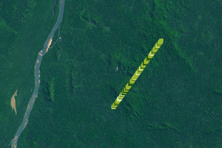
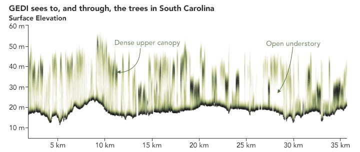
The raw data from GEDI offer a two-dimensional view of forest. The image above shows profile measurements of a South Carolina woodland from the winter of 2019. Darker greens show where the leaves and branches were denser, while lighter areas show sparser parts of the canopy. The data and processing shown here are preliminary, but they provide a good preview of what is to come.
“GEDI will provide a vertical record, not only of how tall trees are, but how much canopy material there is at any height,” said Ralph Dubayah, GEDI principal investigator and a professor at the University of Maryland. “GEDI will make more than 10 billion individual observations of this canopy structure, which is orders of magnitude more than we have ever had.”
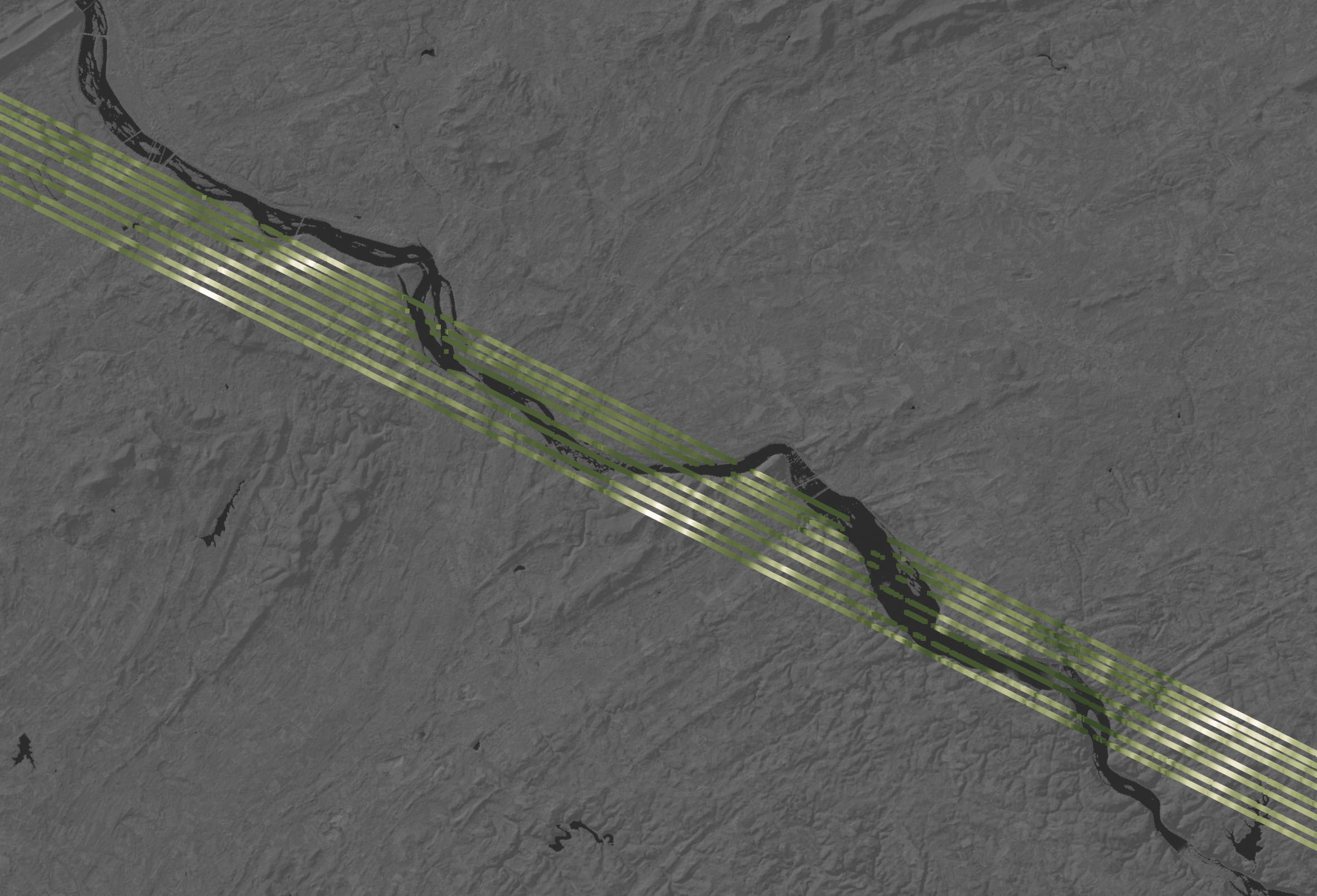
GEDI was designed to image forests, but it also can gather information about Earth’s topography. In the figures above, the instrument gathered a profile of the hills and fields on either side of the Susquehanna River’s winding riverbanks in southeastern Pennsylvania. One unusual feature appeared as a steep drop in the single-wave image, initially causing the science team to fear that it was a data error. In fact, GEDI’s lasers had detected Safe Harbor Dam, about 15 kilometers (9 miles) southwest of Lancaster, Pennsylvania.
“We are very excited that GEDI is now in orbit and taking measurements,” said Michelle Hofton, a professor at the University of Maryland and a GEDI co-investigator. “This ability to precisely capture Earth’s surface structure and its underlying topography is unique to GEDI. We’re thrilled at the expansive coverage we’re getting every day and looking forward to the discoveries that can be made using the data.”
“It took a combination of high-powered lasers, sensitive detectors, precisely-designed optical components, high-speed electronics, and on-board software algorithms for GEDI to be able to make these challenging measurements,” said Bryan Blair, GEDI’s deputy principal investigator and instrument scientist. “This is a truly unique sensor that can make these detailed measurements of the canopy top, the canopy interior, and the ground below, even in the most challenging tropical and dense temperate forests.”
NASA Earth Observatory images by Joshua Stevens, using GEDI data courtesy of Michelle Hofton/University of Maryland. Story by Jessica Merzdorf, NASA GSFC, with Mike Carlowicz.
alert message