Though the United States and Cuba have operated in largely separate economic spheres for decades, they are only separated by 150 kilometers (90 miles). On December 2, 2018, the Moderate Resolution Imaging Spectroradiometer (MODIS) on NASA’s Terra satellite captured this image of the narrow, watery boundaries that separate the United States, Cuba, and the Bahamas.
From space, the deep water of the Florida Strait appears dark blue in comparison to the shallower, turquoise water covering the Cay Sal Bank and Bahama Banks. Both of these platforms formed as carbonate minerals—produced by certain types of bacteria and sea organisms—were deposited on the ocean floor over millions of years.
Undeveloped ecosystems (forests and wetlands) cover 53 percent of Cuba, according to an analysis of recent Landsat imagery. About 40 percent of the island’s land surface is used for agriculture. Major crops include cassava, tobacco, grapefruit, and sugar. Reservoirs cover about 1 percent of the island’s land surface, and cities cover less than 1 percent.
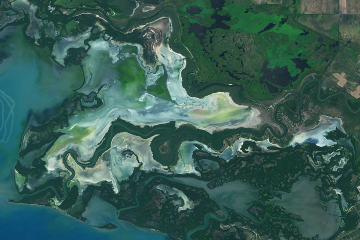
Despite the patchwork of farmland and pastures, Cuba is known for having relatively large stretches of pristine mangrove forests and undisturbed coral reefs, beaches, and sea grass marshes.
“Cuba is an ecological rarity in Latin America and the Caribbean region,” said University of Vermont remote sensing scientist Gillian Galford in a 2018 report. “Its complex political and economic history shows limited disturbances, extinctions, pollution, and resource depletion.”
NASA Earth Observatory image by Joshua Stevens, using MODIS data from NASA EOSDIS/LANCE and GIBS/Worldview. Story by Adam Voiland.
alert message