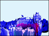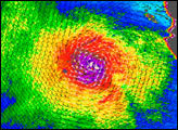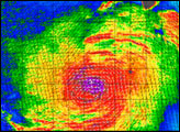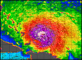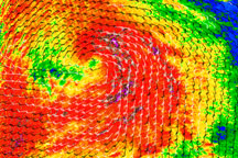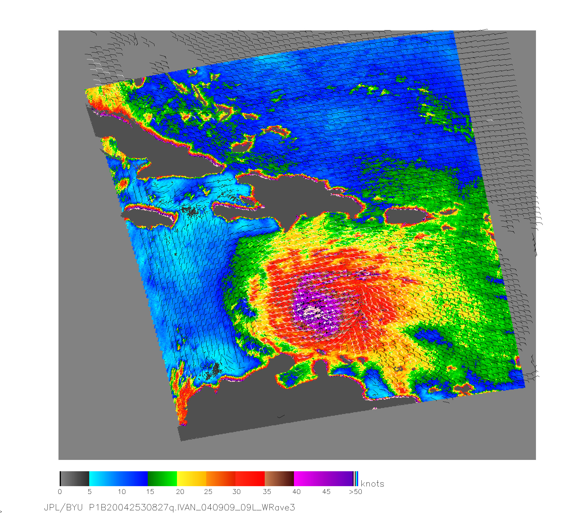
With wind speeds topping 260 kilometers per hour (160 mph), Hurricane Ivan is roaring through the Caribbean as a deadly Category 5 storm. Early on September 9, 2004, the SeaWinds scatterometer aboard NASA’s QuikSCAT satellite saw through Ivan’s swirling clouds to measure wind speed 10 meters above the ocean surface. The result was this multi-colored image of the storm. Purple in the center of the storm shows the highest wind speeds, and green fringes around the outside of the storm show the lowest wind speeds. The black barbs indicate wind speed and direction at QuikSCAT’s nominal 25 km resolution; white barbs indicate areas of heavy rain.
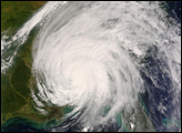
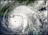
Ivan strengthened after plowing over Grenada on Tuesday, September 7. The storm is forecast to move northwest over Jamaica and Cuba, then on to Florida. For more information, please visit the National Hurricane Center.
NASA’s Quick Scatterometer (QuikSCAT) spacecraft was launched from Vandenberg Air Force Base, California on June 19, 1999. QuikScat carries the SeaWinds scatterometer, a specialized microwave radar that measures near-surface wind speed and direction under all weather and cloud conditions over the Earth’s oceans.
In recent years, the ability to detect and track severe storms has been dramatically enhanced by the advent of weather satellites. Data from the SeaWinds scatterometer is augmenting traditional satellite images of clouds by providing direct measurements of surface winds to compare with the observed cloud patterns in an effort to better determine a hurricane’s location, direction, structure, and strength. Specifically, these wind data are helping meteorologists to more accurately identify the extent of gale-force winds associated with a storm, while supplying inputs to numerical models that provide advanced warning of high waves and flooding.
NASA image courtesy the QuikSCAT team at NASA’s Jet Propulsion Laboratory.