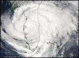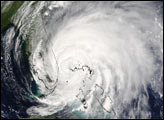

The MODIS instrument aboard NASA's Terra satellite captured this true-color image of Hurricane Frances on September 3, 2004 at 15:15 UTC (11:15 AM EDT). At the time this image was taken, Frances was located approximately 65 km (40 miles) northwest of Eleuthera Island in the Bahamas. Maximum sustained winds had decreased to 185 km/hr (115 mph) and the minimum central pressure had risen to 957 millibars. Frances was moving towards the northwest at 9 mph.
NASA image courtesy Jesse Allen, NASA's Earth Observatory.
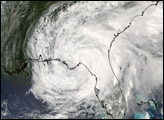
The MODIS instrument aboard NASA's Aqua satellite captured this true-color image of Tropical Storm Frances on September 6, 2004 at 19:00 UTC (3:00 PM EDT).


