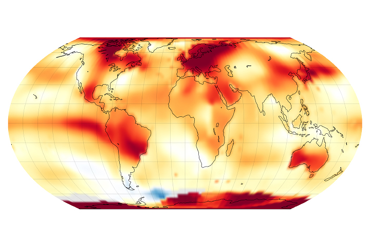
Global temperatures have soared in recent years and climate scientists are trying to understand why.
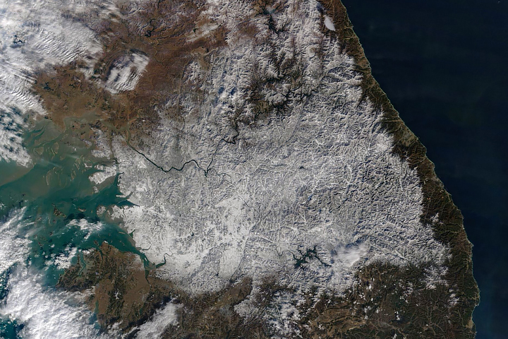
Late-November snowfall blanketed large portions of the country and deposited record-breaking accumulations in Seoul.
Image of the Day Atmosphere Land Severe Storms Snow and Ice Temperature Extremes
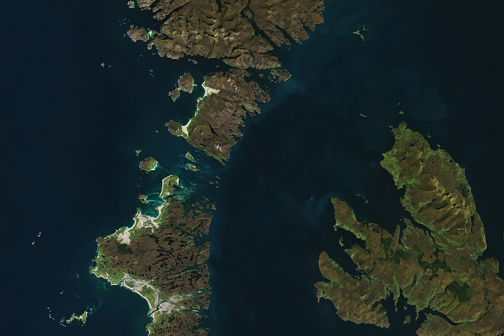
The rugged chain of islands is home to thousands of sheep and known for its white sand beaches.
Published Dec 11, 2024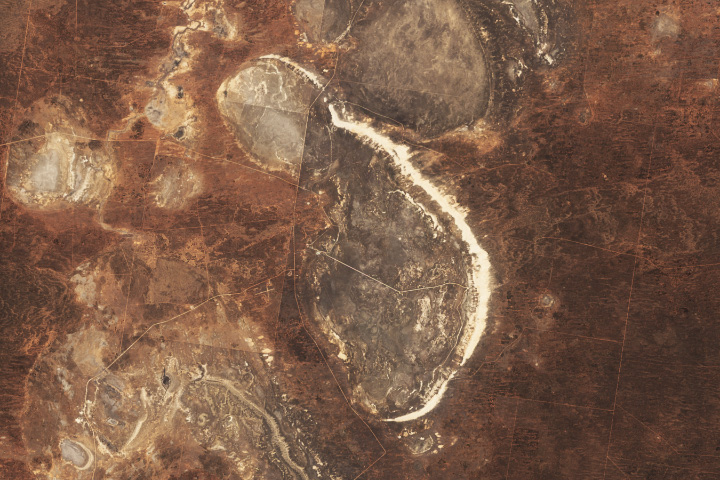
A lunette dune fringing this dried Australian lake preserves relics from ancient times, while today’s grazing patterns create sharp visible contrasts on the land.
Published Dec 10, 2024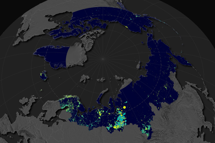
Satellite observations at night indicate that oil, gas, and mining have expanded across Earth’s northern latitudes.
Published Dec 9, 2024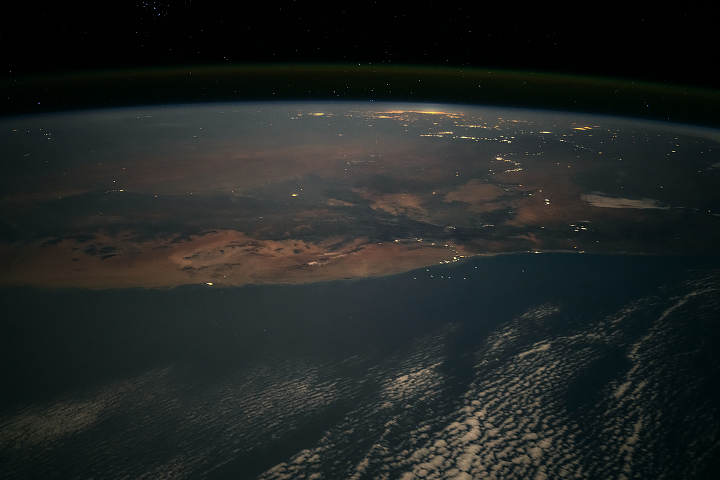
An astronaut’s sweeping nighttime photograph of Namibia and South Africa reveals the region’s lighted communities, many of which are centered around mining.
Published Dec 8, 2024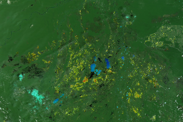
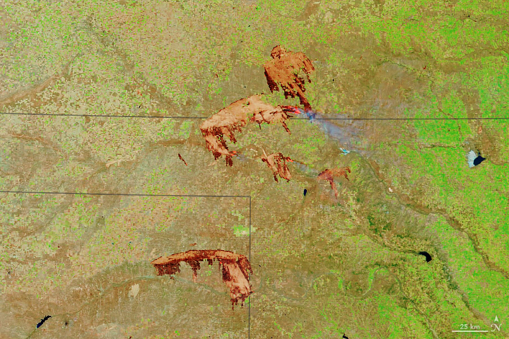
Fire activity in the South American nation was remarkably intense and widespread in 2024.
Published Dec 7, 2024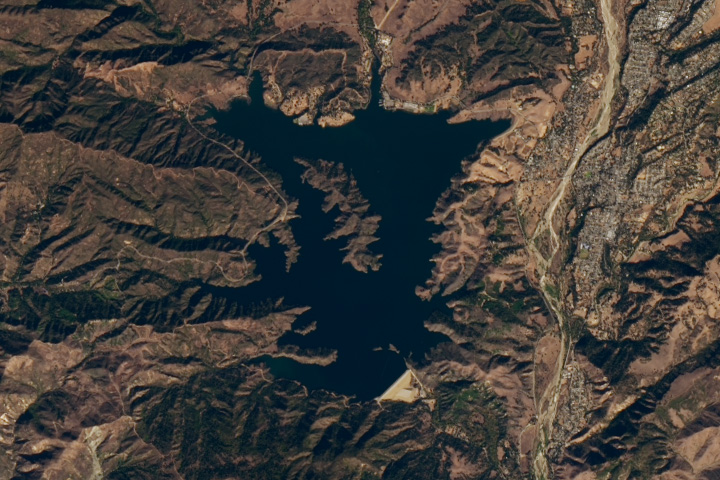
The southern California reservoir refilled from historic lows after two above-average years of rain.
Published Dec 6, 2024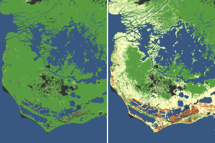
The iconic trees and shrubs of the Florida Everglades are under increased stress due to more frequent, intense hurricanes.
Published Dec 5, 2024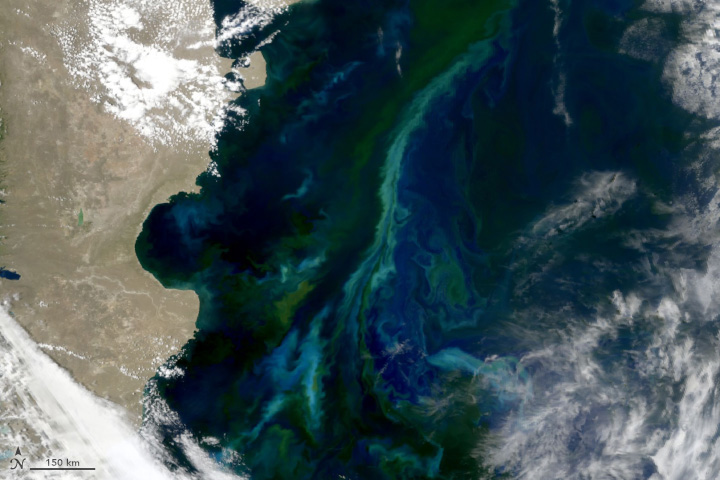
Colorful swirls of water reveal the presence of phytoplankton in the South Atlantic Ocean near the Falkland Islands.
Published Dec 4, 2024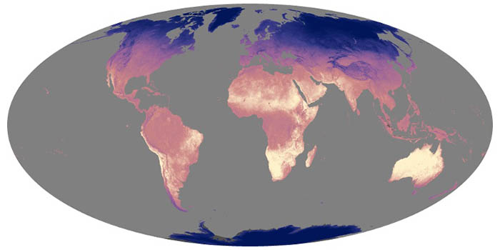
Land surface temperatures rise and fall with the heat of the Sun, and they represent how hot or cold the surface would feel to touch. These maps show daytime land temperatures as measured from space.
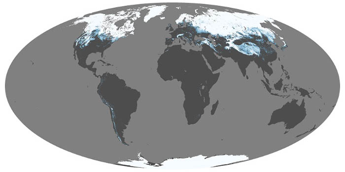
Snow and ice influence climate by reflecting sunlight back into space. When it melts, snow is a source of water for drinking and vegetation; too much snowmelt can lead to floods. These maps show average snow cover by month.

NASA satellites document how our world—forests, oceans, human landscapes, even the Sun—changes over months, seasons, and years.
Published Apr 29, 2009
Scientists are beginning to unravel what comes next, after the ice moves out and vegetation moves in.
Published Dec 2, 2024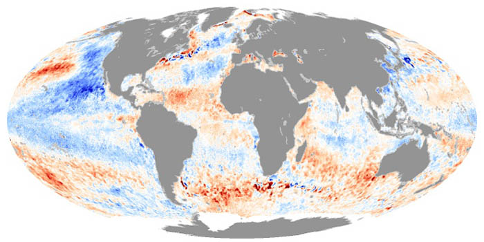
These maps depict how much hotter or cooler an ocean basin was compared to the long-term average. Temperature anomalies can indicate changes in ocean circulation or the arrival of patterns like El Niño and La Niña.

Satellite images of Earth at night have been a curiosity for the public and a tool of fundamental research for at least 25 years. They have provided a broad, beautiful picture, showing how humans have shaped the planet and lit up the darkness.
Published Apr 12, 2017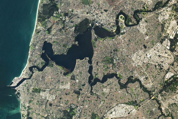
Perth, the only city along the country’s western coastline with more than 1 million people, displays widespread urban infrastructure alongside the Swan and Canning rivers.
Published Dec 1, 2024Have you ever wondered what it would be like to live in a different part of the world? What would the weather be like? What kinds of animals would you see? Which plants live there? By investigating these questions, you are learning about biomes.
Published Aug 28, 2020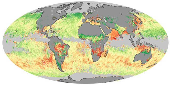
Sea salt, volcanic ash, dust, wildfire smoke, and industrial pollution are types of airborne aerosols. Natural aerosols tend to be larger than human-made aerosols. These maps show when and where aerosols come from nature, humans, or both.
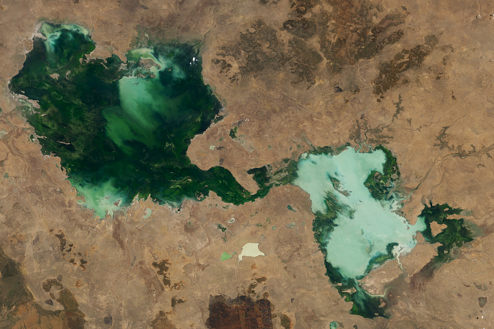
After two particularly wet years, large ephemeral lakes in the Barkly Tableland region were still flooded as the 2024–2025 rainy season got underway.
Published Nov 30, 2024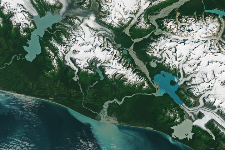
Lake water has quickly filled the void left by a trio of retreating glaciers in the southern part of the state.
Published Nov 28, 2024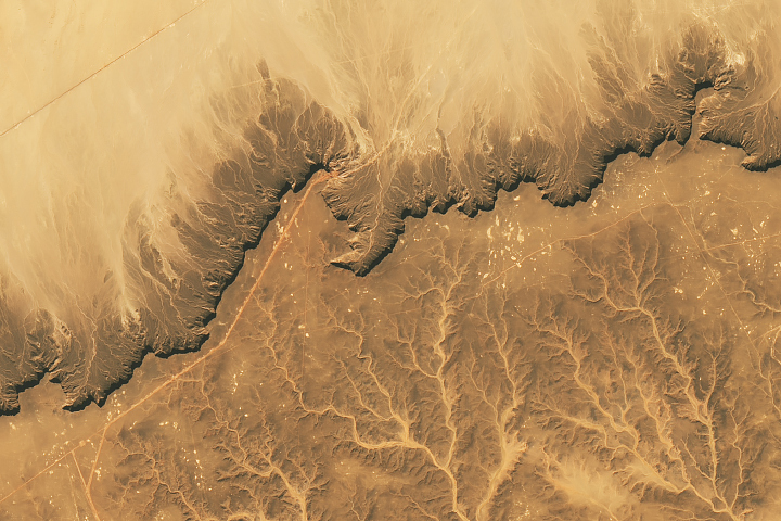
Your challenge is to tell us the location of the satellite image and why it is interesting.
Published Nov 19, 2024
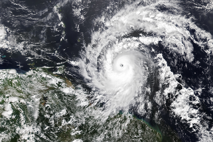
Hurricane season in the basin runs from June 1 to November 30.
Published Jul 1, 2024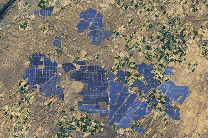
People have developed systems to harvest and store energy from sources such as wind, sunlight, and tidal action. Many of these installations are visible from orbit.
Published May 10, 2024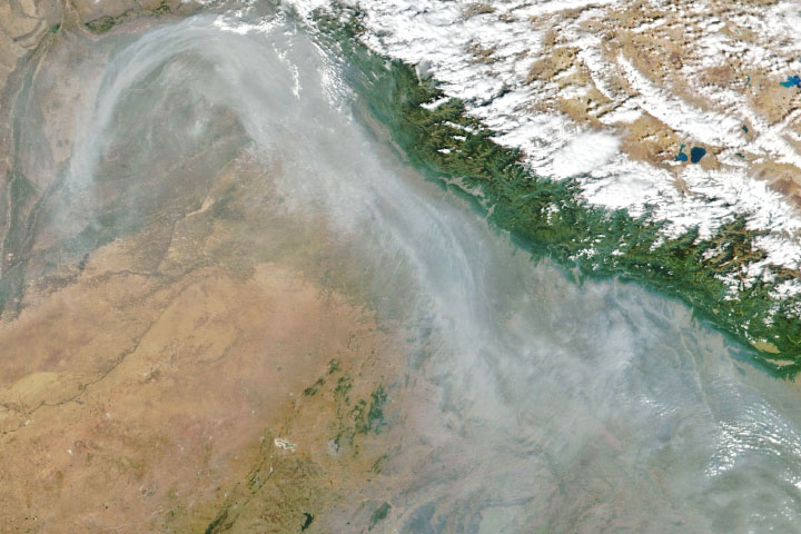
From ground-level ozone to particulate matter to nitrogen dioxide, an array of gasses and particles can affect the air people breathe, with implications for human health.
Published Apr 8, 2024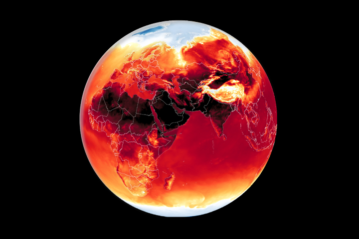
Warmer-than-average temperatures are showing up locally and globally, with consequences for people, landscapes, and ecosystems.
Published Mar 26, 2024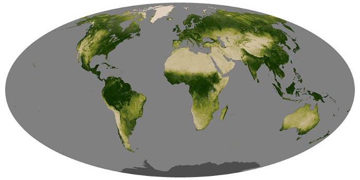
Greenness is an important indicator of health for forests, grasslands, and farms. The greenness of a landscape, or vegetation index, depends on the number and type of plants, how leafy they are, and how healthy they are.

Whether sparked by lightning, intentional land-clearing, or human-caused accidents, wildland fires are burning longer and more often in some areas as the world warms.
Published Feb 27, 2024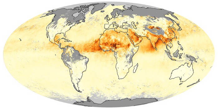
Airborne aerosols can cause or prevent cloud formation and harm human health. These maps depict aerosol concentrations in the air based on how the tiny particles reflect or absorb visible and infrared light.

Warmer-than-average temperatures are showing up locally and globally, with consequences for people, landscapes, and ecosystems.
Published Aug 15, 2023
What do you do when presented with a new satellite image? Here's what the Earth Observatory team does to understand the view.
Published Nov 18, 2013
12 months of high-resolution global true color satellite imagery.
Published Oct 13, 2005