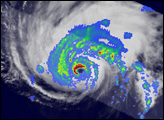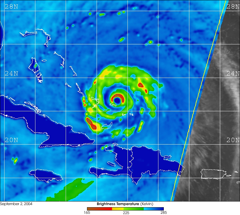
The Advanced Microwave Scanning Radiometer for EOS (AMSR-E) flying aboard NASA's Aqua satellite captured this false-color image of Hurricane Frances on September 2, 2004 at 6:45 UTC (2:45 AM EDT).
The image above is 89 GHz horizontal polarization imagery and is color-coded by brightness temperature to make visual interpretation easier. Brightness temperature is a measure of the intensity of radiation thermally emitted by an object, given in units of temperature (usually Kelvin) because there is a proportional correlation between the intensity of the radiation emitted and physical temperature of the radiating body.
Dramatically lower brightness temperatures occur in the hurricane rain bands and eyewall due to scattering caused by hail and graupel (ice) in the vigorous convective cells of the hurricane. Thus low brightness temperatures are a good proxy for strong convection. The storm structure is then analyzed by noting the percent coverage of strong convection (low brightness temperatures) within the eyewall and in the rain bands spiraling in towards the center of the storm.
When AMSR-E data is combined with data from other sensors to fill in the temporal sampling, the satellite meteorologist is able to see the storm structure's time evolution.
AMSR-E was provided to the Aqua program by the Japan Aerospace Exploration Agency (JAXA).
Near real-time AMSR-E imagery can be found at NRL Monterey Marine Meteorology Division Tropical Cyclone Pages.
Image courtesy of the Naval Research Laboratory Monterey Marine Meteorology Division.
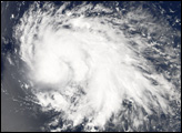
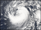
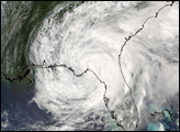
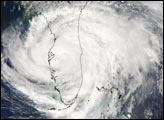
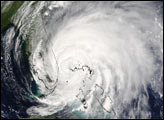
The MODIS instrument aboard NASA's Aqua satellite captured this true-color image of Tropical Storm Frances on September 6, 2004 at 19:00 UTC (3:00 PM EDT).
alert message