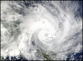

The MODIS instrument onboard NASA’s Terra satellite captured this true-color image of Tropical Cyclone Elita as it was making landfall off the coast of Mahajanga, Madagascar on January 28, 2004. Elita’s maximum sustained winds were near 60 knots (70 mph) with gusts to 75 knots (85 mph). The storm was expected to dissipate over the next 24-36 hours at it interacted with the Madagascar land body.
Image courtesy Jeff Schmaltz, MODIS Land Rapid Response Team at NASA GSFC.
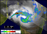
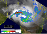
The TRMM satellite captured these images of Tropical Cyclone Elita as it was making landfall off the coast of Mahajanga, Madagascar.


