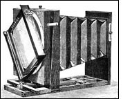
 The technology of modern remote sensing began with the invention of the
camera more than 150 years ago. Although the
first, rather primitive photographs were taken as "stills" on the
ground, the idea and practice of looking down at the Earth's surface
emerged in the 1840s when pictures were taken from cameras secured to
tethered balloons for purposes of topographic mapping. Perhaps the most
novel platform at the end of the last century is the famed pigeon fleet
that operated as a novelty in Europe. By the
first World War, cameras mounted on airplanes provided aerial views of
fairly large surface areas that proved invaluable in military
reconnaissance. From then until the early 1960s, the aerial photograph
remained the single standard tool for depicting the surface from a
vertical or oblique perspective. The technology of modern remote sensing began with the invention of the
camera more than 150 years ago. Although the
first, rather primitive photographs were taken as "stills" on the
ground, the idea and practice of looking down at the Earth's surface
emerged in the 1840s when pictures were taken from cameras secured to
tethered balloons for purposes of topographic mapping. Perhaps the most
novel platform at the end of the last century is the famed pigeon fleet
that operated as a novelty in Europe. By the
first World War, cameras mounted on airplanes provided aerial views of
fairly large surface areas that proved invaluable in military
reconnaissance. From then until the early 1960s, the aerial photograph
remained the single standard tool for depicting the surface from a
vertical or oblique perspective.
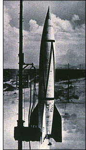 Satellite remote sensing can be
traced to the early days of the space age (both Russian and American
programs) and actually began as a dual approach to imaging surfaces
using several types of sensors from spacecraft. In 1946, V-2 rockets
acquired from Germany after World War II were launched to high altitudes
from White Sands, New Mexico. These rockets, while never attaining
orbit, contained automated still or movie cameras that took pictures as
the vehicle ascended. Then, with the emergence of the space program in
the 1960s, Earth-orbiting cosmonauts and astronauts acted much like
tourists by taking photos out the window of their spacecraft. Satellite remote sensing can be
traced to the early days of the space age (both Russian and American
programs) and actually began as a dual approach to imaging surfaces
using several types of sensors from spacecraft. In 1946, V-2 rockets
acquired from Germany after World War II were launched to high altitudes
from White Sands, New Mexico. These rockets, while never attaining
orbit, contained automated still or movie cameras that took pictures as
the vehicle ascended. Then, with the emergence of the space program in
the 1960s, Earth-orbiting cosmonauts and astronauts acted much like
tourists by taking photos out the window of their spacecraft.
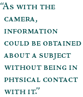
The term "remote sensing," first used in the United States in the 1950s
by Ms. Evelyn Pruitt of the U.S. Office of Naval Research, is now
commonly used to describe the science—and art—of identifying,
observing, and measuring an object without coming into direct contact
with it. This process involves the detection and measurement of
radiation of different wavelengths reflected or emitted from distant
objects or materials, by which they may be identified and categorized by
class/type, substance, and spatial distribution.
next: Radiation
|
|
by Steve Graham
September 17, 1999
 Remote Sensing
Introduction and History
Radiation
Electromagnetic Spectrum
Absorption Bands and Atmospheric Windows
Spectral Signatures
Pixels and Bits
Color Images
Remote Sensing Methods
NASA Remote Sensing Accomplishments
References
Related Data Sets:
Observation Deck
|
