
Hello from the Goddard Instrument Field Team! Earlier this summer, we visited Katmai National Park as guest researchers. These are some of our photos and notes from the field.
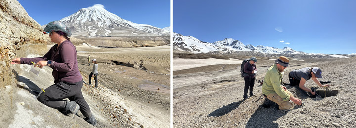
In June 1912, the largest volcanic eruption of the 20th century blanketed glaciers with ash in what’s now known as the Valley of Ten Thousand Smokes. Our 2024 expedition took us deep into the valley, seeking answers about icy volcanic landscapes on Earth, Mars, and beyond. The data and samples we gathered here will help us understand how these buried glaciers and the volcanic deposits on top are evolving over time.
Into the Valley of Ten Thousand Smokes
How do you pack for nine days of hiking and camping in bear territory? Carefully! We secured food and scented items in bear-proof canisters, mapped out tent placements to fit within the perimeter of a portable bear fence, and worked closely with Katmai National Park to minimize our impact while in the backcountry.

The journey from Anchorage to our base camp near Knife Creek included flights on tiny aircraft, “Bear School,” a school bus equipped to ford rivers, and a sixteen-mile hike complete with more water crossings and high winds. On day two in the field, a helicopter carrying large items, such as heavy science gear and a group water filter, reached the valley. In case weather prevented the airdrop, we were ready to complete some key tasks using just what we carried on our backs, but we were glad to see the equipment arrive.
Studying Buried Glaciers
In the field, we worked on and around glaciers covered in huge piles of ashy debris. Some team members used ground penetrating radar (GPR) to scan subsurface structures from above. Together with drill coring, hand-dug pits, and a soil moisture probe, GPR gives us insight into what’s going on underground.
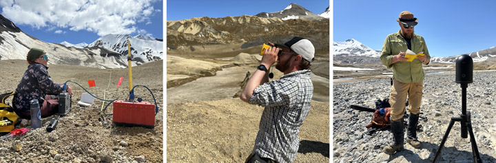
Other scientists studied the insulated glaciers from a different perspective: edge-on. They used laser ranging techniques to find out how the face of an ash-coated ice cliff morphed and receded throughout our week of work. We’ll compare these on-the-ground measurements with orbital images of the same area captured over longer periods of time. Combining field data and satellite imagery helps us better understand how the glaciers are evolving.
Planetary Science, Close to Home
We’re a team of planetary scientists, so our science questions on this trip applied to both Earth and other worlds. How does a blanket of ash affect the way glaciers are preserved? What chemical and mineral signatures can we find in the debris from a huge volcano like this one, and how are those signatures changing? What can the patterns we see today tell us about how microbial life has interacted with rock in this extreme environment?

Many planets and moons have volcanic pasts, and we’re still trying to learn exactly what kinds of volcanism have shaped their surfaces. Ice is common throughout our solar system, too. Ground-truth data from field sites like this one can help us interpret evidence found on faraway worlds, where it’s harder to collect and examine samples.
Learn More
Into the Field with NASA: Valley of Ten Thousand Smokes
Comparing Earth and Other Worlds: NASA Planetary Analogs