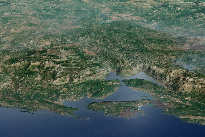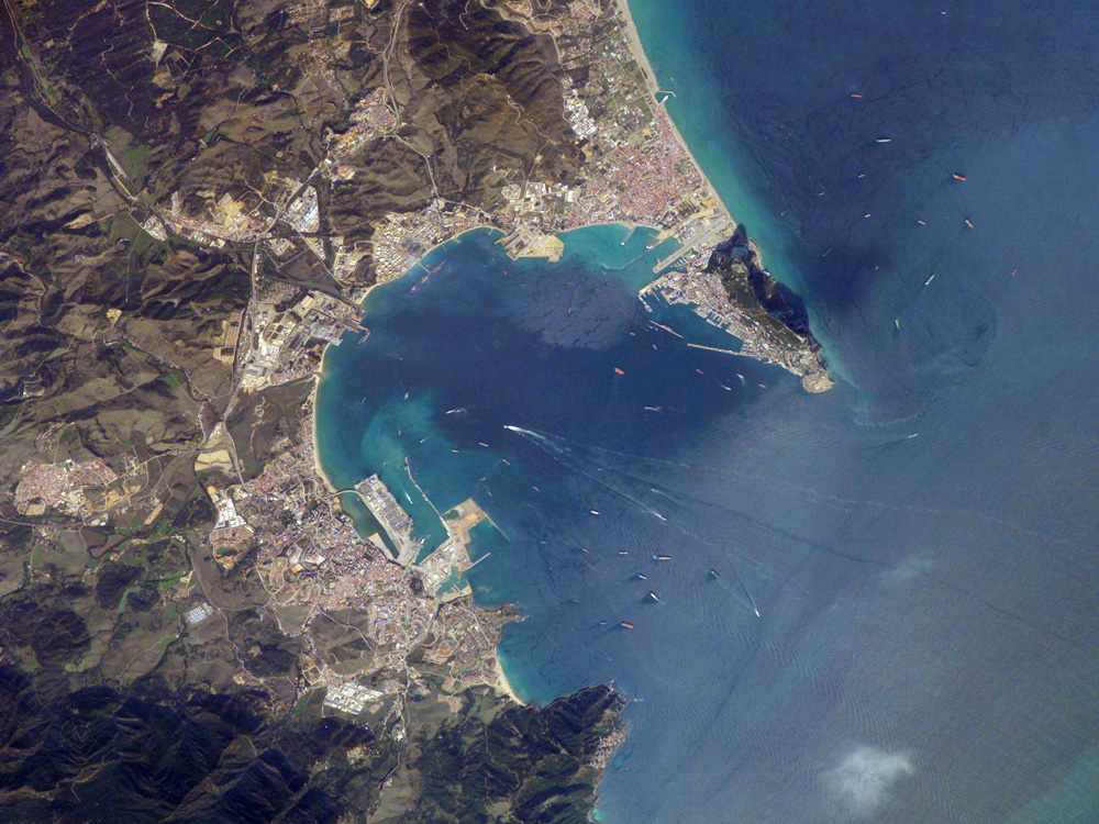
Gibraltar Bay, located near the southernmost tip of the Iberian Peninsula, is the central feature of this astronaut photograph. The famous Rock of Gibraltar that forms the northeastern border of the bay is formed of Jurassic-era seafloor sediments that solidified into limestone, a rock formed mostly of the mineral calcite, which is found in the shells of sea creatures. The limestone was subsequently lifted above the ocean surface when the African and Eurasian tectonic plates collided. The cities of La Linea and Algeciras bordering the bay, together with petroleum-processing facilities along the northern shoreline, are part of Spain, whereas the city of Gibraltar itself (to the west of and including the Rock) is under the jurisdiction of the United Kingdom.
The protected waters of Gibraltar Bay and its location close to Africa and the Strait of Gibraltar (the gateway between the Atlantic Ocean and the Mediterranean Sea), contribute to the region’s past and current strategic and economic importance. Numerous ships and several ship wakes are visible within the bay; the majority of these are freighters and cargo tankers accessing the petroleum facilities. Ships nearer to the Rock of Gibraltar are more likely cruise ships, as Gibraltar is a popular destination for tourists. Partial sunglint (light reflected directly back to the camera onboard the International Space Station) within the bay highlights surface water roughened by winds funneled into the bay by the surrounding highlands. One such area is visible directly to the west of La Linea.
Astronaut photograph ISS014-E-6812 was acquired October 30, 2006, with a Kodak 760C digital camera using a 400 mm lens, and is provided by the ISS Crew Earth Observations experiment and the Image Science & Analysis Group, Johnson Space Center. The image in this article has been cropped and enhanced to improve contrast. The International Space Station Program supports the laboratory to help astronauts take pictures of Earth that will be of the greatest value to scientists and the public, and to make those images freely available on the Internet. Additional images taken by astronauts and cosmonauts can be viewed at the NASA/JSC Gateway to Astronaut Photography of Earth.