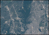
The Golden Gate National Recreation Area stretches from Tomales Bay north of Point Reyes all the way south to San Mateo County. With 30,512 hectares (75,398 acres) of park land, it is one of the largest city parks in the world. Established as a National Park in 1972, it is one of the most heavily visited sites in the U.S. National Park Service, with an estimated 16 million visitors each year.
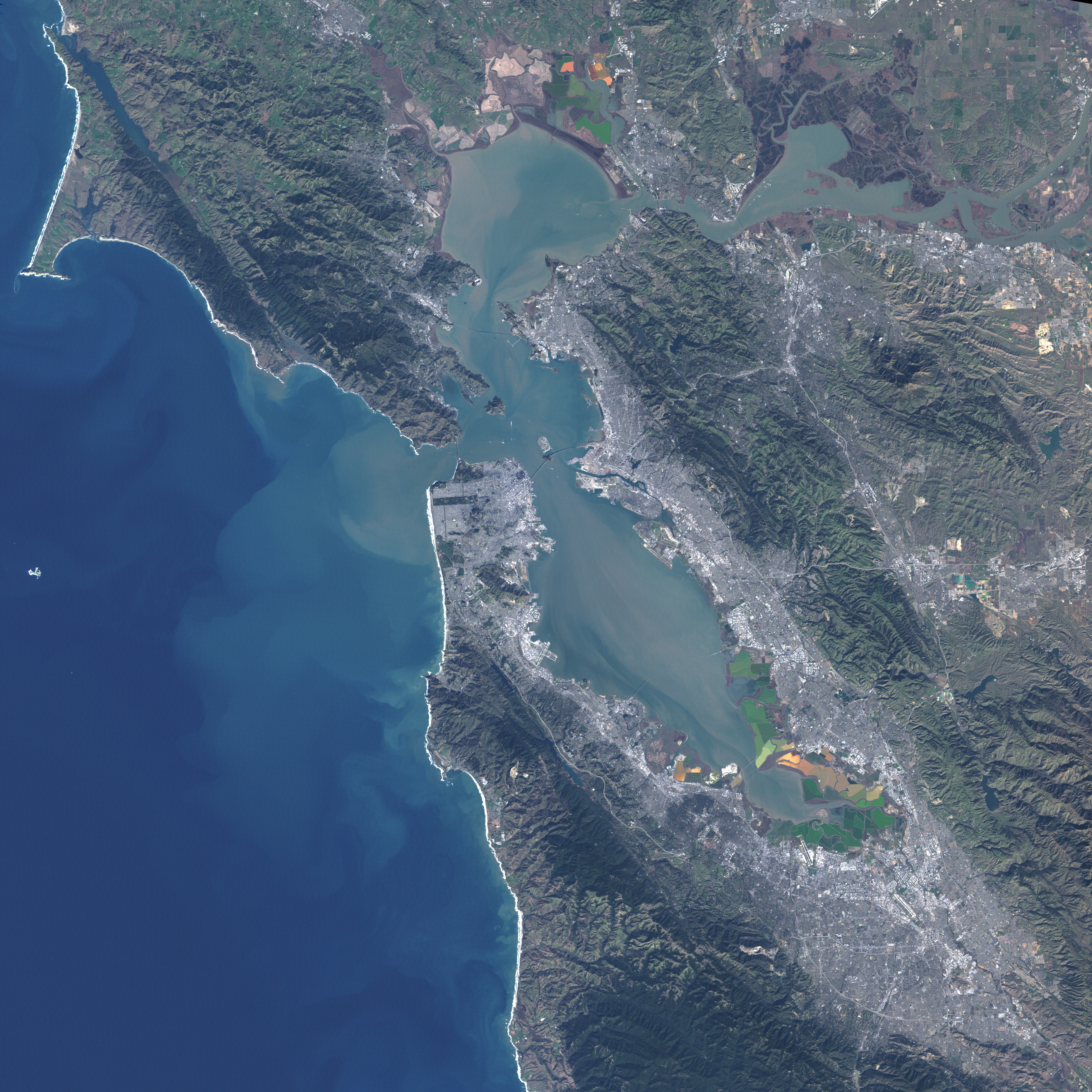
This natural-color image was created from data collected by the Enhanced Thematic Mapper Plus (ETM+) instrument on the Landsat 7 satellite on January 17, 2001. In this image, most sections of the park are quite obvious as green areas that contrast sharply with the surrounding grey of the city of San Francisco. The small image above centers on the most urban portion of the park; the large image shows the full extent of the park. The long, rectangular section running from the ocean inland for several kilometers is urban parkland, with pale green being open grass and dark green indicating trees.
Another obvious parkland area is the greenery along the south point of the Golden Gate, which includes the world-famous Exploratorium, the old military installations established to guard the entrance to the city, and sandy beaches frequented by sea lions. The Golden Gate Bridge is visible across the entrance to the bay. Its distinctive red color is less obvious from space than from the ground, but the long shadow cast by the suspension bridge’s support towers can be seen. To the north of the Golden Gate lie steep hillsides which appear as a mottled mixture of reddish browns (exposed rock or soil) and deep green (forest).
The thin, wavering gray line leading north from the Golden Gate Bridge is U.S. Highway 101, which carries traffic from the city north to the bayside communities. The two islands visible in this image are the large Angel Island and smaller Alcatraz. Alcatraz is part of the Golden Gate National Recreational Area, with the former prison buildings covering almost the entire island. Once a high-security prison, it now is a historical park site, and it includes artifacts and displays from the time before the prison, when the island housed a fort.
The park has unusually diverse content: historical fortifications such as The Presido, Native American cultural sites, the Japanese Tea Garden, the city aquarium and planetarium, coastal beaches, redwood forests, and the park’s namesake, the Golden Gate. The park takes in seven watershed areas, many distinct ecosystems, and some 80 different rare, threatened, or endangered species, 33 of which are currently under federal protection. These include the Northern Spotted Owl, California Red-legged Frog, and Coho Salmon.
NASA image created by Jesse Allen, Earth Observatory, using data provided courtesy of the Landsat Project Science Office.