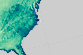
An extreme rainfall event saturated the soil along the U.S. East Coast.
Published Oct 8, 2015
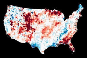
Views from the ground and from space are helping scientists understand how soil moisture affects U.S. agriculture.
Published Nov 25, 2015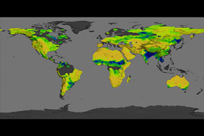
The Aquarius instrument was designed to study ocean salinity, but it is also making an important contribution to studies of the water cycle on land.
Published Jul 15, 2014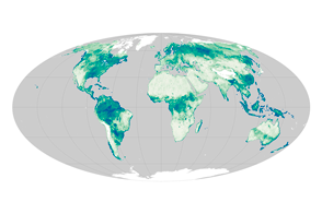
Satellite sensors uncover a global view of the water hidden between soil particles.
Published Nov 12, 2015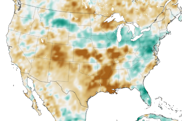
The amount of water contained in the top few centimeters of soil is small on a global scale, but it is critical for agriculture analysts trying to monitor commodity production and humanitarian need.
Published Jun 2, 2018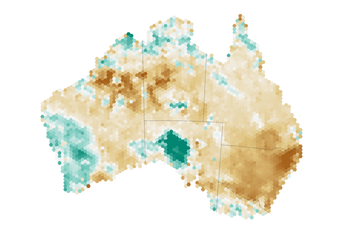
Eastern Australia has been hit particularly hard by drought, taking a toll on the region’s soil moisture and agriculture.
Published Aug 9, 2018Image of the Day Land Water Drought Human Presence Remote Sensing
Though a series of winter storms provided some relief, a pair of satellites operated by NASA shows that groundwater supplies remained unusually low in many parts of the country.
Published Jan 19, 2013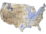
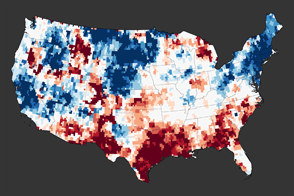
A new map reveals the extreme depletion of groundwater in Texas and other parts of the southern United States due to drought.
Published Dec 1, 2011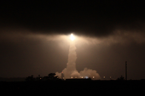
The SMAP mission lifts off to make the most accurate, high-resolution soil moisture measurements ever collected from space.
Published Feb 1, 2015
The proportion of sand, silt, and clay contained in soil across the U.S. affects the amount of water it can hold.
Published Jan 9, 2016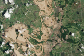
The Brazos River reached record-high water levels west of Houston.
Published Jun 3, 2016Image of the Day Land Water Floods Severe Storms Human Presence
alert message
