This false-color image taken by the Landsat-7 satellite on June 7, shows how completely the Wallow Fire is burning the forest in the mountains of eastern Arizona.
Published Jun 9, 2011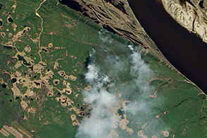
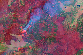
Needle-leaf forest stretches away from the Lena River in Russia’s remote eastern reaches. The EO-1 satellite captured these images just as fire swept through the area.
Published Jun 17, 2011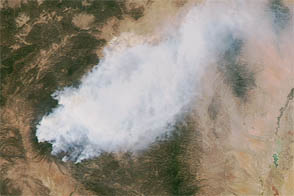
The Whitewater-Baldy wildfire is the largest on record in New Mexico.
Published May 30, 2012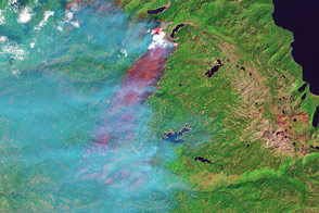
The fast-moving fire burned in Eldorado National Forest in September 2014.
Published Sep 23, 2014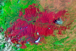
The EO-1 satellite observed the burn scar from the Little Bear Fire.
Published Jun 14, 2012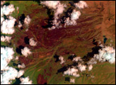
This image shows the extent of Arizona’s Wallow Fire on June 15, 2011.
Published Jun 16, 2011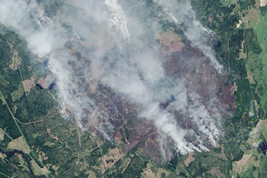
The largest wildfire Swedes have seen in four decades forced thousands to flee their homes in August 2014.
Published Aug 9, 2014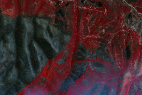
Though the Wallow Fire in the White Mountains of eastern Arizona is not yet fully out, the time to assess and recover has already begun via satellite imagery.
Published Jun 29, 2011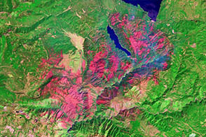
One of a number of large wildfires that have affected northern California in 2012, the Chips fire burned more than 75,000 acres by the time firefighters had contained it.
Published Sep 5, 2012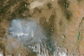
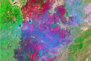
New Mexico’s largest fire has grown in fits and starts.
Published Jun 4, 2012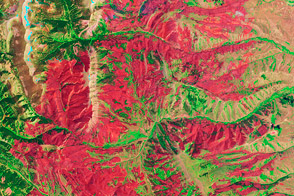
A fire in Bridger-Teton National Park in Wyoming has burned more than 50,000 acres.
Published Jul 5, 2012alert message
