In 2015, the annual maximum extent of Antarctic sea ice dropped below previous consecutive years of record highs.
Published Oct 18, 2015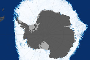
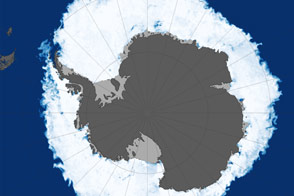
This map shows sea ice extent around Antarctica on September 22, 2013, when ice covered more of the Southern Ocean than at any other time in the satellite record.
Published Oct 1, 2013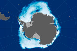
Shifting winds and warm air temperatures contributed to the record-low extent of sea ice around Antarctica in November.
Published Dec 16, 2016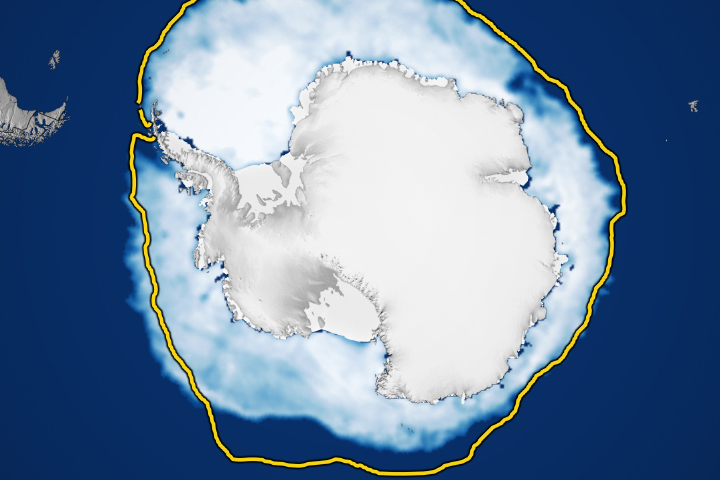
The extent of winter sea ice surrounding Antarctica is in uncharted territory in the satellite record.
Published Aug 14, 2023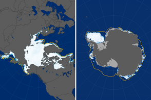
In 2017, the Arctic maximum and Antarctic minimum extents of sea ice plunged to record lows.
Published Mar 23, 2017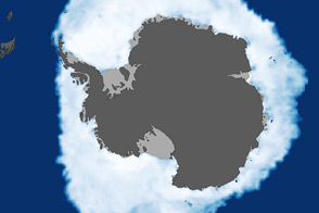
As the Arctic experienced a new record summer minimum for ice extent, the Antarctic set a new record for maximum winter sea ice.
Published Oct 11, 2012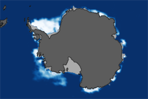
This pair of images shows Antarctic sea ice concentrations at the 2008 winter maximum and the 2009 summer minimum compared to the median ice extent from 1979–2000.
Published May 23, 2009
Due to accelerated Arctic losses, Earth has been shedding sea ice since 1979 at an annual rate of 35,000 square kilometers (13,500 square miles).
Published Feb 11, 2015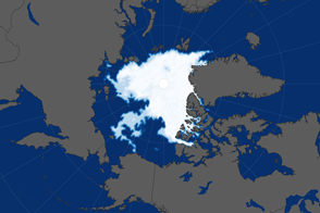
Since satellites began monitoring sea ice in 1979, researchers have observed a decline in the average extent of Arctic sea ice in every month of the year.
Published Sep 16, 2016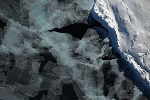
A spectacular view of sea ice was captured during an Operation IceBridge flight in 2014; the mission surveyed ice at both poles again in 2015, this time simultaneously.
Published Oct 4, 2015alert message
