
As they prepare for a satellite that will measure the height and areal extent of rivers in unprecedented detail, hydrologists have released a better map of North American river widths.
Published Jul 9, 2015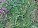

Acquired April 2, 2011, and February 27, 2011, these natural-color images show rising waters on the Kuiseb River, which flowed all the way to the Atlantic Ocean for the first time in decades.
Published Apr 12, 2011
Floods and new infrastructure have long since separated the distinctive bend in the river that was portrayed by landscape painter Thomas Cole in 1836.
Published Oct 15, 2017
Trees have long been cherished here for timber and for the colors they bring to “the Fall Rhapsody.”
Published Oct 24, 2020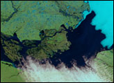
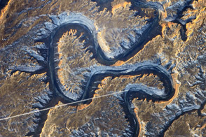
The Green River in eastern Utah once carved soft sediment into meanders on a floodplain. Then the land and mountains rose and the river dug deep, preserving those meanders in stone.
Published Mar 17, 2014
Acquired May 1, 2011, this natural-color image shows the James River completely filling the river valley near Jamesville, South Dakota.
Published May 3, 2011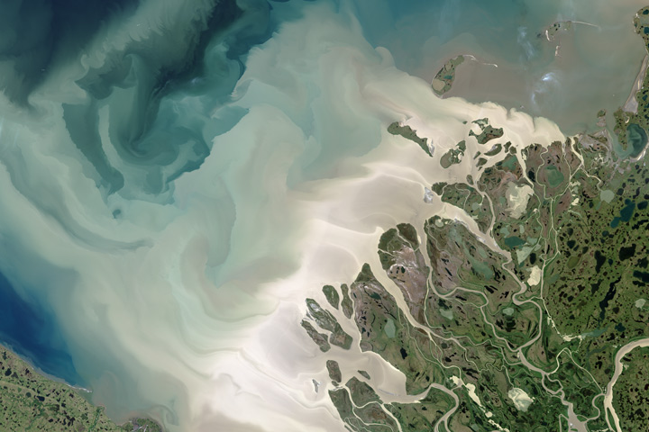
Canada’s largest and longest river delivers vast amounts of fresh water and sediment to the sea.
Published Aug 6, 2017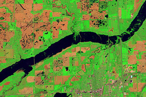
Acquired June 5, 2011, and May 19, 2005, these false-color images compare conditions along the James River near Mitchell, South Dakota.
Published Jun 7, 2011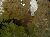
Russia’s Ob River flows from south to north, and each summer, it thaws in the same direction. The result is that an ice jam sits downstream from thawed portions of the river, which is laden with heavy runoff from melted snow.
Published Jul 11, 2007alert message
