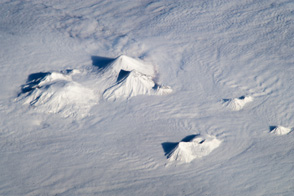
The combination of a low viewing angle, shadows, and height and distance from the volcanoes contributes to the appearance of topographic relief.
Published Nov 19, 2012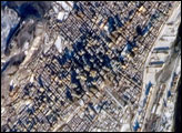
The largest city in the Canadian province of Québec and the largest inland port in the world, Montréal takes its name from a distinctive landscape feature at the center of the city. Mont-Royal (“royal mountain” in French) rises to an elevation of 233 meters (about 764 feet) at Colline de la Croix peak.
Published Feb 26, 2007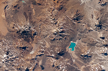
The landscape in the central Andes Mountains, near the border between Chile and Argentina, is dominated by volcanoes and associated landforms.
Published Sep 6, 2010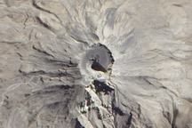
Free of vegetation, the gray and white lava-covered peak of the Ubinas Volcano looks like it could be on the Moon or some other extraterrestrial body in this detailed true-color image from July 24, 2010.
Published Feb 6, 2011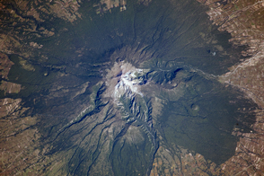
Though there are no historical accounts, geologic evidence suggests an eruption about 3,100 years ago affected Pre-Columbian settlements in Mexico.
Published Nov 25, 2013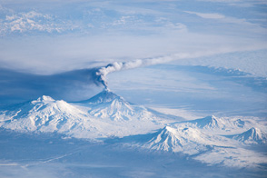
An astronaut captured this view of an eruption plume amidst a chain of volcanoes on Russia’s Kamchatka Peninsula.
Published Dec 2, 2013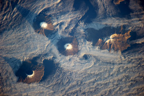
Four volcanoes double as islands in Alaska’s Aleutian chain.
Published Dec 16, 2013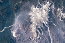
This astronaut photograph highlights two volcanoes located near the southern boundary of the Nazca–South America subduction zone in southern Chile. Dominating the scene is the massive Minchinmávida Volcano at image center. At bottom center is its smaller, but currently active, neighbor Chaitén.
Published Mar 9, 2009
Volcan Parinacota is a potentially active stratovolcano located on the Altiplano, a high plateau in the Andes mountains.
Published Oct 17, 2011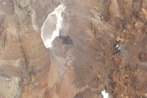
Acquired February 4, 2003, this natural-color image shows Parque Nacional Llullaillaco along the Chile-Argentina border.
Published Oct 9, 2011alert message
