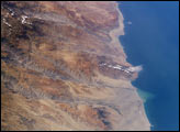
Following the last major upheaval of the Andes Mountains, rivers flowing down into the Pacific Ocean have carved dramatic canyons along Peru’s southern coast. In geologic terms, the canyons are relatively young—carved over the past 8 million years. This oblique (off-vertical) image from March 14, 2003, provides a southward look down Peru’s rugged, arid coastline between 15.5 and 17 degrees South latitude. The canyons run from left to right and appear grayer than the surrounding reddish-brown terrain.
Published Mar 21, 2005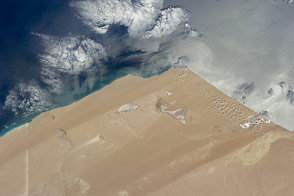
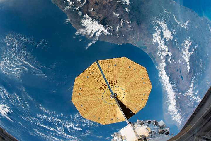
Recently tweeted from the International Space Station, this image of the extremely arid West African coast of the Atlantic Ocean looks otherworldly.
Published Jun 30, 2014
From one million miles away, the DSCOVR satellite returned its first view of the entire sunlit side of Earth.
Published Jul 21, 2015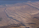
Some of the deepest canyons in the world cut west to the Pacific from the high crest of the Andes Mountains in Peru. This dramatic image taken from the International Space Station provides a birds-eye view down the canyons of the Rio Camana and the Rio Ocona. The low early morning sun highlights the extreme topography created by rapidly uplifting mountains and powerful water erosion by water dropping nearly 10,000 feet (more than 3000 m) in this view. At the edge of the image is the snowy flanks of Nevado Coropuna, the highest mountain in the Cordillera Occidental (6613 meters).
Published Jul 20, 2003
An ISS astronaut using a short camera lens captured almost all of Mexico in one shot.
Published May 3, 2020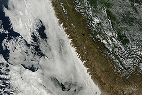
Tendrils of fog outline river valleys as the Andes Mountains block advancing banks of ocean clouds.
Published Jun 14, 2015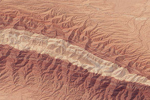
The “Mountain of Sulfur” rises from the desert in north-central Iran.
Published Sep 26, 2015
An Earth Observatory reader used widely available software to correct the oblique perspective of an earlier photograph of Montserrat and to adjust the color. The story of how he modified the image includes step-by-step instructions that can be applied to other photographs.
Published Mar 27, 2002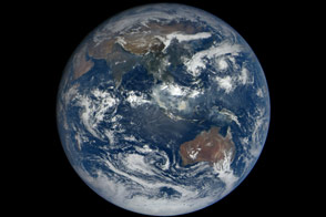
When the DSCOVR mission was conceived in the late 1990s, one of the central ideas was to provide daily, natural-color views of the entire Earth so that everyday citizens could see it. Seventeen years later, we have that view.
Published Oct 23, 2015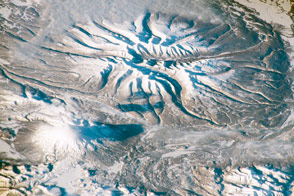
Astronauts captured this view of two snow-covered volcanoes in southern Kamchatka, Russia.
Published Dec 21, 2015alert message
