
Acquired May 1, 2011, this natural-color image shows the James River completely filling the river valley near Jamesville, South Dakota.
Published May 3, 2011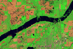
Acquired June 5, 2011, and May 19, 2005, these false-color images compare conditions along the James River near Mitchell, South Dakota.
Published Jun 7, 2011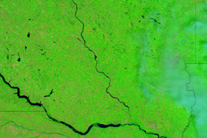
Acquired August 1, 2011, and August 6, 2010, these false-color images compare conditions along the James River, a Missouri River tributary, in South Dakota.
Published Aug 2, 2011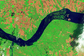
Acquired June 5, 2011, and May 19, 2005, these false-color images compare conditions around Lewis and Clark Lake in South Dakota.
Published Jun 7, 2011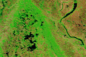
Acquired June 1, 2011, and May 29, 2010, these false-color images compare parts of the James and Little Minnesota Rivers.
Published Jun 2, 2011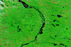
Acquired August 7, 2011, and July 7, 2011, these false-color images compare conditions along the Souris River, which flooded in the summer of 2011.
Published Aug 8, 2011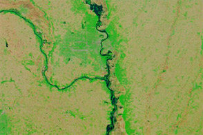
Acquired June 6, 2011, and June 16, 2010, these false-color images compared conditions along the Missouri River in Nebraska, Iowa, and Missouri.
Published Jun 7, 2011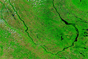
Acquired June 23, 2011, and June 24, 2010, these false-color images compare conditions along the Souris River in North Dakota.
Published Jun 23, 2011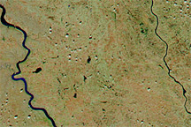
Acquired April 4, 2011, and March 5, 2011, these false-color images show snow cover retreat and rising rivers in South Dakota.
Published Apr 5, 2011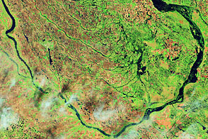
Acquired June 1, 2011, and July 2, 2002, these false-color images compare conditions along the Souris River in North Dakota.
Published Jun 6, 2011