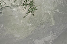
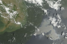
Acquired in the months after the Deepwater Horizon oil spill, this natural-color image shows possible oil patches near the Mississippi Delta.
Published Jul 30, 2010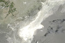
Acquired June 25, 2010, this natural-color image shows the oil slick in the Gulf of Mexico.
Published Jun 26, 2010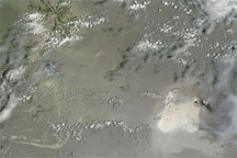
Acquired July 11, 2010, this natural-color image shows an apparent oil slick southeast of the Mississippi Delta.
Published Jul 11, 2010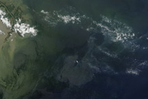
Regions of heavy oil in the Gulf of Mexico are visible in this photo-like image from June 7, 2010.
Published Jun 8, 2010
Acquired July 4, 2010, this natural-color image shows the Deepwater Horizon oil slick lingering off the Mississippi Delta.
Published Jul 7, 2010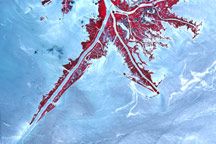
Acquired June 10,2010, this false-color image shows parts of the oil slick from the Deepwater Horizon rig nearing the Mississippi Delta.
Published Jun 11, 2010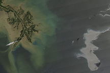
These satellite images were among the first revealing the scope of the Deepwater Horizon spill.
Published Apr 27, 2010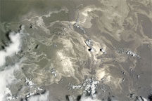
Acquired June 18, 2010, this natural-color image shows the lingering Deepwater Horizon oil slick in the Gulf of Mexico.
Published Jun 19, 2010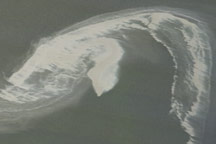
The northwestern tip of the oil slick in the Gulf of Mexico almost touches the Mississippi Delta in this image from April 29, 2010.
Published Apr 30, 2010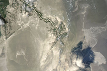
The oil spill in the Gulf of Mexico appeared large and sprawling in this natural-color image from May 25, 2010.
Published May 26, 2010