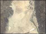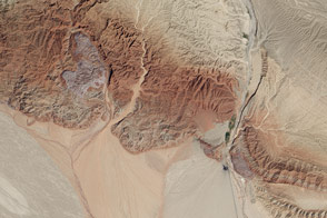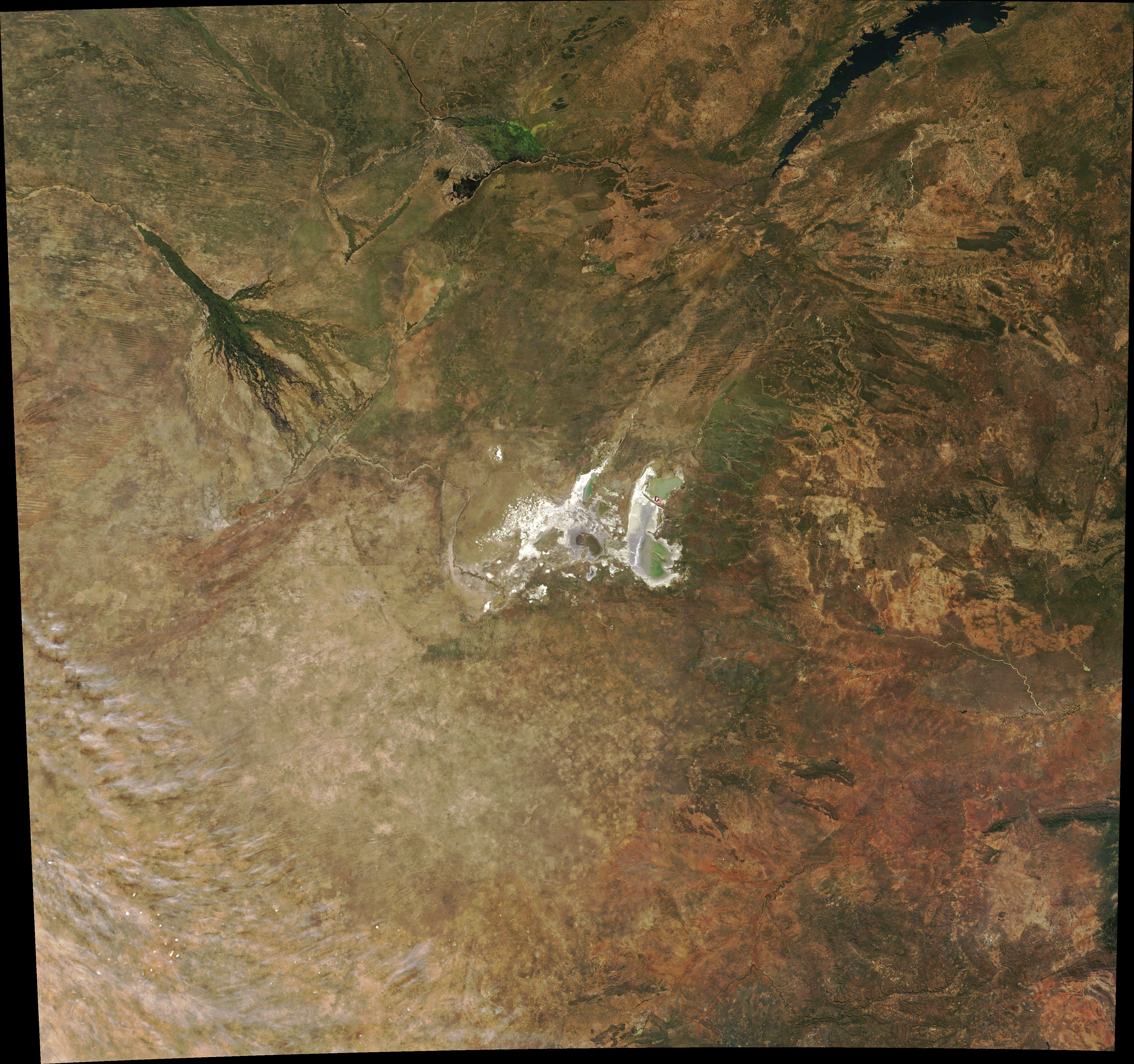
Northeast of Africa’s Kalahari Desert and southeast of the Okavango Delta lies one of the largest salt pans in the world. It was once the site of one of the largest inland seas on Earth.
On June 10, 2018, the Moderate Resolution Imaging Spectroradiometer (MODIS) on NASA’s Terra satellite acquired this natural-color image of the Makgadikgadi Salt Pans. The collection of salt flats covers roughly 30,000 square kilometers (10,000 square miles) amidst desert and dry savanna in Botswana. Located in Makgadikgadi National Park and Nxai Pan National Park, the salt pans are rivaled in extent only by the Salar de Uyuni in Bolivia.
For much of the year, the salt pans glimmer in white, parched by the sun and the salt and allowing little more than algae to grow. But during the rainy season (roughly November to March), the area can be transformed into a crucial wetland. Water can flow in from the Boteti and Nata rivers, filling ephemeral ponds, watering holes, and shallow lakes and creating short-lived but abundant grasslands. The event draws migrating wildebeest and zebras, as well as the predators that hunt them. The waters fill with ducks, geese, pelicans, and flamingos—one of just two breeding spots in southern Africa for the long-legged birds.
The pans are the salty remains of ancient Lake Makgadikgadi. Scientists estimate that the inland sea once spanned anywhere from 80,000 to 275,000 square kilometers. The Okavango, Zambezi, and Cuando rivers likely emptied into this lake until tectonic shifts changed the elevation of the landscape and a changing climate dried up the rains.
NASA Earth Observatory image by Joshua Stevens, using MODIS data from LANCE/EOSDIS Rapid Response. Story by Mike Carlowicz.
alert message