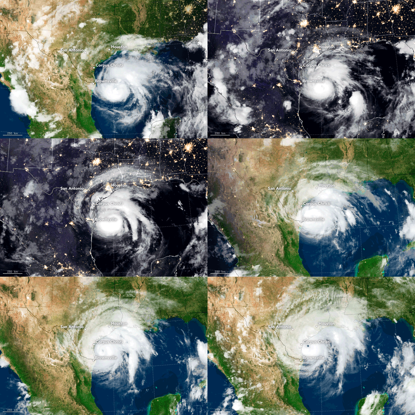


Residents along the coast of Texas braced for a potent hurricane to make landfall late on August 25. Forecasters believe the storm will be at major intensity (category 3 or higher) and will be the strongest to make landfall in the United States in 12 years. Hurricane Harvey was predicted to come ashore somewhere between Port O’Connor and Corpus Christi, Texas.
Forecast models were predicting rain accumulations of 15 to 30 inches (38 to 76 centimeters) in many places along the Texas coast, with localized totals up to 40 inches (100 centimeters). Significant rainfall, though somewhat less extreme, is expected inland. The storm system is expected to stall and linger for several days as it interacts with another weather front. In a forecast advisory on August 25, the National Hurricane Center (NHC) declared: “Rainfall of this magnitude will cause catastrophic and life-threatening flooding.”
The animation above shows Harvey as the hurricane evolved between 7:15 p.m. Central Daylight Time on August 24 and 3:15 p.m. on August 25. Infrared data (band 4) from Geostationary Operational Environmental Satellite 13 (GOES-13) is overlaid on a MODIS blue marble. The satellite is operated by the National Oceanic and Atmospheric Administration (NOAA), while NASA helps develop and launch the GOES series of satellites.
At 4 p.m. Central Daylight Time (19:00 Universal Time) on August 25, the National Hurricane Center reported that Harvey had maximum sustained winds of 125 miles (205 kilometers) per hour and a minimum central pressure of 941 millibars (27.79 inches). The category 3 hurricane was about 60 miles (95 kilometers) east-southeast of Corpus Christi, Texas; tropical storm force winds and outer rain bands were beginning to hit the Texas coast. Hurricane-force winds extended outward up to 35 miles (55 kilometers) from the center, and tropical storm winds stretched for 140 miles (220 kilometers).
At 12:25 p.m. local time (17:25 UTC) on August 25, the Moderate Resolution Imaging Spectroradiometer (MODIS) on NASA’s Terra satellite acquired this natural-color image (above) of Hurricane Harvey.
On August 24, astronauts on the International Space Station recorded this video footage of the rapidly intensifying storm over the Gulf of Mexico.
Visit the National Hurricane Center web site for official forecasts and advisories. You can also find more coverage on the NASA Hurricane Page.
NASA Earth Observatory images by Joshua Stevens and Jesse Allen, using data from the NASA-NOAA GOES project and the University of Wisconsin’s Space Science and Engineering Center MODIS Direct Broadcast system. Story by Mike Carlowicz.