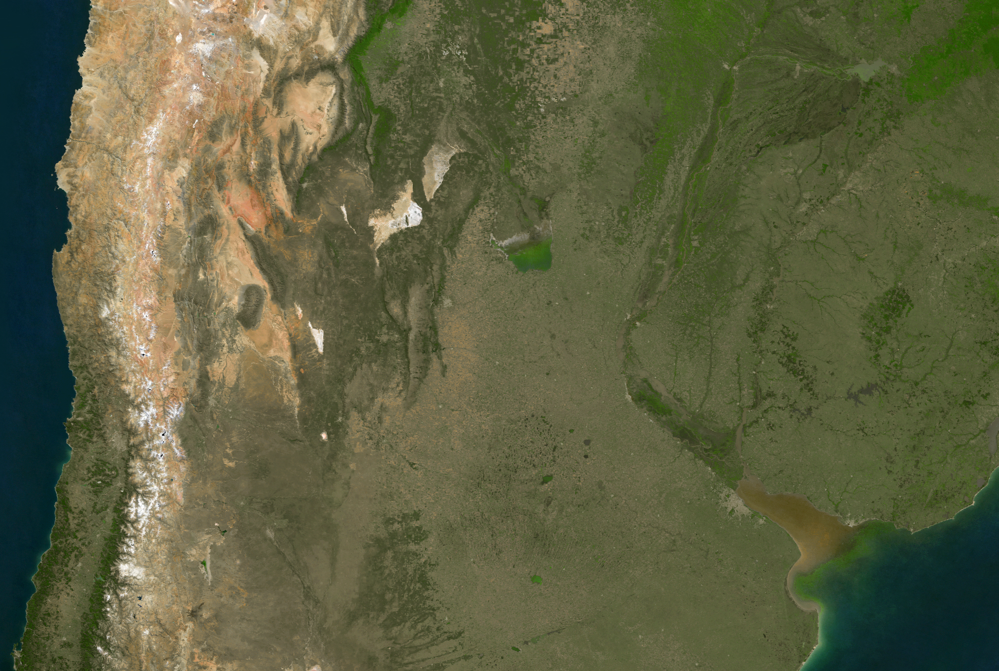
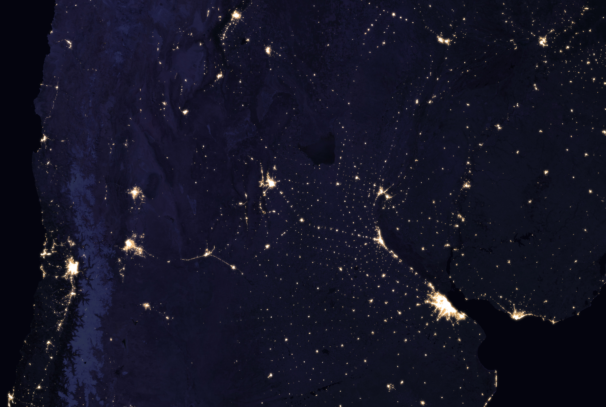
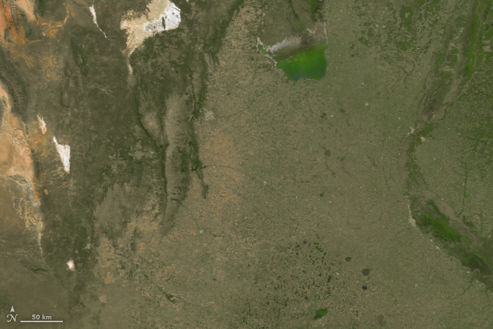
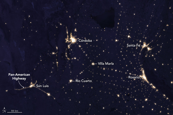
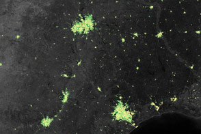
When viewed from a satellite in daylight, the landscape of central Argentina shows barely a sign of human settlement. But by night, the place could be mistaken for a game of luminescent connect-the-dots. Rows of bright, evenly spaced points of light puncture the darkness. The nighttime lights betray the presence of towns.
It’s no mistake that these lights appear every 30 to 50 kilometers (roughly 20 to 30 miles), as many of the towns grew up around railway stations. Maps from the middle of the 20th century show the network of railway lines that gave shape to this curious configuration.
Today, cars have outpaced trains in popularity, but the mark of the railways remains emblazoned in the terrain. Some tracks are still visible from space, such as those running parallel to the road between Cordoba and Villa Maria. The same is true of the line that runs northeast through Rio Cuarto. Highways now connect the “dots”—and these cities.
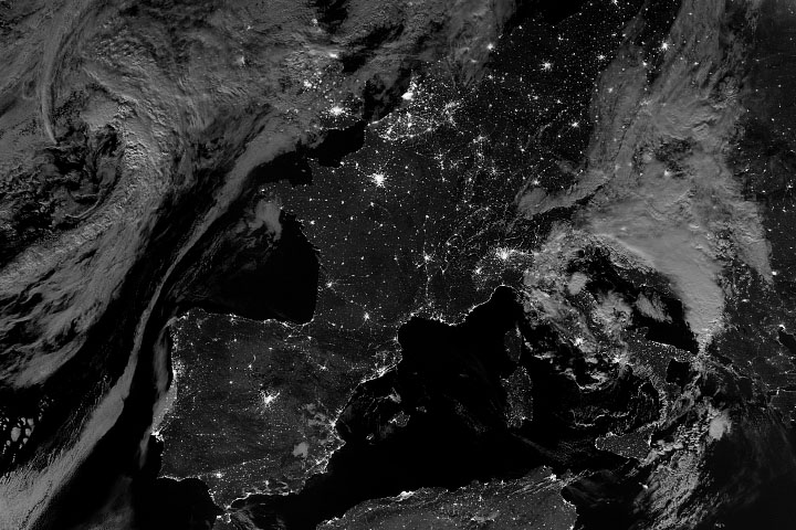
The second image on this page shows Argentina’s night lights as observed in 2016. The image is drawn from a global composite that was made by selecting the best cloud-free nights in each month over each land mass on Earth. The data come from the Visible Infrared Imaging Radiometer Suite (VIIRS) on the NASA-NOAA Suomi NPP satellite. VIIRS includes a special “day/night band,” a low-light sensor that measures light emissions and reflections, allowing researchers to distinguish the intensity, types, and sources of night lights and to observe how they change over time.
A natural-color image (top) shows the same area by day with a cloudless composite from the Moderate Resolution Imaging Spectroradiometer (MODIS) on Aqua and Terra satellites.
Fields for growing crops and raising cattle dominate the landscape. Most people reside in the country’s main cities, including Cordoba and Santa Fe. A mere 10 percent of Argentina’s population lives in rural areas, according to the Food and Agriculture Organization of the United Nations.
NASA Earth Observatory images by Joshua Stevens, using Suomi NPP VIIRS data from Miguel Román, NASA GSFC, and MODIS data from the Land Processes Distributed Active Archive Center (LP DAAC) and Google Earth Engine. Story by Pola Lem.


