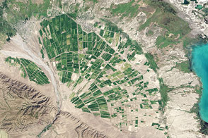
In the Late Jurassic period, a network of braided rivers flowed across the Colorado Plateau in an area about 8 kilometers (5 miles) northwest of Hanksville, Utah. The rivers cut through layers of bedrock, chiseling valleys and depositing sand and gravel on their bottoms.
Over the past 150 million years, geologic processes have reversed the area’s topography. The sandy deposits from the channel beds hardened into erosion-resistant caps of sandstone, while winds and water chewed away at the shale and claystone rocks on the river’s adjacent floodplains. Today, the shales and claystones have largely eroded and the sandy deposits that were stream channels are now sinuous ridges that rise above the landscape.
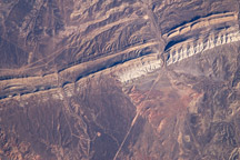
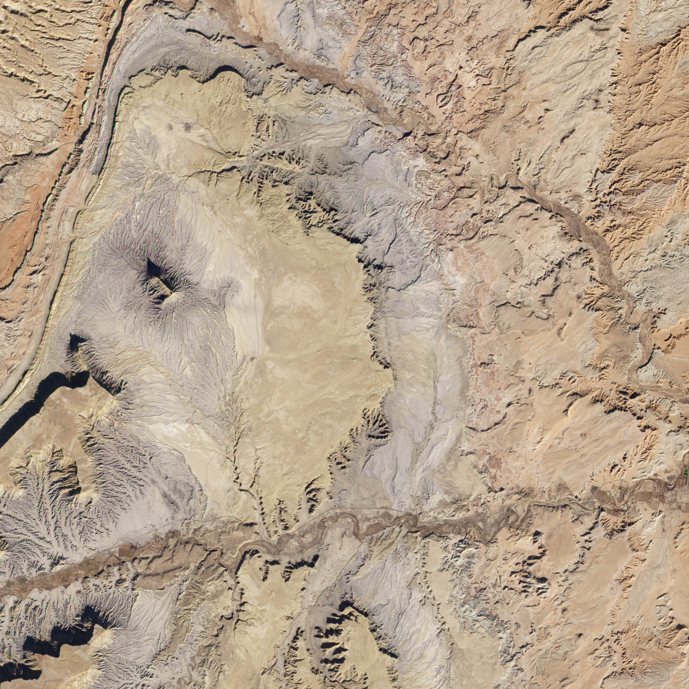
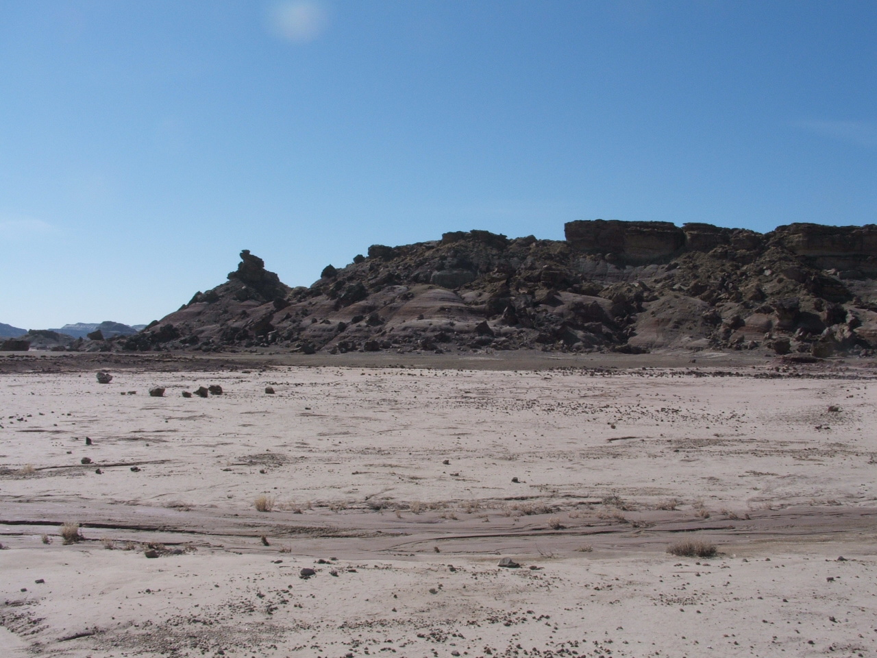
Remnants of these inverted channels are visible in this view of part of the San Rafael Swell of central Utah. The Advanced Land Imager (ALI) aboard NASA’s Earth Observing (EO-1) satellite acquired the image on November 25, 2012. One of the most prominent features is Kissing Camel Ridge, the curving feature in the middle of the top image. The lower image shows Kissing Camel Ridge from the ground.
To the east of Kissing Camel Ridge, another inverted river channel rises above the landscape. Both ridges sit atop a plain comprised mainly of shale. The broader area around the ridge also contains beds of sandstones. On the far left, erosive forces have exposed an underlying layer of grayer rock made of marine clays. Both layers are part of the Morrison Formation, a sequence of sedimentary rock layers famous for containing dinosaur fossils.
Inverted stream channels are of great interest to scientists who study Mars because satellites have observed similar features on the Red Planet—a clue that liquid water may once have been abundant there. The inverted channels in the San Rafael Swell are of particular interest because geologists have unearthed spherical mineral deposits on the western edge of the Kissing Camel Ridge that could have only formed in the presence of liquid water in the subsurface. The Mars rover Opportunity found similar spheres—dubbed Martian “blueberries”—strewn across the surface near its landing site in 2004. Scientists affiliated with NASA Ames Research Center and the Mars Society Australia authored a study in 2011 that described the similarities in size and shape of the spheres found in the San Rafael Swell and on Mars.
So far, Curiosity, the newest Mars rover, has not discovered spherical deposits while exploring the 154-kilometer (96 mile) wide Gale Crater, which may have held a lake in the past and contains an intriguing mountain with exposed sedimentary rock layers. Gale Crater also contains many sinuous ridges that appear to be inverted stream channels.
Curiosity has not investigated any of the channels at close range yet, but the rover did send back images of sedimentary conglomerate rocks in September 2012 that scientists think were deposited by a stream.
On December 3, 2012, Curiosity’s science team also announced that the rover had used its full array of instruments to analyze Martian soil for the first time. Curiosity’s instruments detected water, sulfur, and chlorine-containing substances, among other ingredients.
NASA Earth Observatory image created by Jesse Allen and Robert Simmon, using EO-1 ALI data provided courtesy of the NASA EO-1 team. Photograph by Jonathan Clarke. Caption by Adam Voiland, with information from Carol Stoker and Jonathan Clarke.