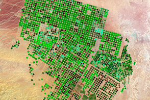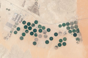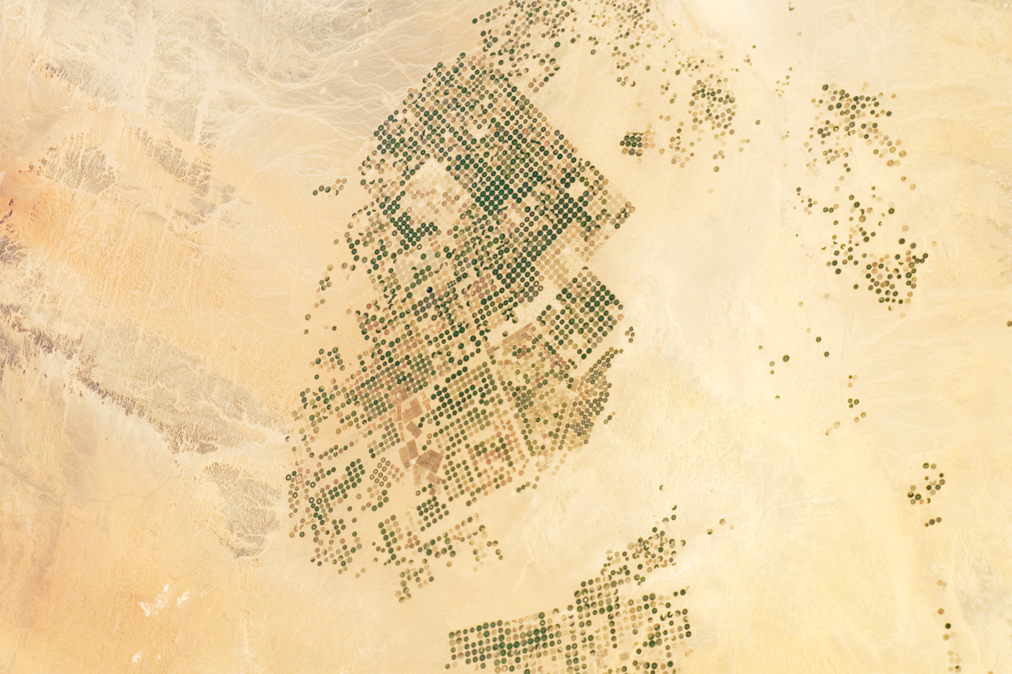
Northern Saudi Arabia hosts some of the most extensive sand and gravel deserts in the world, but modern agriculture has changed the face of some of them. This photograph from astronauts on the International Space Station presents an almost surreal view of abundant green fields in the midst of a barren desert.
As recently as 1986, there was little to no agricultural activity in the Wadi As-Sirhan Basin. But over the past 26 years, agricultural fields have been steadily developed, largely as a result of the investment of oil industry revenues by the Saudi government. Crops grown in the area include fruits, vegetables, and wheat.
The fields are irrigated by water pumped from underground aquifers. That water is distributed in rotation about a center point within a circular field—a technique known as center-pivot agriculture. The approach affords certain benefits compared to traditional surface irrigation, such as better control of water and fertilizer use. This so-called “precision agriculture” is particularly important in regions subject to high water loss due to evaporation. By better controlling the amount and timing of water application, evaporative losses can be minimized.
For a sense of scale, the agricultural fields in active use (dark green) or fallow (brown to tan), are approximately one kilometer in diameter. While much of the Wadi As-Sirhan Basin shown here is sandy (light tan to brown surfaces) and relatively flat, low hills and rocky outcrops (dark gray) of underlaying sedimentary rocks are visible at image left and right.
Astronaut photograph ISS030-E-90918 was acquired on February 21, 2012, with a Nikon D2Xs digital camera using a 65 mm lens, and is provided by the ISS Crew Earth Observations experiment and Image Science & Analysis Laboratory, Johnson Space Center. The image was taken by the Expedition 30 crew. The image has been cropped and enhanced to improve contrast, and lens artifacts have been removed. The International Space Station Program supports the laboratory as part of the ISS National Lab to help astronauts take pictures of Earth that will be of the greatest value to scientists and the public, and to make those images freely available on the Internet. Additional images taken by astronauts and cosmonauts can be viewed at the NASA/JSC Gateway to Astronaut Photography of Earth. Caption by William L. Stefanov, Jacobs/ESCG at NASA-JSC.