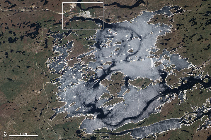


On May 19, 2011, the Advanced Land Imager (ALI) on NASA’s Earth Observing-1 (EO-1) satellite observed a work in progress in northern Quebec, east of James Bay. The project—known as the Eastmain-1-A/Sarcelle/Rupert Project—is designed to increase hydroelectric power for the Canadian province.
The top image is a wide-area view of the hydroelectric project, and it shows the Eastmain Reservoir, which lies about 800 kilometers (500 miles) north of Montreal. A layer of ice lingers on the reservoir's surface, with areas of open water appearing in darker shades of blue. Cracks on the ice span the reservoir, especially in the south.
The white outline in the top image shows the area covered in the lower, close-up view. This image provides a detailed look at some of the structures along this reservoir: the Eastmain-1 power house and the Eastmain-1-A power house, which is under construction.
Eastmain-1 has three water turbines that can collectively generate as much as 480 megawatt hours of electricity, according to the EM-1 Project plan. Meanwhile, HydroQuébec explains that Eastmain-1-A is intended to supplement its slightly older neighbor. When complete, Eastmain-1-A is expected to generate up to 768 megawatts.
The construction of the Eastmain-1-A power house is just one part of a much larger undertaking. Also included in the Eastmain-1-A/Sarcelle/Rupert Project is the partial diversion of the Rupert River, where Eastmain-1 and Eastmain-1-A are located; construction of a 150-megawatt powerhouse, Sarcelle, at the outlet of the Opinaca Reservoir; and the construction of a new drinking-water plant at Waskaganish.
HydroQuébec is responsible for Québec’s electricity transmission system, and distributes energy throughout Québec, and exports some energy to the United States. HydroQuébec undertook the Eastmain-1-A/Sarcelle/Rupert Project to harness and develop hydropower in the region. In 2006, a provincial review committee reported that the appearance and flow of the Rupert River would undeniably change as a result of the planned power structures. Nonetheless, the project was allowed to move forward.
NASA Earth Observatory image created by Jesse Allen and Robert Simmon, using EO-1 ALI data provided courtesy of the NASA EO-1 team and the United States Geological Survey. Caption by Michon Scott.
Image of the Day Land Snow and Ice
Acquired May 19, 2011, this natural-color scene shows a work-in-progress hydroelectric project along the Rupert River in Quebec, Canada.
Image of the Day for August 7, 2011