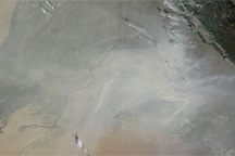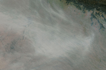

A dense cluster of agricultural fires burning in northwest India filled the skies over much of India and Pakistan with smoke in late October and early November 2009. The Moderate Resolution Imaging Spectroradiometer (MODIS) on NASA’s Aqua satellite captured this true-color image on November 4. The fires, marked with faint red dots, are clustered in the upper right corner of the image. The smoke, which may be mingled with urban pollution and dust, seems to follow the course of the plant-lined Indus River to the Arabian Sea.
The large image provided above has a resolution of 250 meters per pixel, the sensor’s maximum resolution. The image is available in additional resolutions from the MODIS Response Response Team.
NASA image courtesy Jeff Schmaltz, MODIS Rapid Response Team at NASA GSFC. Caption by Holli Riebeek.
Haze built over the Ganges Plain along the front of the Himalaya Mountains in late October 2009.


