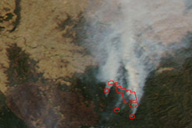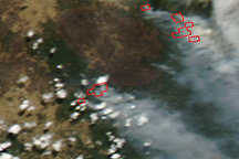

Firefighters in Victoria were still working around the clock on February 16, 2009, to protect lives, property, and the catchment areas for the city of Melbourne’s water supply from devastating bushfires that had killed more than 180 people, according to news reports. This image of the area northeast of Melbourne was captured by the Moderate Resolution Imaging Spectroradiometer (MODIS) on NASA’s Terra satellite on February 16. Places where the sensor detected active fires are marked in red. Active fire locations were scattered across the rugged terrain of the Great Dividing Range Mountains.
The high-resolution image provided above is at MODIS’ full spatial resolution (level of detail) of 250 meters per pixel. The MODIS Rapid Response System provides this image at additional resolutions.
NASA image by Jeff Schmaltz, MODIS Rapid Response Team, Goddard Space Flight Center. Caption by Rebecca Lindsey.
Out-of-control bushfires killed at least 200 people in southeastern Australia in early February 2009.


