The Earth Observatory has published its last Image of the Day on this website. Please join us on our new home at science.nasa.gov/earth/earth-observatory.
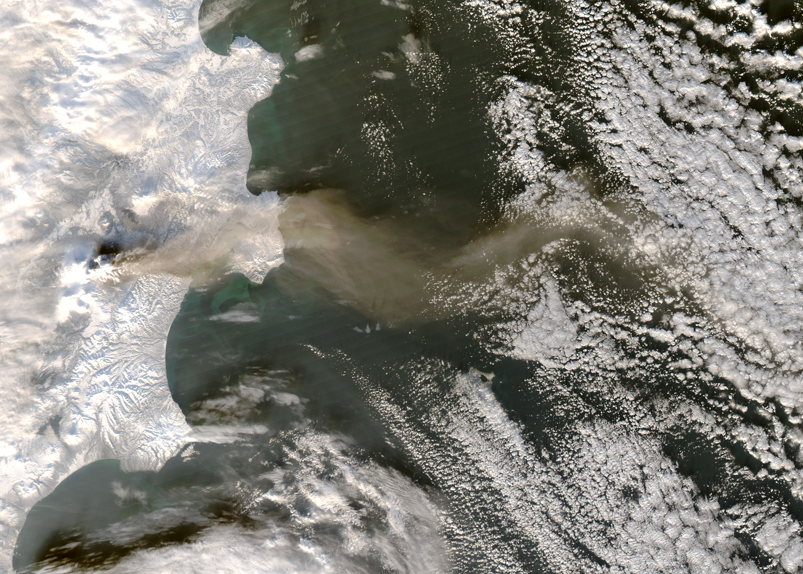
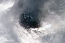
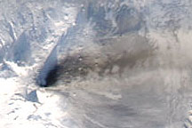
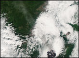
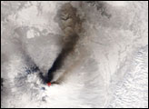
The Klyuchevskaya Volcano on Russia’s Kamchatka Peninsula released a plume of ash on December 9, 2008. The same day, the Moderate Resolution Imaging Spectroradiometer (MODIS) on NASA’s Aqua satellite captured this image at 01:35 UTC.
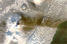
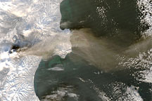
This image shows the plume taking a zigzag path eastward over the Bering Sea. The plume’s ash content lends it a brownish hue that contrasts with both the snow-covered land surface of Kamchatka and the clouds hovering over the ocean. The same day MODIS acquired this image, the U.S. Air Force Weather Agency reported that ash from Klyuchevskaya had traveled roughly 725 kilometers (390 nautical miles) east of the volcano.
With an altitude of 4,835 meters (15,863 feet), Klyuchevskaya (also Klyuchevskoy or Kliuchevskoi) is the highest volcano on the Kamchatka Peninsula. It also ranks among the peninsula’s most active as it is part of the Pacific “Ring of Fire.” Klyuchevskaya is a stratovolcano composed of alternating layers of solidified ash, hardened lava, and rocks produced by previous eruptions. Klyuchevskaya is estimated to have experienced more than 100 flank eruptions in the past 3,000 years, and has seldom been quiet since its formation 6,000 years ago.
NASA image by Jeff Schmaltz, MODIS Rapid Response Team. Caption by Michon Scott.