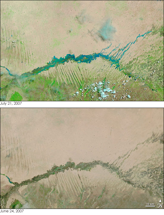
Rivers across much of Sudan continued to rise under the onslaught of unusually heavy wet-season rains at the end of July 2007. The rain started in early July and was expected to continue on and off through the end of the rainy season in September. The Government of Sudan expected that the floods would peak in August, but warned that the Nile and its tributaries were already on the brink of critical levels on July 23.
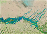
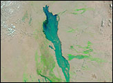
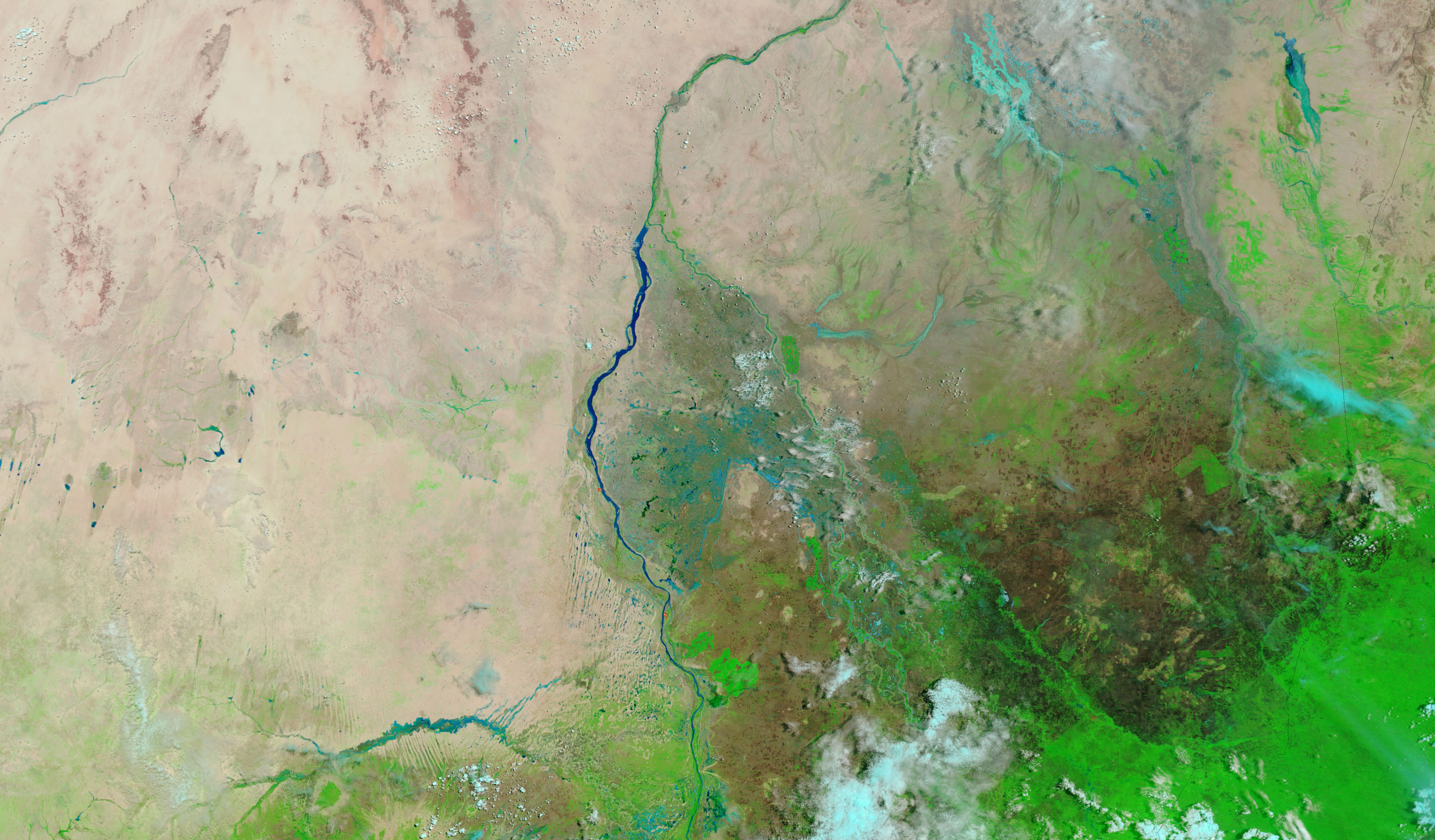
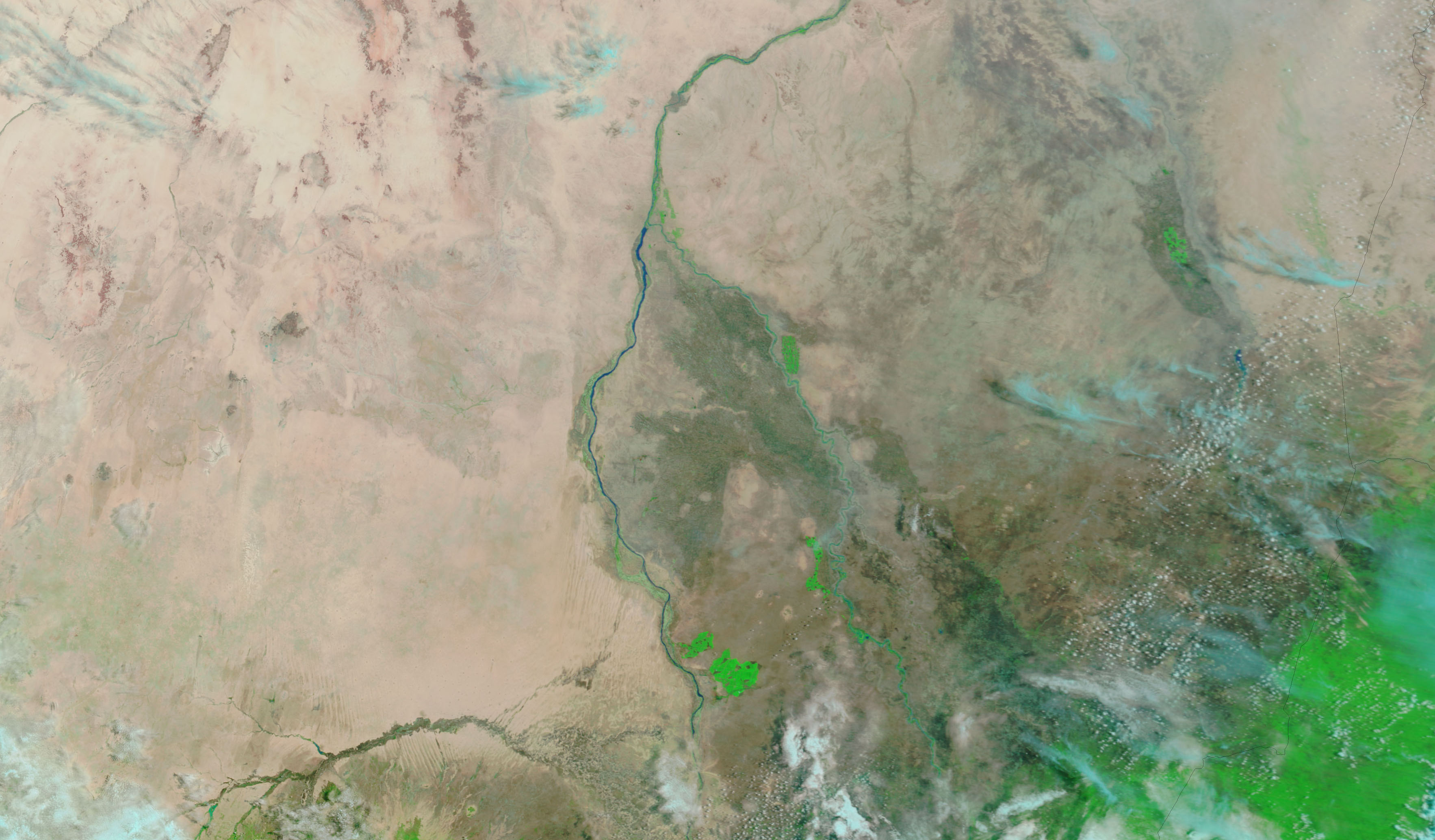
The Moderate Resolution Imaging Spectroradiometer (MODIS) on NASA’s Terra satellite captured the top image of flooding along a tributary of the White Nile on July 21, 2007. As the lower image (taken on June 24 by Terra MODIS) shows, the river appears to be a seasonal river. Traces of blue water are evident in places in the lower image, but for the most part, the riverbed is a dry brown. By July 21, water filled the river. The water is dark blue where it runs clear, and lighter blue where loaded with sediment. These images were made with infrared and visible light to highlight the presence of water on the ground. Plant-covered areas are bright green, desert land is tan-pink, and clouds are pale blue and white. The MODIS Rapid Response System provides daily images of Sudan in both false color (as shown here) and photo-like true color.
NASA images courtesy the MODIS Rapid Response Team at NASA GSFC.
Intense rains swept across Sudan starting on July 8, 2007, causing floods across much of the North African country throughout July, August, and September.
alert message


