India’s annual monsoon triggered widespread flooding throughout the country in early July 2007. In West Bengal, ABC News reported, nearly a million people were stranded by flooding. Every major river in the East Indian state was swollen from torrential rain and releases from too-full reservoirs, ABC added. As of July 10, at least 187 people had died and 7 million had been affected by flooding across India, said Reuters.
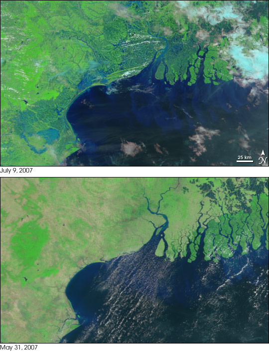
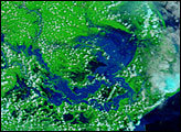
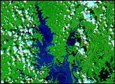
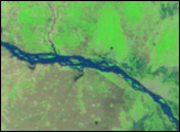
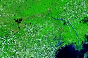
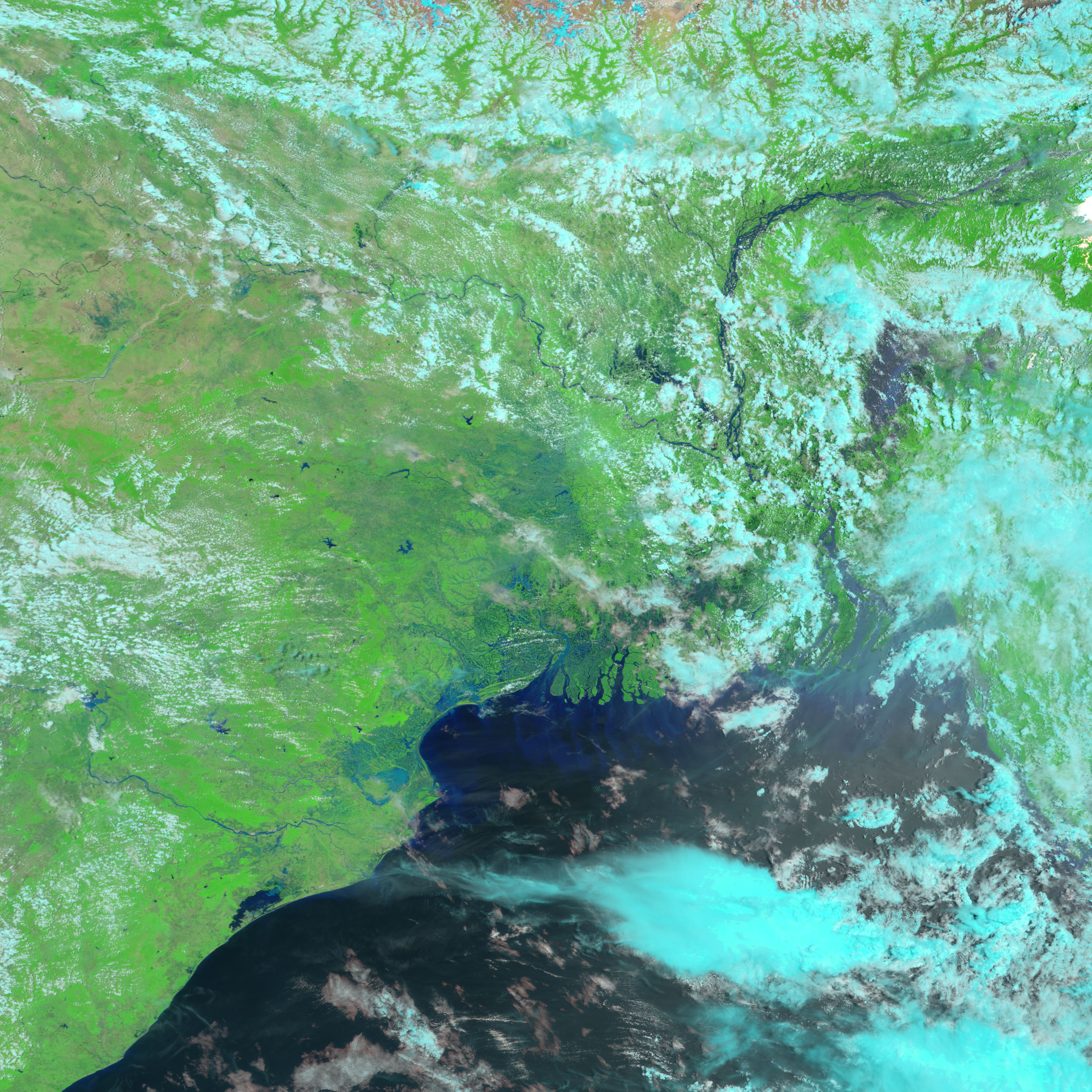
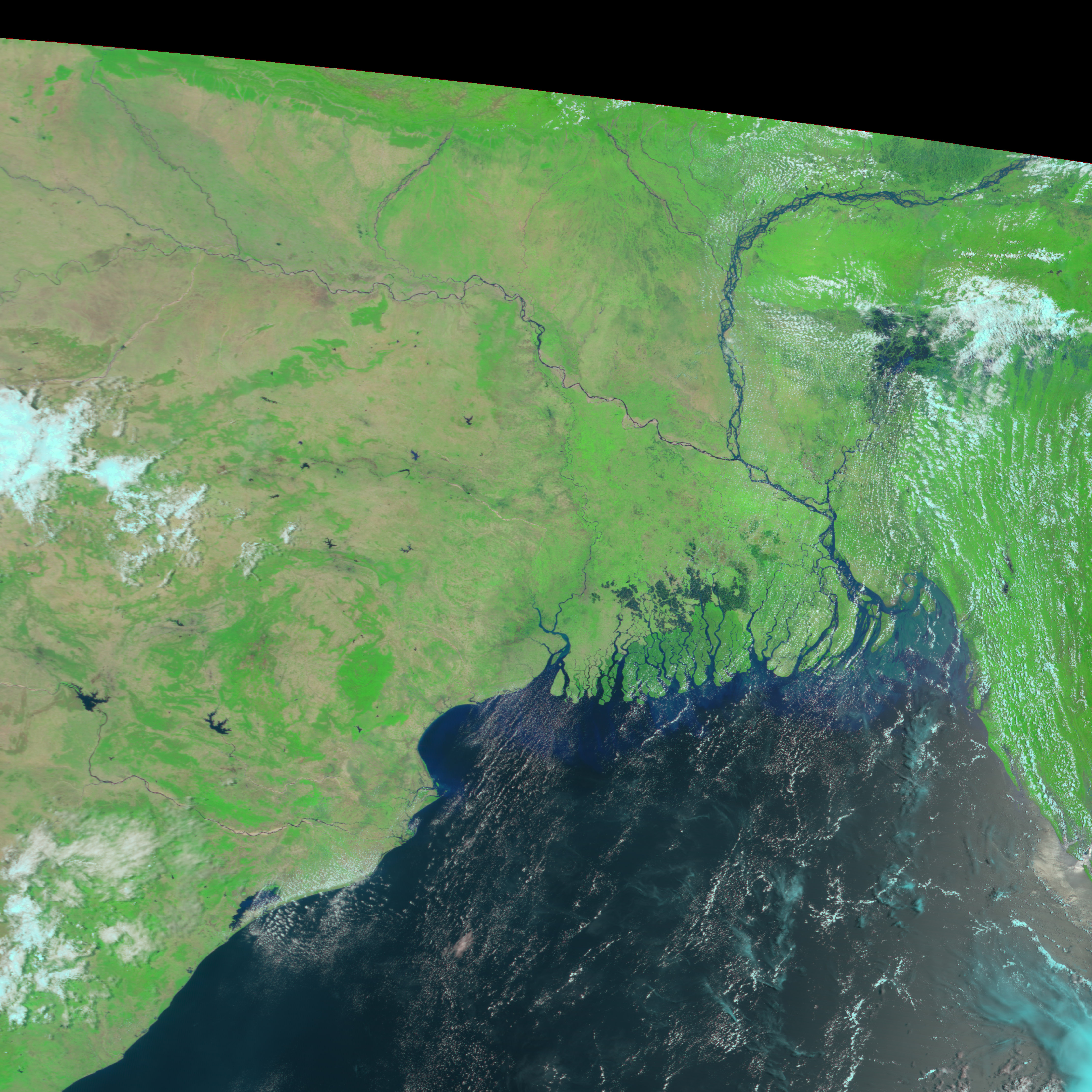
This image shows extensive flooding in West Bengal (top) and northern Orissa (lower left) as seen by the Moderate Resolution Imaging Spectroradiometer (MODIS) flying on NASA’s Terra satellite on July 9, 2007. The lower image was taken on May 31, before the monsoon rains started. In this type of image, water is typically black, as seen in the Bay of Bengal. However, the water is heavily laden with mud in the flooded landscape, so its coloring is light blue. The extensive floods cut between the channels of the Ganges River, which flow into the Bay of Bengal in the center of the image, and extend southwest along the coast. Additional flooding is visible in the large image, which shows a broader area.
Clouds, which appear light blue and white in this image made from infrared and visible light, cover the floods in Bangladesh to the east. In addition to causing floods, the monsoon rains have brought new life to eastern India. The landscape has gone from the tan-pink of bare earth to the bright green that indicates plant cover.
You can download a 250-meter-resolution KMZ file of the flooding and comparison imagery from May 31, suitable for use with Google Earth.
NASA image created by Jesse Allen, using data provided courtesy of the MODIS Rapid Response team.
India's annual monsoon triggered widespread flooding throughout the country in July and August 2007.
alert message


