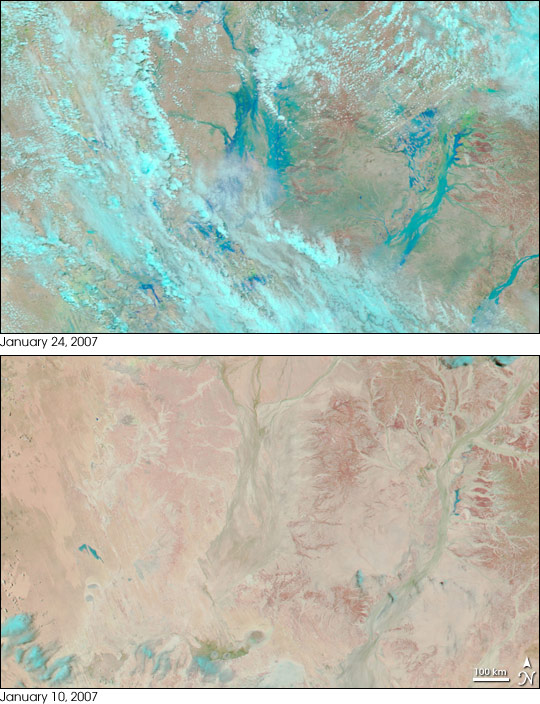
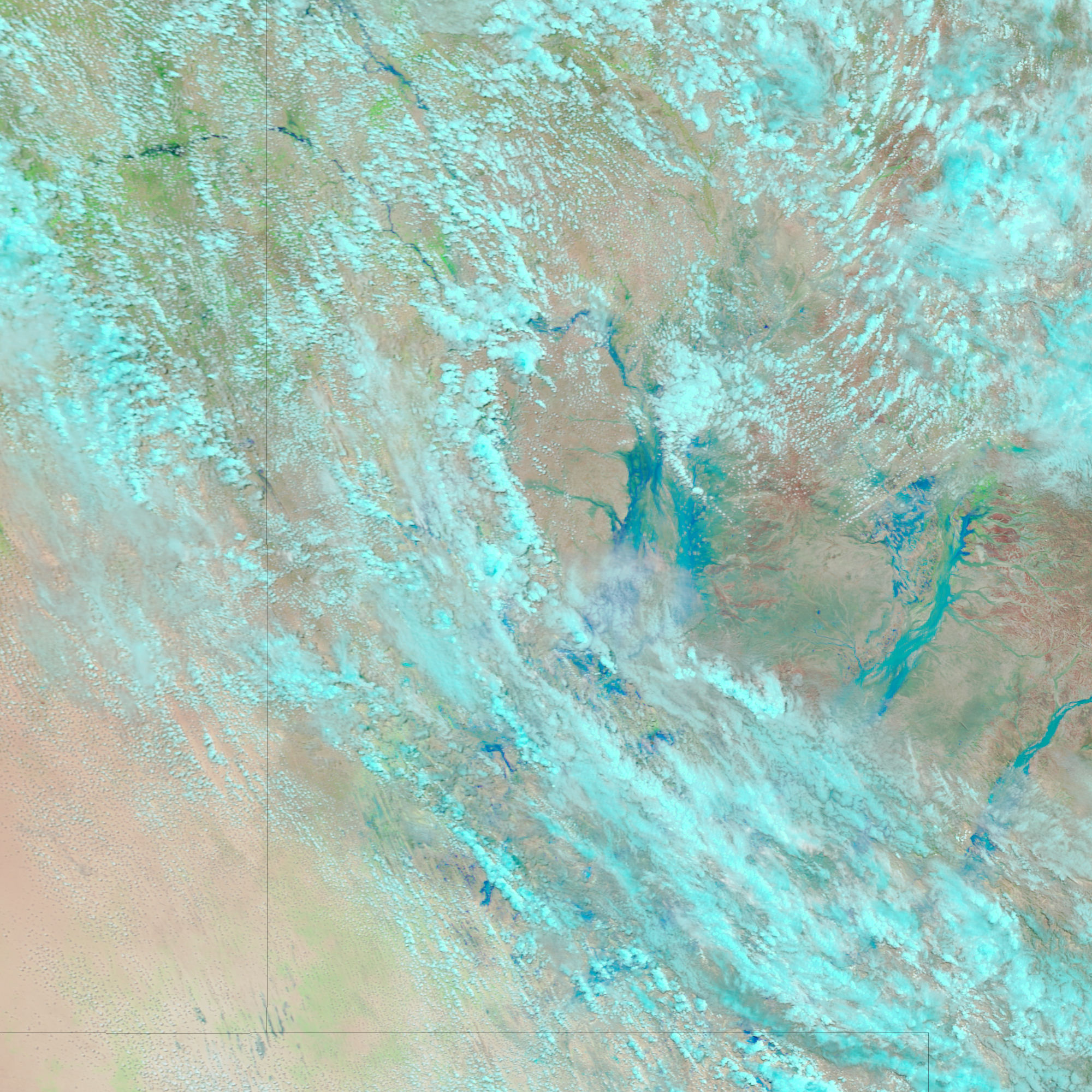
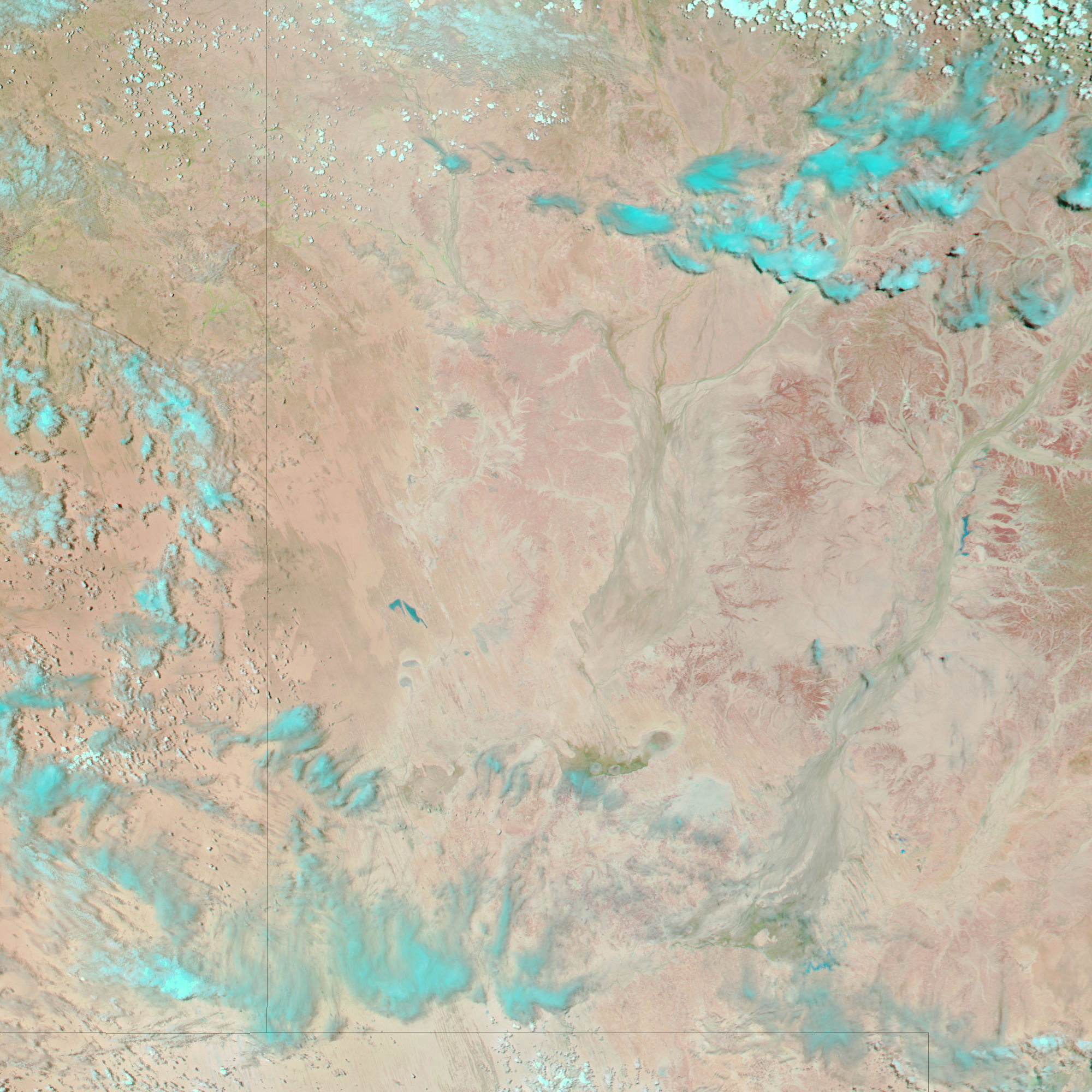
A large, soaking storm drenched a huge swath of the Australian Outback in the third week of January 2007. Major floods affected the arid interior of the country in several states and territories, including Northern Territory, South Australia, and Queensland. Rivers that are usually little more than a string of pools rushed out of their banks, flooded small rural towns, and cut off roads to the outside world.
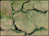
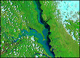
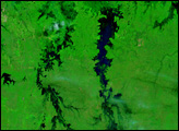
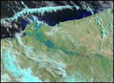
This pair of images of southwestern Queensland shows flooding in a region known as the Channel Country. Captured by the Moderate Resolution Imaging Spectroradiometer (MODIS) on NASA’s Terra (top) and Aqua (bottom) satellites, the images use visible and infrared light detected by MODIS to make flooded areas more obvious than they would be in a photo-like image. Standing water is blue, vegetation is green, and bare or very sparsely vegetated ground is pinkish tan. On January 10, before the rains, dry river and stream channels traced faint gray-green paths across the landscape, which appears virtually barren of other vegetation. On January 24, the flooded rivers and streams leap out from the landscape in bright blue. Vegetation in the surrounding countryside appears to be springing back to life, with a faint green tinge spreading across the underlying pinkish-tan terrain.
The large image provided above has a spatial resolution (level of detail) of 250 meters per pixel. The MODIS Rapid Response Team provides twice-daily subset images of Australia in additional resolutions via a clickable map.
NASA image created by Jesse Allen, using data provided courtesy of the MODIS Rapid Response team.


