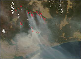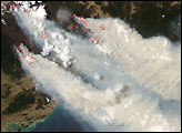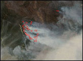

Between Lake Eildon and the Dartmouth Reservoir in Victoria, Australia, dozens of active fires churned out thick clouds of smoke in early December. In remote, rugged terrain in the Great Dividing Range Mountains, firefighters battled the blazes in hot, windy conditions. This image of the area was captured by the Moderate Resolution Imaging Spectroradiometer (MODIS) on NASA’s Aqua satellite on December 10, 2006. Places where MODIS detected actively burning fire are marked with red outlines. The smoke pours southeast over the Bass Strait. Puffy towers of clouds are embedded in the smoke; these clouds may be the result of strong updrafts and aerosols (particles in the air that can act as “seeds” for cloud droplets) produced by the fires themselves, or they may be part of the larger-scale weather pattern over the area. The next day, a swath of clouds over the region may have provided some relief for firefighters.
The large image provided above has a spatial resolution (level of detail) of 250 meters per pixel. The MODIS Rapid Response Team provides twice-daily images of the region in additional resolutions.
A 250-meter-resolution KMZ file is available for use with Google Earth.
NASA image courtesy the MODIS Rapid Response Team, Goddard Space Flight Center
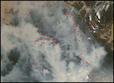
In Victoria, bushfires that began in early December 2006 were still burning in 2007. This image shows the burning area on January 16, 2007.


